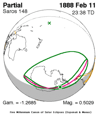
Solar eclipse of February 11, 1888
| Solar eclipse of February 11, 1888 | |
|---|---|
 Map | |
| Type of eclipse | |
| Nature | Partial |
| Gamma | -1.2684 |
| Magnitude | 0.5029 |
| Maximum eclipse | |
| Coordinates | 70°42′S 35°42′W / 70.7°S 35.7°W |
| Times (UTC) | |
| Greatest eclipse | 23:38:15 |
| References | |
| Saros | 148 (14 of 75) |
| Catalog # (SE5000) | 9252 |
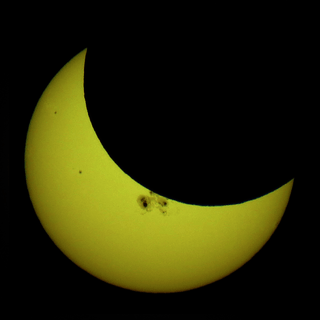
A partial solar eclipse occurred on February 11, 1888 during summer. A solar eclipse occurs when the Moon passes between Earth and the Sun, thereby totally or partly obscuring the image of the Sun for a viewer on Earth. A partial solar eclipse occurs in the polar regions of the Earth when the center of the Moon's shadow misses the Earth.
It was the first of three partial eclipses that took place that year,[1] the next was on July 9 in the same hemisphere. It was part of solar saros 148, the next eclipses of the cycle were on December 13, 1898, December 24, 1916 and January 5, 1935.[2]
Description
The eclipse took place in much of Antarctica with the exception of the northernmost areas that are south of Africa, the southernmost of the Indian Ocean, a part of the southern Pacific Ocean, most of Patagonia except for its northern boundary and the ice shelf portion of the Atlantic. The greatest eclipse was offshore in the bay or ice shelf at 70.7 S and 35.7 W at 23:38 UTC (9:38 PM local time.[1]
The rim of the eclipse included Chile's Puerto Montt.
It showed around 5% obscuration of the sun at Antarctica by the Indian Ocean, 10% in the south of Patagonia, 30% in the west of the peninsula and up to over 50% in the ice shelf. The center of the Moon's shadow was missed by about 1,400 km above the area (70.7 S) south of the Antarctic Circle.
See also
- List of solar eclipses in the 19th century
- List of solar eclipses visible from Antarctica
References
- 1 2 "Solar eclipse of February 11, 1888". NASA. Retrieved March 23, 2017.
- ↑ "Solar Saros 148". NASA. Retrieved March 23, 2017.

