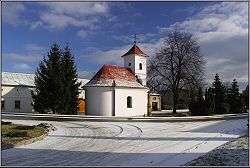
Slatinky
| Slatinky | ||
|---|---|---|
| Municipality | ||
 | ||
| ||
 Slatinky | ||
| Coordinates: 49°32′53″N 17°5′13″E / 49.54806°N 17.08694°ECoordinates: 49°32′53″N 17°5′13″E / 49.54806°N 17.08694°E | ||
| Country |
| |
| Region | Olomouc | |
| District | Prostějov | |
| Area | ||
| • Total | 8.02 km2 (3.10 sq mi) | |
| Elevation | 272 m (892 ft) | |
| Population (2006) | ||
| • Total | 492 | |
| • Density | 61/km2 (160/sq mi) | |
| Postal code | 783 42 | |
| Website | http://slatinky.cz | |

Slatinky is a village and municipality (obec) in Prostějov District in the Olomouc Region of the Czech Republic.
The municipality covers an area of 8.02 square kilometres (3.10 sq mi), and has a population of 492 (as at 28 August 2006).
Slatinky lies approximately 9 kilometres (6 mi) north of Prostějov, 13 km (8 mi) south-west of Olomouc, and 201 km (125 mi) east of Prague.
There is a natural monument Vápenice in the southern part of the territory of the municipality.[1]
Notes
- ↑ "PP Vápenice". Ústřední seznam ochrany přírody. Nature Conservation Agency of the Czech Republic (AOPK ČR). Retrieved 2014-05-02.
References
| Wikimedia Commons has media related to Slatinky. |
This article is issued from
Wikipedia.
The text is licensed under Creative Commons - Attribution - Sharealike.
Additional terms may apply for the media files.