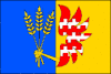
Klopotovice
| Klopotovice | |||
|---|---|---|---|
| Municipality | |||
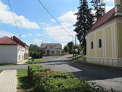 Center of the village | |||
| |||
 Klopotovice | |||
| Coordinates: 49°26′56″N 17°14′42″E / 49.44889°N 17.24500°ECoordinates: 49°26′56″N 17°14′42″E / 49.44889°N 17.24500°E | |||
| Country |
| ||
| Region | Olomouc | ||
| District | Prostějov | ||
| Area | |||
| • Total | 5.33 km2 (2.06 sq mi) | ||
| Elevation | 207 m (679 ft) | ||
| Population (2006) | |||
| • Total | 276 | ||
| • Density | 52/km2 (130/sq mi) | ||
| Postal code | 798 21 | ||

Klopotovice is a village and municipality (obec) in Prostějov District in the Olomouc Region of the Czech Republic.
The municipality covers an area of 5.33 square kilometres (2.06 sq mi), and has a population of 276 (as at 3 July 2006).
Klopotovice lies approximately 11 kilometres (7 mi) east of Prostějov, 17 km (11 mi) south of Olomouc, and 216 km (134 mi) east of Prague.
References
| Wikimedia Commons has media related to Klopotovice. |
This article is issued from
Wikipedia.
The text is licensed under Creative Commons - Attribution - Sharealike.
Additional terms may apply for the media files.