Simonton, Texas
| Simonton, Texas | |
|---|---|
| City | |
 Location of Simonton, Texas | |
| Coordinates: 29°40′47″N 95°59′25″W / 29.67972°N 95.99028°WCoordinates: 29°40′47″N 95°59′25″W / 29.67972°N 95.99028°W | |
| Country | United States |
| State | Texas |
| County | Fort Bend |
| Area | |
| • Total | 2.00 sq mi (5.17 km2) |
| • Land | 1.99 sq mi (5.16 km2) |
| • Water | 0.004 sq mi (0.01 km2) |
| Elevation | 115 ft (35 m) |
| Population (2010) | |
| • Total | 814 |
| • Density | 409/sq mi (157.9/km2) |
| Time zone | UTC-6 (Central (CST)) |
| • Summer (DST) | UTC-5 (CDT) |
| ZIP code | 77476 |
| Area code(s) | 281 |
| FIPS code | 48-67964[1] |
| GNIS feature ID | 1347151[2] |
| Website |
simontontexas |
Simonton is a city in Fort Bend County, Texas, United States, within the Houston–Sugar Land–Baytown metropolitan area. As of the 2010 U.S. Census, the city population was 814,[3] up from 718 at the 2000 census.
History
Simonton was heavily affected by the 2017 Harvey-related flooding.[4]
Geography

Simonton is located in northwestern Fort Bend County at 29°40′47″N 95°59′25″W / 29.67972°N 95.99028°W (29.679783, -95.990302).[5] The center of town is 2 miles (3 km) east of the Brazos River and 16 miles (26 km) northwest of Rosenberg. Downtown Houston is 38 miles (61 km) to the east.
According to the United States Census Bureau, Simonton has a total area of 2.0 square miles (5.2 km2), of which 0.004 square miles (0.01 km2), or 0.24%, is water.[3]
Demographics
| Historical population | |||
|---|---|---|---|
| Census | Pop. | %± | |
| 1980 | 603 | — | |
| 1990 | 717 | 18.9% | |
| 2000 | 718 | 0.1% | |
| 2010 | 814 | 13.4% | |
| Est. 2016 | 870 | [6] | 6.9% |
| U.S. Decennial Census[7] | |||
As of the census[1] of 2000, there were 718 people, 264 households, and 206 families residing in the city. The population density was 354.4 people per square mile (136.6/km²). There were 282 housing units at an average density of 139.2/sq mi (53.6/km²). The racial makeup of the city was 91.64% White, 5.01% African American, 0.28% Asian, 0.14% Pacific Islander, 1.95% from other races, and 0.97% from two or more races. Hispanic or Latino of any race were 6.13% of the population.
There were 264 households out of which 34.8% had children under the age of 18 living with them, 71.6% were married couples living together, 3.8% had a female householder with no husband present, and 21.6% were non-families. 18.6% of all households were made up of individuals and 7.6% had someone living alone who was 65 years of age or older. The average household size was 2.72 and the average family size was 3.07.
The city population is evenly spread: 25.9% is under the age of 18, 4.7% is between 18 and 24, 29.0% is from 25 to 44, 30.4% from 45 to 64, and 10.0% who were 65 years of age or older. The median age was 41 years. For every 100 females, there were 102.8 males. For every 100 females age 18 and over, there were 96.3 males.
The median income for a household in the city was $72,833, and the median income for a family was $81,905. Males had a median income of $51,842 versus $30,333 for females. The per capita income for the city was $30,669. About 2.5% of families and 5.3% of the population were below the poverty line, including 7.9% of those under age 18 and 5.8% of those age 65 or over.
Government and infrastructure
The United States Postal Service operates the Simonton Post Office at 35608 Farm to Market Road 1093.[8]
Fulshear's Bob Lutts Fulshear/Simonton Branch Library, located in Fulshear, is a part of the Fort Bend County Libraries system. The branch, which opened in May 1998, was the third branch built with 1989 bond funds. The land currently occupied by the library was previously the Fort Bend County Precinct 4 headquarters. Bob Lutts, the precinct commissioner, offered the land to the library system. The Fulshear City Council asked the county to name the library after Lutts. The library is now within Precinct 3.[9]
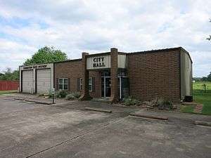 Simonton City Hall and Fire Station on FM 1093
 US Post Office on FM 1093
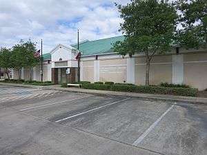 Bob Lutts Library on FM 359 in Fulshear
Education
Simonton is zoned to schools in the Lamar Consolidated Independent School District.[10]
Simonton is zoned to:
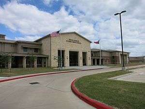
- Huggins Elementary School (Fulshear)
- Leaman Junior High School
- Fulshear High School[11]
Prior to 2016:
- Briscoe Junior High School (Unincorporated Fort Bend County)
- Foster High School (Unincorporated Fort Bend County)
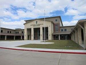
 Dean Leaman Junior High School
 Huggins Elementary School
Media
Simonton is one of the key towns featured in the 2009 documentary "The Heart of Texas Movie"
 Simonton Community Church on FM 1489 south
Notable People
- Dobie Gray, singer
References
- 1 2 "American FactFinder". United States Census Bureau. Retrieved 2008-01-31.
- ↑ "US Board on Geographic Names". United States Geological Survey. 2007-10-25. Retrieved 2008-01-31.
- 1 2 "Geographic Identifiers: 2010 Demographic Profile Data (G001): Simonton city, Texas". U.S. Census Bureau, American Factfinder. Retrieved August 31, 2016.
- ↑ Browne, Drew Jordan, Malachy; Cirillo, Chris (2017-08-31). "Before and After: Harvey's Toll on Texas Towns". The New York Times. ISSN 0362-4331. Retrieved 2017-09-01.
- ↑ "US Gazetteer files: 2010, 2000, and 1990". United States Census Bureau. 2011-02-12. Retrieved 2011-04-23.
- ↑ "Population and Housing Unit Estimates". Retrieved June 9, 2017.
- ↑ "Census of Population and Housing". Census.gov. Retrieved June 4, 2015.
- ↑ "Post Office Location - SIMONTON Archived 2012-07-20 at Archive.is." United States Postal Service. Retrieved on December 4, 2008.
- ↑ "Bob Lutts Fulshear/Simonton Branch Library." Fort Bend County Libraries. Retrieved on May 14, 2010.
- ↑ "2015 City Limits Map." City of Simonton. Retrieved on December 29, 2016.
- ↑ "High School Attendance Zones." Lamar Consolidated Independent School District. Retrieved on December 27, 2016.
External links
- City of Simonton official website
- Simonton, Texas from the Handbook of Texas Online
| Counties | 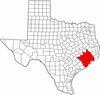 | |
|---|---|---|
| "Principal" cities | ||
| Other cities |
For a complete listing, see list of cities and towns in Houston–The Woodlands–Sugar Land MSA | |
| Unincorporated areas | ||
| Bodies of water | ||
Municipalities and communities of Fort Bend County, Texas, United States | ||
|---|---|---|
| Cities | 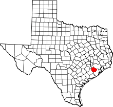 | |
| Town | ||
| Villages | ||
| CDPs |
| |
| Unincorporated communities | ||
| Ghost towns | ||
| Footnotes | ‡This populated place also has portions in an adjacent county or counties;
±Former community annexed by Missouri City | |