Sidi Bel Abbès Province
| Sidi Bel Abbès Province ولاية سيدي بلعباس | |
|---|---|
| Province | |
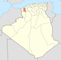
 Map of Algeria highlighting Sidi Bel Abbès | |
| Coordinates: 35°12′N 0°38′W / 35.200°N 0.633°WCoordinates: 35°12′N 0°38′W / 35.200°N 0.633°W | |
| Country |
|
| Capital | Sidi Bel Abbès |
| Government | |
| • PPA president | Mr. M’Kelkel Bouziane (FLN) |
| • Wāli | Mr. Mokhtar Bentabet |
| Area | |
| • Total | 9,150.63 km2 (3,533.08 sq mi) |
| Population (2008)[1] | |
| • Total | 603,369 |
| • Density | 66/km2 (170/sq mi) |
| Time zone | UTC+01 (CET) |
| Area Code | +213 (0) 48 |
| ISO 3166 code | DZ-22 |
| Districts | 15 |
| Municipalities | 52 |
Sidi Bel Abbès (Arabic: ولاية سيدي بلعباس is one of the provinces (wilayas) of Algeria. Its name is derived from the name of its capital, the city of Sidi Bel Abbès. It is situated in the northwestern part of the country.
Administrative divisions
The province is divided into 15 districts (daïras), which are further divided into 52 communes or municipalities.
Districts
Communes
- Aïn Adden
- Aïn El Berd
- Aïn Kada
- Aïn Thrid
- Aïn Tindamine
- Amarnas
- Badredine El Mokrani
- Belarbi
- Ben Badis
- Benachiba Chelia
- Bir El Hammam
- Boudjebaa El Bordj
- Boukhanafis
- Chettouane Belaila
- Dhaya
- El Hacaiba
- Hassi Dahou
- Hassi Zehana
- Lamtar
- Makedra
- Marhoum
- M'Cid
- Merine
- Mezaourou
- Mostefa Ben Brahim
- Moulay Slissen
- Oued Sebaa
- Oued Sefioun
- Oued Taourira
- Ras El Ma
- Redjem Demouche
- Sehala Thaoura
- Sfissef
- Sidi Ali Benyoub
- Sidi Ali Boussidi
- Sidi Bel Abbès
- Sidi Brahim
- Sidi Chaib
- Sidi Dahou el Zairs
- Sidi Hamadouche
- Sidi Khaled
- Sidi Lahcene
- Sidi Yacoub
- Tabya (Tabla)
- Tafissour
- Taoudmout
- Teghalimet
- Telagh
- Tenezara
- Tenira
- Tessala
- Tilmouni
- Zerouala
References
- ↑ Office National des Statistiques, Recensement General de la Population et de l’Habitat 2008 Archived 2008-07-24 at the Wayback Machine. Preliminary results of the 2008 population census. Accessed on 2008-07-02.
External links
| Wikimedia Commons has media related to Sidi Bel Abbès Province. |
| ||
This article is issued from
Wikipedia.
The text is licensed under Creative Commons - Attribution - Sharealike.
Additional terms may apply for the media files.