Sibalom
| Sibalom | |
|---|---|
| Municipality | |
| Municipality of Sibalom | |
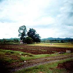 Sugarcane farm in Sibalom | |
 Map of Antique with Sibalom highlighted | |
.svg.png) Sibalom Location within the Philippines | |
| Coordinates: 10°47′N 122°01′E / 10.78°N 122.02°ECoordinates: 10°47′N 122°01′E / 10.78°N 122.02°E | |
| Country |
|
| Region | Western Visayas (Region VI) |
| Province | Antique |
| District | Lone district |
| Barangays | 76 (see Barangays) |
| Government [1] | |
| • Type | Sangguniang Bayan |
| • Mayor | Joel P. Occena |
| • Electorate | 32,546 voters (2016) |
| Area [2] | |
| • Total | 201.30 km2 (77.72 sq mi) |
| Population (2015 census)[3] | |
| • Total | 60,306 |
| • Density | 300/km2 (780/sq mi) |
| Time zone | UTC+8 (PST) |
| ZIP code | 5713 |
| PSGC | 060616000 |
| IDD : area code | +63 (0)36 |
| Climate type | Tropical climate |
| Income class | 2nd municipal income class |
| Revenue (₱) | 145,214,843.01 (2016) |
| Native languages |
Kinaray-a language Ati Tagalog |
| Website |
elgu |
Sibalom, officially the Municipality of Sibalom, (Kinaray-a: Banwa kang Sibalom; Hiligaynon: Banwa sang Sibalom; Filipino: Bayan ng Sibalom), is a 2nd class municipality in the province of Antique, Philippines. According to the 2015 census, it has a population of 60,306 people.[3]
Sibalom is home to the University of Antique.
History
It was in the middle of the 17th century when the town of Sibalom was founded under the Spanish domination. It was inhabited by the Malays that came from Borneo under the leadership of Datu Sumakwel. After the governments of several provinces were established, a pueblo or town was organized. The first capitan and governadorcillo of Sibalom was Don Pedro Antang in 1751. Agustin Baladjay, who had been elected many times as governadorcillo, had been imprisoned by Spanish authorities in the province for having resisted against the abuses of Spanish officials. His followers from the mountains fought against the guards and released him. In 1792 to 1793 when Santiago Damacino was the governadorcillo, the Roman Catholic church was erected. The people were forced to work in the construction of the church. In the year 1802 when Juan Geronimo was holding the position, there was pestilence. A destructive typhoon occurred in the year 1814 when Juan Benito was the governadorcillo. Basilio Vilvar became governadorcillo many times beginning the year 1858. He was considered as one of the most educated and the wealthiest landowner. Later on he lost his wealth for he was too hospitable to the government officials. From 1878 to 1879, when Mariano Rojo was the governadorcillo, there was famine for almost two years. Santiago Lotilla was given a medal of merit in San Jose, Antique. It was under his domination that the Roman Catholic cemetery was erected. He also encouraged the planting of fruit trees such as coffee, cacao, etc. During the term of Felipe Tordesillas in 1888 to 1889, war broke out between the mountaineers of Sibalom and San Remigio. Gregorio Palermo, also known as King Ario, was their leader. They revolted against the Spanish government. They made the mountain of Igbaong, in the barrio of Osorio, as their headquarters. Under the leadership of Mariano Vacera, from 1893 to 1894, the municipal building was erected. Doroteo Alvior was the last governadorcillo to hold office in the year 1896. The Spanish sovereignty lasted until the month of November 1898 when an expeditionary force sent by General Emilio Aguinaldo under the command of General Leandro Fullon and Colonel Angel Salazar conquered the capital of the province San Jose on 24 of November 1898. The people had learned to read and write in Spanish from the Spanish missionaries. The Spanish occupation brought Christianity to the people.
Sibalom during and after World War II
The declaration of war on December 8, 1941 between the United States and Japan alerted not only the people of other places in the province but also the people of Sibalom, who were then still enjoying an easy and peaceful life. Not long after the war was declared, the town of Sibalom gradually became a somewhat deserted place because its people evacuated to nearby mountains, their homes to be abandoned for an indefinite period of time. Looting was rampant then. The Japanese occupation forces, who landed in San Jose on April 17, 1942, arrived at Sibalom at 2:00 p.m. on that day. There were already no people living in the town when the enemy came. The people that time began to panic. However, when the USAFFE surrendered in May 30, 1942, many civilians began to return to the lowlands. Others preferred to stay in the mountains. In June 1942, a Filipino Government was set up with Jose P. Laurel as President of the Philippines, Tobias Fornier was the governor of Antique, and Melquiades Melo (the town mayor when the war broke out) became a puppet mayor in enemy-occupied Sibalom. His work was to assist the Japanese occupation forces, especially in the procurement of food supplies, maintenance of peace, and to attract the people who evacuated to the mountains, to come down. The civil government in town that time was under the Japanese forces. When the Japanese occupation forces came, they immediately occupied the Bongbongan Copper mines. In July 1943, Sibalom Elementary School was reopened and Nipponggo was taught as one of the subjects. The school was headed by Mr. Mariano X. Rojo who was the school Principal and other teachers were Mr. Francisco Occena (II and III), Mrs. Rosario M. Silva and Mr. Juan Vego. Mr. Ambrosio Galera was the food production supervisor. Part of the town plaza was converted into a vegetable garden. The Japanese occupation forces undertook to plant all the rice fields in the plains of Sibalom and to put up fish corrals in San Jose, Hamtic, and Guinsang-an. Bamboo trees in Sibalom were cut down and were used in the construction of these fish corrals. The Bonbongan copper mine was reopened under the management of the Ishihara Mining Co. Two bridges (in Pangpang and Villar) were constructed. The bridge in Pangpang cost around P400,000.00 (Japanese money). Bongbongan copper mines later on was called “Bongbongan City” because it had a population of around 18,000, with many prisoners of war serving as laborers in the mines. On February 8, 1944, Mr. Melquiades Melo was replaced by Mr. Agaton Grasparil as mayor of Sibalom. The replacement was made by the order of Governor Fornier when the Japanese authorities gave back the Philippines its independence. From February 8 to September 15, 1944, Mr. Grasparil served as mayor of Sibalom. On September 16, 1944, the guerilla forces headed by Col. Peralta, ordered the evacuation of Sibalom, so Mr. Grasparil complied with the order and escaped to the mountains. Governor Fornier appointed then Mr. Santiago Lotilla as mayor until the Japanese forces were driven out of the capital. In April 1945, Mr. Santiago Lotilla was replaced by Mr. Ambrosio Galera as acting mayor of the PCAU government. After the Japanese were conquered, the pre-war officials were returned to their posts, and Mr. Pedro Morales, who was elected vice mayor, acted as mayor of Sibalom until elections came.
Civil Government in the “free area” of Sibalom
The civil government outside the enemy territory, was organized on October 17, 1942. Atty. Ramon Maza was appointed deputy governor of Panay. Mr. Pedro Morales (elected vice mayor in 1941 elections) was appointed as mayor. Mr. Miguel Mataquel was the vice mayor. Three councilors who have served before the Japanese landed in Antique were again appointed. These were Pedro Tordesillas, Nicolas Magbanua, and Francisco Bernabe. The three other appointed councilors were Fausto Estioso, Mateo Cordero, and Alejo Mondejar. A food Administrator’s Committee was also organized to be headed by a chairman and eight assistants. In October 24, 1942, the office of the deputy governor was moved to barrio Lambayagan from Catmon. The transfer was necessary because the Deputy Governor’s evacuation place was within the war zone then. Mr. Morales mayorship was from 1942 to January 1943. On February 1, 1943, he resigned thus Miguel Mataquel became the mayor (from February to May 2, 1943). On May 2, 1943, Miguel Mataquel was replaced by Mr. Angel Villafuerte. On January 18, 1944, the Japanese soldiers who patrolled the mountains ruthlessly massacred 40 civilians in Barrio Salvacion. One of the victims was Miss Petronila Petiaoco, an elementary school teacher who was assigned as a Food Administrator in Salvacion and she happened to be present when the Japanese arrived in that barrio. She died a rather heroic death. In May 1944, the Japanese forces constantly patrolled the barrios and mountains, thereby causing many families to move into the enemy-occupied town. In November of the same year, civilians were free to return the town. People were encouraged to go to the lowland to harvest rice. But in December, the guerilla forces launched another counterattack on the enemy; thus the harvest in the lowland was abandoned by panic-stricken people.
Military government
On December 20, 1944, Mr. Ambrosio Galera was appointed as mayor of Sibalom. He succeeded Mr. Angel Villafuerte. The civil government was changed to military government under Col. Peralta. In that month, Peralta dissolved the government of Confesor. The former appointed Atty. Calixto Zaldivar as military governor and at that time Mr. Galera acted as mayor.
Enemy’s Flee to the Mountains On April 3, 4, and 5, the Japanese fled to the mountains and fought against the guerilla men in Sido, Igsoming, Bato Cueva, Canselayan, and Igmaro. The Japanese retreated to the mountains.
PCAU Government
On March 5, 1945, Atty. Ramon Maza was appointed as governor in the PCAU government. He recommended Mr. Angel Villafuerte as mayor. The latter became town mayor from April 7 to September 1945. In September, the Commonwealth authorities were restored to their offices. Governor Tobias Fornier resumed office as governor and he appointed Mr. Rotillo Duazo as mayor of Sibalom. The latter’s term of office lasted until January 13, 1946. In January 14, 1946, Mr. Santiago Lotilla was appointed as town mayor with Pedro Morales as vice mayor. They served until 1947. At this time, many houses were already constructed and people were beginning to live a normal life. Prices of goods were still sky-high. On November 11, 1947, an election was held for the first time after the liberation and the election results made Mr. Tiburcio Tubianosa as mayor with Mr. Espiridion Anovert as vice mayor. Mayor-elect Tubianosa, a candidate of the liberal party, won over Mr. Santiago Lotilla, a Nacionalista. Mayor Tubianosa’s term of office was from 1948 to 1951. In November 11, 1951, was another election day in town again. As a result, Mr. Santiago Lotilla won as mayor, with Mr. Espiridion Anovert as vice mayor. Such is a series of facts, events, incidents, and personages in Sibalom, during and after World War II until 1953.
Geography
Sibalom is located at 10°47′N 122°01′E / 10.78°N 122.02°E. It is 11 kilometres (6.8 mi) from the provincial capital, San Jose de Buenavista.
According to the Philippine Statistics Authority, the municipality has a land area of 201.30 square kilometres (77.72 sq mi) [2] constituting 7.38% of the 2,729.17-square-kilometre- (1,053.74 sq mi) total area of Antique.
Barangays
Sibalom is politically subdivided into 76 barangays.[4] From 1953 to 1955, Barangay Catmon was known as Barangay Pajarito.[5][6]
| PSGC | Barangay | Population | ±% p.a. | |||
|---|---|---|---|---|---|---|
| 2015[3] | 2010[7] | |||||
| 060616002 | Alangan | 1.4% | 834 | 712 | 3.06% | |
| 060616004 | Bari | 1.7% | 1,009 | 878 | 2.68% | |
| 060616005 | Biga-a | 0.5% | 329 | 291 | 2.36% | |
| 060616006 | Bongbongan I | 1.3% | 760 | 653 | 2.93% | |
| 060616007 | Bongbongan II | 0.9% | 524 | 515 | 0.33% | |
| 060616008 | Bongsod | 1.0% | 601 | 555 | 1.53% | |
| 060616009 | Bontol | 1.4% | 849 | 764 | 2.03% | |
| 060616010 | Bugnay | 0.4% | 253 | 227 | 2.09% | |
| 060616011 | Bulalacao | 0.8% | 475 | 453 | 0.91% | |
| 060616012 | Cabanbanan | 0.5% | 278 | 267 | 0.77% | |
| 060616013 | Cabariuan | 1.2% | 714 | 643 | 2.01% | |
| 060616014 | Cabladan | 1.5% | 875 | 866 | 0.20% | |
| 060616015 | Cadoldolan | 1.1% | 651 | 580 | 2.22% | |
| 060616016 | Calo-oy | 0.4% | 228 | 221 | 0.60% | |
| 060616017 | Calog | 0.7% | 400 | 391 | 0.43% | |
| 060616018 | Catmon | 1.8% | 1,069 | 1,044 | 0.45% | |
| 060616019 | Catungan I | 1.0% | 614 | 558 | 1.84% | |
| 060616020 | Catungan II | 0.7% | 420 | 331 | 4.64% | |
| 060616021 | Catungan III | 1.0% | 589 | 487 | 3.69% | |
| 060616022 | Catungan IV | 1.9% | 1,128 | 1,088 | 0.69% | |
| 060616051 | Cubay-Napultan | 1.8% | 1,101 | 1,036 | 1.17% | |
| 060616023 | Cubay-Sermon | 1.6% | 949 | 999 | −0.97% | |
| 060616061 | District I (Poblacion) | 2.6% | 1,542 | 1,412 | 1.69% | |
| 060616062 | District II (Poblacion) | 2.3% | 1,398 | 1,353 | 0.62% | |
| 060616063 | District III (Poblacion) | 6.2% | 3,740 | 3,398 | 1.84% | |
| 060616064 | District IV (Poblacion) | 3.8% | 2,266 | 2,050 | 1.93% | |
| 060616024 | Egaña | 5.5% | 3,333 | 3,121 | 1.26% | |
| 060616025 | Esperanza I | 0.7% | 425 | 296 | 7.13% | |
| 060616026 | Esperanza II | 0.8% | 460 | 451 | 0.38% | |
| 060616027 | Esperanza III | 0.7% | 425 | 366 | 2.89% | |
| 060616028 | Igcococ | 1.1% | 673 | 621 | 1.54% | |
| 060616030 | Igdagmay | 0.6% | 360 | 326 | 1.91% | |
| 060616029 | Igdalaquit | 1.8% | 1,076 | 983 | 1.74% | |
| 060616031 | Iglanot | 1.6% | 974 | 860 | 2.40% | |
| 060616032 | Igpanolong | 0.7% | 450 | 418 | 1.41% | |
| 060616033 | Igparas | 0.6% | 347 | 351 | −0.22% | |
| 060616034 | Igsuming | 1.1% | 659 | 634 | 0.74% | |
| 060616035 | Ilabas | 2.1% | 1,293 | 1,138 | 2.46% | |
| 060616036 | Imparayan | 1.0% | 579 | 573 | 0.20% | |
| 060616037 | Inabasan | 1.0% | 616 | 571 | 1.45% | |
| 060616038 | Indag-an | 0.6% | 359 | 597 | −9.23% | |
| 060616039 | Initan | 0.9% | 515 | 504 | 0.41% | |
| 060616040 | Insarayan | 0.9% | 556 | 452 | 4.02% | |
| 060616041 | Lacaron | 3.3% | 2,009 | 1,839 | 1.70% | |
| 060616042 | Lagdo | 0.8% | 491 | 459 | 1.29% | |
| 060616043 | Lambayagan | 0.8% | 487 | 479 | 0.32% | |
| 060616044 | Luna | 0.5% | 328 | 283 | 2.85% | |
| 060616045 | Luyang | 0.7% | 410 | 404 | 0.28% | |
| 060616046 | Maasin | 0.7% | 435 | 441 | −0.26% | |
| 060616047 | Mabini | 1.1% | 673 | 633 | 1.17% | |
| 060616048 | Millamena | 0.6% | 340 | 326 | 0.80% | |
| 060616049 | Mojon | 0.5% | 328 | 327 | 0.06% | |
| 060616050 | Nagdayao | 2.0% | 1,198 | 1,175 | 0.37% | |
| 060616053 | Nazareth | 1.3% | 787 | 767 | 0.49% | |
| 060616054 | Odiong | 1.4% | 838 | 715 | 3.07% | |
| 060616055 | Olaga | 0.8% | 472 | 401 | 3.15% | |
| 060616056 | Pangpang | 1.1% | 665 | 650 | 0.44% | |
| 060616057 | Panlagangan | 0.8% | 472 | 398 | 3.30% | |
| 060616058 | Pantao | 0.4% | 245 | 229 | 1.29% | |
| 060616059 | Pasong | 1.1% | 686 | 604 | 2.45% | |
| 060616060 | Pis-Anan | 3.9% | 2,355 | 2,174 | 1.53% | |
| 060616065 | Rombang | 0.8% | 502 | 500 | 0.08% | |
| 060616066 | Salvacion | 1.1% | 639 | 662 | −0.67% | |
| 060616067 | San Juan | 2.2% | 1,318 | 1,159 | 2.48% | |
| 060616068 | Sido | 1.4% | 849 | 729 | 2.94% | |
| 060616069 | Solong | 1.7% | 1,007 | 983 | 0.46% | |
| 060616070 | Tabongtabong | 0.6% | 389 | 368 | 1.06% | |
| 060616071 | Tig-Ohot | 0.9% | 516 | 524 | −0.29% | |
| 060616073 | Tigbalua I | 1.2% | 717 | 682 | 0.96% | |
| 060616079 | Tigbalua II | 0.4% | 264 | 197 | 5.73% | |
| 060616074 | Tordesillas | 0.7% | 418 | 412 | 0.28% | |
| 060616075 | Tulatula | 1.3% | 771 | 677 | 2.51% | |
| 060616003 | Valentin Grasparil (Bad-as) | 0.8% | 483 | 442 | 1.70% | |
| 060616076 | Villafont | 1.2% | 696 | 581 | 3.50% | |
| 060616077 | Villahermosa | 1.0% | 633 | 624 | 0.27% | |
| 060616078 | Villar | 2.0% | 1,189 | 1,180 | 0.14% | |
| Total | 60,306 | 56,058 | 1.40% | |||
Demographics
| Population census of Sibalom | ||
|---|---|---|
| Year | Pop. | ±% p.a. |
| 1903 | 15,562 | — |
| 1918 | 17,844 | +0.92% |
| 1939 | 22,178 | +1.04% |
| 1948 | 28,558 | +2.85% |
| 1960 | 24,468 | −1.28% |
| 1970 | 30,392 | +2.19% |
| 1975 | 32,247 | +1.20% |
| 1980 | 35,515 | +1.95% |
| 1990 | 42,647 | +1.85% |
| 1995 | 46,143 | +1.49% |
| 2000 | 49,971 | +1.72% |
| 2007 | 53,934 | +1.06% |
| 2010 | 56,058 | +1.42% |
| 2015 | 60,306 | +1.40% |
| Source: Philippine Statistics Authority[3][7][8][9] | ||
In the 2015 census, Sibalom had a population of 60,306.[3] The population density was 300 inhabitants per square kilometre (780/sq mi).
Sibalom Natural Park
Sibalom Natural Park, one of the last patches of lowland forest on Panay Island and the first protected area in the island, harbors many unique species of plants and animals, some of which are on the brink of extinction. About 5,000 hectares (12,000 acres) of forest in Sibalom from Mount Porras extending to Mount Igmatindog, covering Sibalom river and its main tributaries Mao-it river and Tipulu-an river, was declared a natural park on April 23, 2000. Of this forest, 672 hectares (1,660 acres) are undisturbed by any human activity while about 4,223 hectares (10,440 acres) constitutes the 50-year-old reforestation site. One highlight is the Rafflesia speciosa, discovered in Mount Porras and surrounding Barangays in 2002.[10] Dubbed the biggest bloom in the world, its discovery put Sibalom in the map of tourist stopovers in the Philippines. Sibalom also has century-old industries and structures, as well as boulders of gemstones and treacherous mountain trails.
Tourism
Sibalom's tourism industry dawned after the proclamation of the Sibalom Natural Park.
References
- ↑ "Municipality". Quezon City, Philippines: Department of the Interior and Local Government. Retrieved 31 May 2013.
- 1 2 "Province: Antique". PSGC Interactive. Quezon City, Philippines: Philippine Statistics Authority. Retrieved 12 November 2016.
- 1 2 3 4 5 Census of Population (2015). "Region VI (Western Visayas)". Total Population by Province, City, Municipality and Barangay. PSA. Retrieved 20 June 2016.
- ↑ "Municipal: Sibalom". PSGC Interactive. Quezon City, Philippines: Philippine Statistics Authority. Retrieved 8 January 2016.
- ↑ "An Act to Change the Name of the Barrio of Catmon, Municipality of Sibalom, Province of Antique, to Pajarito". LawPH.com. Retrieved 2011-04-09.
- ↑ "An Act to Change the Name of the Barrio of Pajarito, Municipality of Sibalom, Province of Antique, to Catmon". LawPH.com. Retrieved 2011-04-09.
- 1 2 Census of Population and Housing (2010). "Region VI (Western Visayas)". Total Population by Province, City, Municipality and Barangay. NSO. Retrieved 29 June 2016.
- ↑ Censuses of Population (1903–2007). "Region VI (Western Visayas)". Table 1. Population Enumerated in Various Censuses by Province/Highly Urbanized City: 1903 to 2007. NSO.
- ↑ "Province of Antique". Municipality Population Data. Local Water Utilities Administration Research Division. Retrieved 17 December 2016.
- ↑ Barcelona, J.F.; Pelser, P.B.; Balete, D.S.; Co, L.L. (30 October 2009). "Taxonomy, ecology, and conservation status of Philippine Rafflesia (Rafflesiaceae)". Blumea - Biodiversity, Evolution and Biogeography of Plants. 54 (1): 77–93. doi:10.3767/000651909X474122. Retrieved 2 January 2013.
External links
| Wikimedia Commons has media related to Sibalom. |
Places adjacent to Sibalom | |
|---|---|