Laua-an
| Laua-an | |
|---|---|
| Municipality | |
| Municipality of Laua-an | |
 Map of Antique with Laua-an highlighted | |
.svg.png) Laua-an Location within the Philippines | |
| Coordinates: 11°09′N 122°03′E / 11.15°N 122.05°ECoordinates: 11°09′N 122°03′E / 11.15°N 122.05°E | |
| Country |
|
| Region | Western Visayas (Region VI) |
| Province | Antique |
| District | Lone district |
| Founded | January 1, 1915 |
| Barangays | 40 (see Barangays) |
| Government [1] | |
| • Type | Sangguniang Bayan |
| • Mayor | Francisco G. Baladjay Jr. |
| • Electorate | 16,835 voters (2016) |
| Area [2] | |
| • Total | 100.72 km2 (38.89 sq mi) |
| Population (2015 census)[3] | |
| • Total | 26,072 |
| • Density | 260/km2 (670/sq mi) |
| Time zone | UTC+8 (PST) |
| ZIP code | 5705 |
| PSGC | 060609000 |
| IDD : area code | +63 (0)36 |
| Climate type | Tropical climate |
| Income class | 4th municipal income class |
| Revenue (₱) | 74,159,664.05 (2016) |
| Native languages |
Kinaray-a language Tagalog |
| Website |
elgu |
Laua-an, officially the Municipality of Laua-an, (Kinaray-a: Banwa kang Laua-an; Hiligaynon: Banwa sang Laua-an; Filipino: Bayan ng Laua-an), is a 4th class municipality in the province of Antique, Philippines. According to the 2015 census, it has a population of 26,072 people.[3]
Laua-an celebrates its Pahinis Festival every January.
History
The municipality of Laua-an formerly named as Nalupa Nuevo (pueblo near the mouth of the river) was already a pueblo before the Spanish-American war. Capitan Luis Sarmiento was the first Capitan del Pueblo of Laua-an. When the Filipino-American War broke out, Barbaza became an integral part of Laua-an, because its Municipal Hall was burned. The seat of government of Laua-an was then transferred to Barbaza through a resolution approved by the council under the leadership of Capitan Justiano Barrientos. Pursuant to the provisions of Act No. 1748 and as per Executive Order No. 14 of Governor General James F. Smith, the seat of the Municipal Government of Laua-an was transferred to Barbaza effective June 1, 1908. Many of the inhabitants of Poblacion and Barangay Guisijan filed a petition to the Governor-General that Laua-an be separated from Barbaza with a promise that the municipal building of Laua-an will be constructed at their own expense. Upon the recommendation of the Provincial Board and pursuant to the provision of Act. No. 1748, the 11 Municipalities of Antique was increased to 12 as established by Act. No. 961 which was amended by act No. 987. Pursuant to Executive Order No. 129 issued by Governor Francis Burton Harrison, Laua-an was declared as a Municipality on January 1, 1915.[4]
Geography
Laua-an is located at 11°09′N 122°03′E / 11.15°N 122.05°E. It is 56 kilometres (35 mi) from the provincial capital, San Jose de Buenavista.
According to the Philippine Statistics Authority, the municipality has a land area of 100.72 square kilometres (38.89 sq mi) [2] constituting 3.69% of the 2,729.17-square-kilometre- (1,053.74 sq mi) total area of Antique.
Barangays
Laua-an is politically subdivided into 40 barangays.[5], 12 of which are located along the coast and the rest are considered inland/upland barangays located along two big rivers of Paningayan and Cairawan. It has a total of 85 sitios, The total land area of Laua-an is approximately 18,692,456.5 hectares, representing 7.41% of the total land area of the Province of Antique. Of the total land area 7,832,222.9 has. Or 42% is alienable and disposable land and 10,860,2336 has. Or 58% is classified as timber land. Total Population of Laua-an in 2009 as per survey conducted by the Municipal Social Work and Development Office (MSWDO), reached to 26,959 in which 13,468 are males and 13,491 are females with total households of 5,392.
| PSGC | Barangay | Population | ±% p.a. | |||
|---|---|---|---|---|---|---|
| 2015[3] | 2010[6] | |||||
| 060609043 | Bagongbayan | 2.7% | 706 | 659 | 1.32% | |
| 060609002 | Banban | 0.6% | 147 | 129 | 2.52% | |
| 060609003 | Bongbongan | 1.0% | 250 | 265 | −1.10% | |
| 060609004 | Cabariwan | 2.5% | 660 | 620 | 1.20% | |
| 060609005 | Cadajug | 4.4% | 1,153 | 1,110 | 0.73% | |
| 060609006 | Canituan | 2.2% | 568 | 572 | −0.13% | |
| 060609007 | Capnayan | 1.4% | 365 | 319 | 2.60% | |
| 060609008 | Casit-an | 4.6% | 1,200 | 1,157 | 0.70% | |
| 060609010 | Guiamon | 1.0% | 249 | 239 | 0.78% | |
| 060609009 | Guinbanga-an | 7.2% | 1,879 | 1,864 | 0.15% | |
| 060609011 | Guisijan | 9.2% | 2,404 | 2,382 | 0.18% | |
| 060609012 | Igtadiao | 1.1% | 294 | 262 | 2.22% | |
| 060609013 | Intao | 2.5% | 660 | 672 | −0.34% | |
| 060609014 | Jaguikican | 3.4% | 874 | 896 | −0.47% | |
| 060609015 | Jinalinan | 0.8% | 202 | 220 | −1.61% | |
| 060609016 | Lactudan | 0.9% | 247 | 274 | −1.96% | |
| 060609017 | Latazon | 1.8% | 476 | 494 | −0.70% | |
| 060609018 | Laua-an | 1.5% | 379 | 349 | 1.58% | |
| 060609020 | Liberato | 1.6% | 411 | 463 | −2.24% | |
| 060609021 | Lindero | 6.3% | 1,649 | 1,560 | 1.06% | |
| 060609022 | Liya-liya | 1.6% | 422 | 395 | 1.27% | |
| 060609019 | Loon | 2.8% | 743 | 735 | 0.21% | |
| 060609023 | Lugta | 2.8% | 719 | 576 | 4.31% | |
| 060609024 | Lupa-an | 2.1% | 559 | 557 | 0.07% | |
| 060609025 | Magyapo | 1.0% | 257 | 242 | 1.15% | |
| 060609026 | Maria | 5.0% | 1,311 | 1,364 | −0.75% | |
| 060609027 | Mauno | 2.0% | 524 | 457 | 2.64% | |
| 060609028 | Maybunga | 2.0% | 525 | 343 | 8.44% | |
| 060609029 | Necesito (Paniatan) | 1.2% | 307 | 339 | −1.87% | |
| 060609030 | Oloc | 4.5% | 1,168 | 994 | 3.12% | |
| 060609031 | Omlot | 1.0% | 260 | 233 | 2.11% | |
| 060609032 | Pandanan | 1.4% | 359 | 346 | 0.70% | |
| 060609034 | Paningayan | 1.5% | 384 | 360 | 1.24% | |
| 060609035 | Pascuala | 0.7% | 194 | 202 | −0.77% | |
| 060609036 | Poblacion (Centro) | 7.6% | 1,975 | 1,933 | 0.41% | |
| 060609038 | San Ramon | 0.6% | 167 | 139 | 3.56% | |
| 060609039 | Santiago | 2.6% | 670 | 622 | 1.43% | |
| 060609040 | Tibacan | 0.7% | 177 | 230 | −4.86% | |
| 060609041 | Tigunhao | 1.3% | 343 | 375 | −1.68% | |
| 060609042 | Virginia | 0.9% | 235 | 263 | −2.12% | |
| Total | 26,072 | 25,211 | 0.64% | |||
Demographics
| Population census of Laua-an | ||
|---|---|---|
| Year | Pop. | ±% p.a. |
| 1903 | 8,915 | — |
| 1918 | 10,340 | +0.99% |
| 1939 | 12,614 | +0.95% |
| 1948 | 15,438 | +2.27% |
| 1960 | 12,967 | −1.44% |
| 1970 | 15,461 | +1.77% |
| 1975 | 17,498 | +2.51% |
| 1980 | 18,785 | +1.43% |
| 1990 | 19,865 | +0.56% |
| 1995 | 21,069 | +1.11% |
| 2000 | 23,258 | +2.14% |
| 2007 | 23,808 | +0.32% |
| 2010 | 25,211 | +2.11% |
| 2015 | 26,072 | +0.64% |
| Source: Philippine Statistics Authority[3][6][7][8] | ||
In the 2015 census, Laua-an had a population of 26,072.[3] The population density was 260 inhabitants per square kilometre (670/sq mi).
Economy

Laua-an has an agricultural-based economy with rice, sugarcane and corn as primary crops. About 4,267,264 has. are devoted to agricultural crop production representing 22.83% of the total land area of the municipality. Laua-an produce Rice, Corn, Vegetables, Peanuts, Mango, Banana, Abaca and other crops. It has 42 Day Care Centers, 12 Complete Elementary Schools and 4 Secondary Schools. In Health services, it has 1 Rural Health Center, 8 Brgy. Health Stations and 13 Health & Nutrition Posts. Laua-an has a total of 76.065 km. of Barangay roads; 2.160 km. of municipal roads; 2.450 km. of provincial roads and 11.125 km. of National Roads. A mini-hydro project is being constructed at Brguy. San Ramon by Sun West Water and Electric Company and at Sitio Sadsadan, Brgy. Maybunga and Villa Siga Bugasong. Four cell sites (Globe, Sun and Smart) were installed at Brgy. Poblacion, Bagongbayan and Liya-Liya rerspectively. It is observed that even upland barangays have signal which contributed to the improvement of information technology in the area.
Farming is the major occupation of the people and fishing is the secondary source of income. The deep sea waters of Sulu Sea is abundant with fish and marine life like sardines, tuna, squids, mackerel, crabs and other seafoods which is a source of living for most residents.
Tourism
Among the tourist attractions are Mount Igmatongtong in barangay Capnayan, Maybunga Water falls in barangay Maybunga, and Estaka Hill in barangay Poblacion. Estaca Hill in the Poblacion provides a strategic place to view the barangay Poblacion, the Sulu Sea and its environs.
Festivals
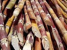
Pre-Catholic pre-Spanish Indianized Srivijaya-era Pahinis Festival similar to Makar Sankranti, is celebrated annually to feature the muscovado sugar industry of the town, the technology of which dates back to the Spanish era. "Pahinis" means to clean and prepare the tools for sugarcane milling which corresponds to a celebration to thank God for a fine harvest of sugarcane.
The town celebrates its centennial foundation in January 2015. Weeklong celebration features Pahinis Festival Mardi Gras; LGU, professionals, senior citizens and barangay night; Bugal Kang Laua-an (Pride of Laua-an) Awards Night; and Search for Hara de Pahinis (Pahinis Queen) Beauty Pageant and Coronation Night. The winner of this pageant represents the municipality during the Search for Lin-ay kang Antique (Miss Antique) during the Binirayan Festival in the capital town of San Jose de Buenavista every last week of December. Other events include boat racing along the Sulu Sea, and Aring Beach Festival at the last night of the celebration in Barangay Cadajug.
References
- ↑ "Municipality". Quezon City, Philippines: Department of the Interior and Local Government. Retrieved 31 May 2013.
- 1 2 "Province: Antique". PSGC Interactive. Quezon City, Philippines: Philippine Statistics Authority. Retrieved 12 November 2016.
- 1 2 3 4 5 Census of Population (2015). "Region VI (Western Visayas)". Total Population by Province, City, Municipality and Barangay. PSA. Retrieved 20 June 2016.
- ↑ http://lauaanantiquephilippines.blogspot.com/2016/09/history.html
- ↑ "Municipal: Laua-an". PSGC Interactive. Quezon City, Philippines: Philippine Statistics Authority. Retrieved 8 January 2016.
- 1 2 Census of Population and Housing (2010). "Region VI (Western Visayas)". Total Population by Province, City, Municipality and Barangay. NSO. Retrieved 29 June 2016.
- ↑ Censuses of Population (1903–2007). "Region VI (Western Visayas)". Table 1. Population Enumerated in Various Censuses by Province/Highly Urbanized City: 1903 to 2007. NSO.
- ↑ "Province of Antique". Municipality Population Data. Local Water Utilities Administration Research Division. Retrieved 17 December 2016.
Places adjacent to Laua-an | ||||||||||
|---|---|---|---|---|---|---|---|---|---|---|
| ||||||||||