Shughnon District
| Shughnon District Ноҳияи Шуғнон Xuγnủn | |
|---|---|
| District | |
| Ноҳияи Шуғнон | |
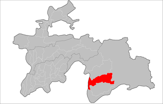 Location of Shughnon District in Tajikistan | |
| Country |
|
| Province | Gorno-Badakhshan Autonomous Region |
| Capital | Mithenshor |
| Population (2008) | |
| • Total | 38,000 |
| as of 1 January 2008 | |
| Time zone | UTC+5 (TJT) |
| Postal code | 736100 |
| Area code(s) | +992 355 |
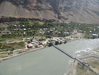
Friendship bridge between Afghanistan and Tajikistan Across the Panj river in Region shughnon-shughnan!
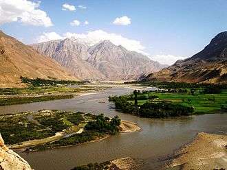
Beautiful view of the Panj river, the border between 

Shughnon District or Nohiya-i Shughnon (Tajik: Ноҳияи Шуғнон) is a district in east Tajikistan, in the central-western part of Gorno-Badakhshan Autonomous Region (GBAO). It is bordered by the Panj River and Afghanistan on the west, the Rushan Range and Rushon district on the north, Murghab district on the east and the Shughnon Range and Roshtqal'a district on the south. It corresponds to the valley of the Gunt River.[1] The district capital is Khorugh, which is also the capital of Gorno-Badakhshan Autonmous Region. The population of Shughnon District is 38,000 (1 January 2008 estimate).[2]
Administrative divisions
The district is divided administratively into jamoats. They are as follows (and population).[3]
| Jamoats of Darvoz District | |
| Jamoat | Population |
|---|---|
| Darmorakht | 2588 |
| Navobod | 5772 |
| Porshinev | 7430 |
| Sokhcharv | 2452 |
| Suchon | 7344 |
| Vanqala | 5165 |
| Ver | 4690 |
References
- ↑ Republic of Tajikistan, map showing administrative division as of January 1, 2004, "Tojikkoinot" Cartographic Press, Dushanbe
- ↑ Population of the Republic of Tajikistan as of 1 January 2008, State Committee of Statistics, Dushanbe, 2008 (in Russian)
- ↑ "List of Jamoats". UN Coordination, Tajikistan. Archived from the original on July 16, 2011. Retrieved April 4, 2009.
| Districts |  | |
|---|---|---|
| Main cities and towns | ||
| Geography | ||
This article is issued from
Wikipedia.
The text is licensed under Creative Commons - Attribution - Sharealike.
Additional terms may apply for the media files.