Ishkoshim District
| Ishkoshim District ناحیه اشکاشم | |
|---|---|
| District | |
| Ноҳияи Ишкошим | |
|
Location of Ishkoshim District in Tajikistan | |
| Country |
|
| Province | Gorno-Badakhshan Autonomous Region |
| Capital | Ishkoshim |
| Area | |
| • Total | 1,412 sq mi (3,656 km2) |
| Population (2008) | |
| • Total | 28,400 |
| as of 1 January 2008 | |
| Time zone | UTC+5 (TJT) |
| Postal code | 736500 |
| Area code(s) | +992 3553 |
Ishkoshim District or Nohiya-i Ishkoshim (Tajik: Ноҳияи Ишкошим) is a district in east Tajikistan, in the extreme south-west of the Gorno-Badakhshan Autonomous Region (GBAO). It borders Afghanistan along the Panj River to the south and to the west.[1] The population of Ishkoshim district is 28,400 (1 January 2008 estimate).[2]
The district is roughly V-shaped and lies northeast of the Panj River where its course turns from west to north. It is bordered on the south and west Afghanistan across the Panj River and the lower Pamir River and on the north by Roshtqal'a District. There are short borders with Shughnon District to the north and Murghab District to the east. The Shakhdara Range is along the northern border with Roshtqal'a District and the north-south Ishkoshim Range is along the district's eastern border.[1]
The district capital is Ishkoshim, a town at the bend of the Panj, opposite the Ishkashim district with a similar name. There is an ancient balas ruby (technically spinel) mine at Kuh-i-Lal. Ishkoshim District is a particularly attractive destination in Gorno-Badakhshan for its archeological sites and spectacular scenery.[3]
Administrative divisions
The district is divided administratively into jamoats. They are as follows (and population).[4]
| Jamoats of Ishkoshim District | |
| Jamoat | Population |
|---|---|
| Andarob | 2527 |
| Brang | 5152 |
| Ishkoshim | 6567 |
| Pitob | |
| Qozideh | 1880 |
| Shitkharv | 4862 |
| Zong | 4863 |
References
- 1 2 Republic of Tajikistan, map showing administrative division as of January 1, 2004, "Tojikkoinot" Cartographic Press, Dushanbe
- ↑ Population of the Republic of Tajikistan as of 1 January 2008, State Committee of Statistics, Dushanbe, 2008 (in Russian)
- ↑ Robert Middleton and Huw Thomas, Tajikistan and the High Pamirs, 2008
- ↑ "List of Jamoats". UN Coordination, Tajikistan. Archived from the original on July 16, 2011. Retrieved April 4, 2009.
| Districts | 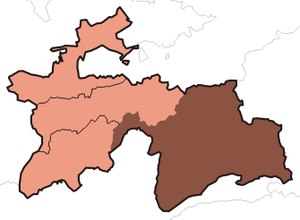 | |
|---|---|---|
| Main cities and towns | ||
| Geography | ||