Whiteriver, Arizona
| Whiteriver, Arizona | |
|---|---|
| Census designated place | |
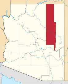
 Location in Navajo County and the state of Arizona | |
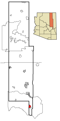
 Whiteriver, Arizona Location in the United States | |
| Coordinates: 33°49′59″N 109°58′28″W / 33.83306°N 109.97444°WCoordinates: 33°49′59″N 109°58′28″W / 33.83306°N 109.97444°W | |
| Country | United States |
| State | Arizona |
| County | Navajo |
| Area[1] | |
| • Total | 15.79 sq mi (40.88 km2) |
| • Land | 15.67 sq mi (40.59 km2) |
| • Water | 0.11 sq mi (0.29 km2) |
| Elevation[2] | 5,164 ft (1,574 m) |
| Population (2010)[3] | |
| • Total | 4,104 |
| • Estimate (2016)[4] | N/A |
| Time zone | UTC−7 (MST) |
| • Summer (DST) | UTC−7 (no DST/PDT) |
| ZIP code | 85941 |
| Area code(s) | 928 |
| FIPS code | 04-82530 |
| GNIS ID(s) | 13704, 2409588 |
Whiteriver (Western Apache: Chʼílwozh) is a census-designated place (CDP) located on the Fort Apache Indian Reservation in Navajo County, Arizona, United States. The population was 4,104 at the 2010 census, making it the largest settlement on the Reservation.[3]
Geography
Whiteriver is located at 33°49′59″N 109°58′28″W / 33.83306°N 109.97444°W (33.833005, -109.974547).[5]
According to the United States Census Bureau, the CDP has a total area of 17.8 square miles (46 km2), all of it land.
Demographics
As of the 2000 United States Census,[7] there were 5,220 people, 1,249 households, and 1,054 families residing in the CDP. The population density was 293.0 people per square mile (113.1/km²). There were 1,330 housing units at an average density of 74.6/sq mi (28.8/km²). The racial makeup of the CDP was 3.03% White, 0.04% Black or African American, 95.10% Native American, 0.04% Asian, 0.31% from other races, and 1.49% from two or more races. 1.90% of the population were Hispanic or Latino of any race.
There were 1,249 households out of which 56.4% had children under the age of 18 living with them, 43.1% were married couples living together, 34.3% had a female householder with no husband present, and 15.6% were non-families. 12.8% of all households were made up of individuals and 1.3% had someone living alone who was 65 years of age or older. The average household size was 4.10 and the average family size was 4.45.
In the CDP, the population was spread out with 44.4% under the age of 18, 10.6% from 18 to 24, 28.6% from 25 to 44, 13.3% from 45 to 64, and 3.2% who were 65 years of age or older. The median age was 21 years. For every 100 females, there were 91.7 males. For every 100 females age 18 and over, there were 89.5 males.
The median income for a household in the CDP was $17,415, and the median income for a family was $17,774. Males had a median income of $18,490 versus $20,463 for females. The per capita income for the CDP was $5,719. About 46.9% of families and 51.6% of the population were below the poverty line, including 59.2% of those under age 18 and 35.2% of those age 65 or over.
Religion: As of 2005, the Apache Reservation in which Whiteriver is located showed a decrease from 73% traditional or atheist to 43%. The percent of the population that consider themselves "Christian" is currently 53%.
Transportation
Whiteriver Airport is a public use general aviation airport located one nautical mile (2 km) southwest of the central business district of Whiteriver.[8]
Education
Whiteriver is served by the Whiteriver Unified School District.
Alchesay High School is the secondary school of Whiteriver.
East Fork Lutheran School is a Christian grade school and high school of the Wisconsin Evangelical Lutheran Synod in Whiteriver.[9][10]
Climate
Whiteriver has a Mediterranean climate (Köppen Csa/Csb) with summers featuring hot afternoons and mild mornings, and winters featuring comfortable afternoons and freezing mornings. Unlike most climates of its type, the summer drought only covers the first half of the hot season – monsoonal rains arrive in July and peak in August before falling off in September. During the dry early summer wildfires are however always a risk. The typical winter weather of mild days and freezing nights is sometimes interrupted by heavy rainfall or snowfall from Pacific storms, which bring an average of between 1.5 and 2 inches (38.1 and 50.8 mm) of precipitation each month, and a mean of 16.5 inches or 0.42 metres of snow – although the median annual snowfall is only 6.3 inches or 0.16 metres.
| ||||||||||||||||||||||||||||||||||||||||||||||||||||||||||||||||||||||||||||||||||||||||||||||||||||||||||||||||||||||||||||||||||||||||||||||||||||||||||
See also
- Fort Apache Indian Reservation
- Bashas
- Tribal Office
References
- ↑ "2016 U.S. Gazetteer Files". United States Census Bureau. Retrieved Jul 18, 2017.
- ↑ "Feature Detail Report for: Whiteriver". Geographic Names Information System. United States Geological Survey.
- 1 2 U.S. Census Bureau (2010). "2010 Census Interactive Population Search". U.S. Government.
- ↑ "Population and Housing Unit Estimates". Retrieved June 9, 2017.
- ↑ "US Gazetteer files: 2010, 2000, and 1990". United States Census Bureau. 2011-02-12. Retrieved 2011-04-23.
- ↑ "CENSUS OF POPULATION AND HOUSING (1790-2010)". U.S. Census Bureau. Retrieved 2013-12-11.
- ↑ "American FactFinder". United States Census Bureau. Retrieved 2008-01-31.
- ↑ FAA Airport Master Record for E24 (Form 5010 PDF). Federal Aviation Administration. Effective November 15, 2012.
- ↑ "Home - East Fork Lutheran School".
- ↑ "East Fork Lutheran Grade School".
- ↑ "Whiteriver, AZ" (PDF). National Oceanic and Atmospheric Administration. December 2011. Retrieved December 6, 2011.