Shirley Field (Tallulah, Louisiana)
|
Shirley Field | |
  | |
| Location | Along Airport Road, about 2.2 miles (3.5 km) east of Tallulah |
|---|---|
| Nearest city | Tallulah, Louisiana |
| Coordinates | 32°24′59″N 91°09′03″W / 32.41625°N 91.15076°WCoordinates: 32°24′59″N 91°09′03″W / 32.41625°N 91.15076°W |
| Area | 25 acres (10 ha) |
| Built | 1922 |
| Built by | USDA Delta Laboratory |
| Architectural style | Mission Revival,Spanish Revival |
| NRHP reference # | 85000270[1] |
| Added to NRHP | February 14, 1985 |
Shirley Field, also known as Scott Airfield, located off US 80 just east of Tallulah, Louisiana, dates from 1922. It was listed on the National Register of Historic Places on February 14, 1985. The listing included two contributing buildings and a contributing site.[1]
It is notable in the area of agriculture for its role in the development of cotton crop dusting, to control boll weevils.[2]
The field includes a Mission Revival-style terminal with round arch windows and a metal tile roof. It also includes a frame hangar from the 1920s, as well as two hangars from the 1950s.[2]
See also
References
- 1 2 National Park Service (2013-11-02). "National Register Information System". National Register of Historic Places. National Park Service.
- 1 2 "Shirley Field / Scott Airfield" (PDF). State of Louisiana's Division of Historic Preservation. 1985. Retrieved June 20, 2017. with two photos and two maps


Municipalities and communities of Madison Parish, Louisiana, United States | ||
|---|---|---|
| Cities | 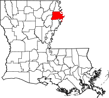 | |
| Villages | ||
| Unincorporated communities | ||
This article is issued from
Wikipedia.
The text is licensed under Creative Commons - Attribution - Sharealike.
Additional terms may apply for the media files.