Shilabati River
| Silabati River (শিলাবতি নদী) | |
| Silai River, শিলাই | |
 Sunset on the Silabati in December | |
| Country | India |
|---|---|
| State | West Bengal |
| Tributaries | |
| - left | Jaypanda River |
| City | Purulia |
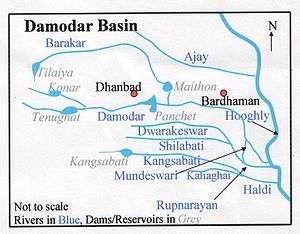 | |
The Silabati River (also known as Silai) originates in the terrain of the Chhota Nagpur Plateau in the Purulia district of the state of West Bengal in eastern India. It flows in an almost southeasterly direction through the districts of Bankura and West Midnapore. The Silabati joins the Dwarakeswar near Ghatal and afterwards is known as Rupnarayan. It finally joins the Hooghly River, which empties into the Bay of Bengal.[1]
Almost every year the Silabati causes flooding, particularly in Banka, Khirpai and Ghatal area. There is a small reservoir on the Silabati near Khatra known as Kadam Deuli Dam where a canal from Mukutmanipur Kangsabati dam meets.
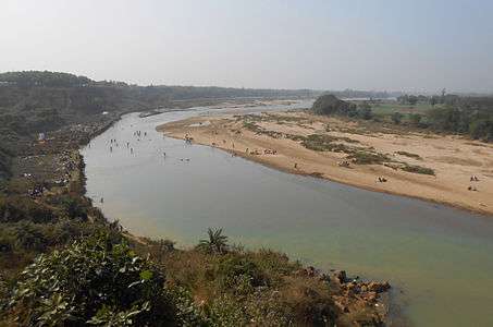 Tourists on the banks of Silabati on New Year's Eve |
References
- ↑ O’Malley, L.S.S., ICS, Bankura, Bengal District Gazetteers, p. 7, 1995 reprint, Government of West Bengal
Coordinates: 23°14′52″N 86°28′34″E / 23.247655°N 86.476135°E
Government of West Bengal - Irrigation & Waterways Dept. Government of West Bengal - Irrigation & Waterways Dept. Government of West Bengal - Irrigation & Waterways Dept. Government of West Bengal - Irrigation & Waterways Dept. Government of West Bengal - Irrigation & Waterways Dept.