San Miguel, Surigao del Sur
| San Miguel | |
|---|---|
| Municipality | |
| Municipality of San Miguel | |
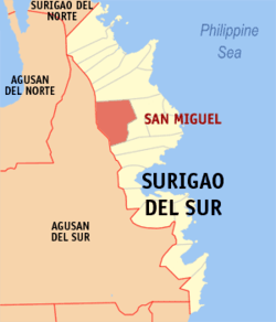 Map of Surigao del Sur with San Miguel highlighted | |
.svg.png) San Miguel Location within the Philippines | |
| Coordinates: 8°53′N 126°00′E / 8.88°N 126°ECoordinates: 8°53′N 126°00′E / 8.88°N 126°E | |
| Country |
|
| Region | Caraga (Region XIII) |
| Province | Surigao del Sur |
| District | 1st District |
| Barangays | 18 (see Barangays) |
| Government [1] | |
| • Type | Sangguniang Bayan |
| • Mayor | Alvaro S. Elizalde |
| • Electorate | 21,727 voters (2016) |
| Area [2] | |
| • Total | 558.00 km2 (215.45 sq mi) |
| Population (2015 census)[3] | |
| • Total | 39,340 |
| • Density | 71/km2 (180/sq mi) |
| Time zone | UTC+8 (PST) |
| ZIP code | 8301 |
| PSGC | 166816000 |
| IDD : area code | +63 (0)86 |
| Climate type | Tropical rainforest climate |
| Income class | 1st municipal income class |
| Revenue (₱) | 150,222,484.61 (2016) |
| Native languages |
Surigaonon Agusan language Cebuano Tagalog |
San Miguel, officially the Municipality of San Miguel, is a 1st class municipality in the province of Surigao del Sur, Philippines. According to the 2015 census, it has a population of 39,340 people.[3]
With an area of 55,800 hectares (138,000 acres), it is the largest among the municipalities and cities in the province.
Antique gold discoveries
In 1981, Edilberto "Berto" Morales, a farmer employed as a bulldozer operator in an irrigation project accidentally unearthed a hoard of authentic gold artifacts and jewelries weighing up to 30 kg in Barangay Magroyong which includes masks, figurines, bowls, daggers, trinkets, belts, and all sorts of body ornaments. Through a support of several historical accounts, archaeologists and historians believed that the gold items were associated between 10th to 13th century used by pre-colonial Filipinos, years before Spaniards came to the country. Some of the golden artifacts, jewelries and ornaments, dubbed as the "Surigao Treasures", were then sold to and currently exhibited at the Ayala Museum in the city of Makati, Philippines and some pieces at the Central Bank of the Philippines. Morales' discoveries were then considered one of the first proofs that gold was an important link between the early people of pre-colonial Philippines and the neighboring Southeast Asian countries.[4][5][6][7]
Barangays
San Miguel is politically subdivided into 18 barangays.
- Bagyang
- Baras
- Bitaugan
- Bolhoon
- Calatngan
- Carromata
- Castillo
- Libas Gua
- Libas Sud
- Magroyong
- Mahayag (Maitum)
- Patong
- Poblacion
- Sagbayan
- San Roque
- Siagao
- Tina
- Umalag
Demographics
| Population census of San Miguel | ||
|---|---|---|
| Year | Pop. | ±% p.a. |
| 1970 | 9,307 | — |
| 1975 | 12,443 | +6.00% |
| 1980 | 17,642 | +7.23% |
| 1990 | 21,671 | +2.08% |
| 1995 | 24,006 | +1.94% |
| 2000 | 27,883 | +3.26% |
| 2007 | 32,737 | +2.24% |
| 2010 | 36,287 | +3.82% |
| 2015 | 39,340 | +1.55% |
| Source: Philippine Statistics Authority[3][8][9][10] | ||
References
- ↑ "Municipality". Quezon City, Philippines: Department of the Interior and Local Government. Retrieved 31 May 2013.
- ↑ "Province: Surigao del Sur". PSGC Interactive. Quezon City, Philippines: Philippine Statistics Authority. Retrieved 12 November 2016.
- 1 2 3 Census of Population (2015). "Caraga". Total Population by Province, City, Municipality and Barangay. PSA. Retrieved 20 June 2016.
- ↑ Camposano, Jerni May (28 July 2015). "Global audience to see previously unknown Surigao gold hoard". Philippine Daily Inquirer. Retrieved 2 January 2016.
- ↑ Carballo, Bibsy M. (4 March 2013). "The country's treasures for worldwide appreciation". Philippine Star. Retrieved 2 January 2016.
- ↑ Nelson, RN (12 April 2009). "the surigao archaeological golds". A Dose A Day (Digital Catharsis). Retrieved 2 January 2016.
- ↑ Santos, Mariano (30 April 2013). ""The Fire Beneath": Mining a Gold Find". Pinoy News Magazine. Retrieved 2 January 2016.
- ↑ Census of Population and Housing (2010). "Caraga". Total Population by Province, City, Municipality and Barangay. NSO. Retrieved 29 June 2016.
- ↑ Censuses of Population (1903–2007). "Caraga". Table 1. Population Enumerated in Various Censuses by Province/Highly Urbanized City: 1903 to 2007. NSO.
- ↑ "Province of Surigao del Sur". Municipality Population Data. Local Water Utilities Administration Research Division. Retrieved 17 December 2016.
External links
- Philippine Standard Geographic Code
- Philippine Census Information
- Local Governance Performance Management System
Places adjacent to San Miguel, Surigao del Sur | |
|---|---|
Tandag (capital) | |
| Municipalities | |
| Component cities | |