Marihatag, Surigao del Sur
| Marihatag | |
|---|---|
| Municipality | |
| Municipality of Marihatag | |
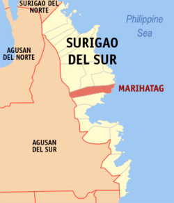 Map of Surigao del Sur with Marihatag highlighted | |
.svg.png) Marihatag Location within the Philippines | |
| Coordinates: 8°48′N 126°18′E / 8.8°N 126.3°ECoordinates: 8°48′N 126°18′E / 8.8°N 126.3°E | |
| Country |
|
| Region | Caraga (Region XIII) |
| Province | Surigao del Sur |
| District | 1st district of Surigao del Sur |
| Barangays | 12 (see Barangays) |
| Government [1] | |
| • Type | Sangguniang Bayan |
| • Mayor | Raul T. Cubil |
| • Electorate | 11,637 voters (2016) |
| Area [2] | |
| • Total | 312.50 km2 (120.66 sq mi) |
| Population (2015 census)[3] | |
| • Total | 18,518 |
| • Density | 59/km2 (150/sq mi) |
| Time zone | UTC+8 (PST) |
| ZIP code | 8306 |
| PSGC | 166814000 |
| IDD : area code | +63 (0)86 |
| Climate type | Tropical rainforest climate |
| Income class | 3rd municipal income class |
| Revenue (₱) | 95,826,705.30 (2016) |
| Native languages |
Surigaonon Agusan language Cebuano Kamayo Tagalog |
| Website |
www |
Marihatag, officially the Municipality of Marihatag, is a 3rd class municipality in the province of Surigao del Sur, Philippines. According to the 2015 census, it has a population of 18,518 people.[3]
It was known as Oteiza until 1955.[4]
The municipality hosts the "Balik-Marihatag" Festival which literally means going back home to Marihatag.
Etymology
Its name is a concatenation of Maria Ihatag.
Barangays
Marihatag is politically subdivided into 12 barangays.
- Alegria
- Amontay
- Antipolo
- Arorogan
- Bayan
- Mahaba
- Mararag
- Poblacion
- San Antonio
- San Isidro
- San Pedro
- Sta Cruz
Demographics
| Population census of Marihatag | ||
|---|---|---|
| Year | Pop. | ±% p.a. |
| 1960 | 12,391 | — |
| 1970 | 7,254 | −5.21% |
| 1975 | 9,636 | +5.86% |
| 1980 | 10,779 | +2.27% |
| 1990 | 10,663 | −0.11% |
| 1995 | 13,254 | +4.16% |
| 2000 | 16,394 | +4.66% |
| 2007 | 17,622 | +1.00% |
| 2010 | 17,926 | +0.62% |
| 2015 | 18,518 | +0.62% |
| Source: Philippine Statistics Authority[3][5][6][7] | ||
See also
References
- ↑ "Municipality". Quezon City, Philippines: Department of the Interior and Local Government. Retrieved 31 May 2013.
- ↑ "Province: Surigao del Sur". PSGC Interactive. Quezon City, Philippines: Philippine Statistics Authority. Retrieved 12 November 2016.
- 1 2 3 Census of Population (2015). "Caraga". Total Population by Province, City, Municipality and Barangay. PSA. Retrieved 20 June 2016.
- ↑ Republic Act No. 1261, PhilippineLaw.info, retrieved 2012
- ↑ Census of Population and Housing (2010). "Caraga". Total Population by Province, City, Municipality and Barangay. NSO. Retrieved 29 June 2016.
- ↑ Censuses of Population (1903–2007). "Caraga". Table 1. Population Enumerated in Various Censuses by Province/Highly Urbanized City: 1903 to 2007. NSO.
- ↑ "Province of Surigao del Sur". Municipality Population Data. Local Water Utilities Administration Research Division. Retrieved 17 December 2016.
External links
- Philippine Standard Geographic Code
- Philippine Census Information
- Local Governance Performance Management System
Places adjacent to Marihatag, Surigao del Sur | |
|---|---|
Tandag (capital) | |
| Municipalities | |
| Component cities | |
This article is issued from
Wikipedia.
The text is licensed under Creative Commons - Attribution - Sharealike.
Additional terms may apply for the media files.