Lanuza, Surigao del Sur
| Lanuza | |
|---|---|
| Municipality | |
| Municipality of Lanuza | |
 | |
| Nickname(s): Surf center of Surigao del Sur | |
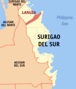 Map of Surigao del Sur with Lanuza highlighted | |
.svg.png) Lanuza Location within the Philippines | |
| Coordinates: 9°14′03″N 126°03′52″E / 9.2342°N 126.0644°ECoordinates: 9°14′03″N 126°03′52″E / 9.2342°N 126.0644°E | |
| Country |
|
| Region | Caraga (Region XIII) |
| Province | Surigao del Sur |
| District | 1st district of Surigao del Sur |
| Founded | December 10, 1918 |
| Barangays | 13 (see Barangays) |
| Government [1] | |
| • Type | Sangguniang Bayan |
| • Mayor | Salvacion Saloma-Azarcon |
| • Electorate | 8,266 voters (2016) |
| Area [2] | |
| • Total | 290.60 km2 (112.20 sq mi) |
| Population (2015 census)[3] | |
| • Total | 12,001 |
| • Density | 41/km2 (110/sq mi) |
| Time zone | UTC+8 (PST) |
| ZIP code | 8314 |
| PSGC | 166810000 |
| IDD : area code | +63 (0)86 |
| Climate type | Tropical rainforest climate |
| Income class | 4th municipal income class |
| Revenue (₱) | 80,037,346.01 (2016) |
| Native languages |
Surigaonon Agusan language Cebuano Kamayo Tagalog |
| Website |
www |
Lanuza, officially the Municipality of Lanuza, is a 4th class municipality in the province of Surigao del Sur, Philippines. According to the 2015 census, it has a population of 12,001 people.[3]
Barangays
Lanuza is politically subdivided into 13 barangays. In 1956, the sitio of Antao was converted into a barrio.[4]
History
On December 10, 1918, Executive Order No. 52 of American Governor General Francis Burton Harrison that was signed by Charles Yeater, divided Cantilan into three parts – Carrascal, present-day Cantilan and Lanuza. Now it is part of the settlement area called Carcanmadcarlan.
Demographics
| Population census of Lanuza | ||
|---|---|---|
| Year | Pop. | ±% p.a. |
| 1903 | 3,133 | — |
| 1939 | 7,314 | +2.38% |
| 1948 | 8,559 | +1.76% |
| 1960 | 10,296 | +1.55% |
| 1970 | 11,528 | +1.14% |
| 1975 | 8,313 | −6.35% |
| 1980 | 7,722 | −1.46% |
| 1990 | 9,051 | +1.60% |
| 1995 | 8,843 | −0.43% |
| 2000 | 10,057 | +2.80% |
| 2007 | 10,788 | +0.97% |
| 2010 | 11,857 | +3.50% |
| 2015 | 12,001 | +0.23% |
| Source: Philippine Statistics Authority[3][5][6][7] | ||
Economy
Lanuza belongs to the economic zone of Cantilan, one of the major economic zones of Surigao del Sur. Business opportunity is mainly dependent on agriculture, fishing, and eco-tourism. Lanuza was awarded a "clean and green" municipality title of the Caraga Region.
For telecommunication there are six cell sites operated by Smart Communications and Globe Telecom that cover the whole area of CarCanMadCarLan (Carrascal, Cantilan, Madrid, Carmen and Lanuza).
Two cable TV providers operate in Cantilan, Carrascal and Madrid. Cantilan has broadband internet with a number of internet cafes. The municipal building in Lanuza has a satellite connection, soon this will be extended to the school and may be offered as an internet cafe in the evenings.
Lanuza is noted as a surfing destination with its various surfing areas from Reef Breaks to Beach Breaks. Surfing season is between the months of November to March where big waves are in constant motion.
Climate
Lanuza's climate is characterized by rainfall that is distributed throughout the year. The period from April to August has the lowest level of rainfall while heavier rains occur from November to February and has 7% exposure to tropical cyclone.
References
- ↑ "Municipality". Quezon City, Philippines: Department of the Interior and Local Government. Retrieved 31 May 2013.
- ↑ "Province: Surigao del Sur". PSGC Interactive. Quezon City, Philippines: Philippine Statistics Authority. Retrieved 12 November 2016.
- 1 2 3 Census of Population (2015). "Caraga". Total Population by Province, City, Municipality and Barangay. PSA. Retrieved 20 June 2016.
- ↑ "An Act Converting into Barrios Certain Sitios in the Province of Surigao, and Dividing the Barrio of Macalaya into Two Barrios, Municipality of Placer, in the Same Province". LawPH.com. Archived from the original on 2012-07-11. Retrieved 2011-04-12.
- ↑ Census of Population and Housing (2010). "Caraga". Total Population by Province, City, Municipality and Barangay. NSO. Retrieved 29 June 2016.
- ↑ Censuses of Population (1903–2007). "Caraga". Table 1. Population Enumerated in Various Censuses by Province/Highly Urbanized City: 1903 to 2007. NSO.
- ↑ "Province of Surigao del Sur". Municipality Population Data. Local Water Utilities Administration Research Division. Retrieved 17 December 2016.
External links
- Philippine Standard Geographic Code
- Philippine Census Information
- Local Governance Performance Management System
- eCarCanMadCarLan Portal
- SurfLanuza - Surfing Gateway of the Philippines
Places adjacent to Lanuza, Surigao del Sur | ||||||||||
|---|---|---|---|---|---|---|---|---|---|---|
| ||||||||||