San Benito, Texas
| San Benito, Texas | |
|---|---|
| City | |
| City of San Benito | |
| Nickname(s): "The Resaca City" | |
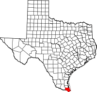
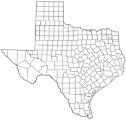 Location of San Benito, Texas | |
 | |
| Coordinates: 26°8′12″N 97°38′9″W / 26.13667°N 97.63583°WCoordinates: 26°8′12″N 97°38′9″W / 26.13667°N 97.63583°W | |
| Country | United States |
| State | Texas |
| County | Cameron |
| Government | |
| • Type | Council-Manager |
| • City Council | Mayor Celeste Sanchez |
| • City Manager | Manuel Lara |
| Area | |
| • Total | 16.1 sq mi (41.8 km2) |
| • Land | 15.8 sq mi (40.9 km2) |
| • Water | 0.3 sq mi (0.9 km2) |
| Elevation | 36 ft (11 m) |
| Population (2010) | |
| • Total | 24,250 |
| • Density | 1,536/sq mi (592.9/km2) |
| Time zone | UTC-6 (Central (CST)) |
| • Summer (DST) | UTC-5 (CDT) |
| ZIP code | 78586 |
| Area code(s) | 956 |
| FIPS code | 48-65036[1] |
| GNIS feature ID | 1375956[2] |
| Website |
www |
San Benito is a city in Cameron County, Texas, United States. The population was 24,250 at the 2010 census.[3] On April 3, 2007, San Benito celebrated the 100th anniversary of its naming.
The post office was named "Diaz" from April to May 1907. The San Benito Museum, Freddy Fender Museum and Conjunto Music Museum opened in the same building Nov. 17, 2007.
On October 25, 1975, on the television show Hee Haw, Freddy Fender saluted his hometown of San Benito, population 15,177.
San Benito is part of the Brownsville–Harlingen–Raymondville and the Matamoros–Brownsville metropolitan areas.
History
San Benito is known as the "Resaca City." The Resaca de los Fresnos, 400-foot (120 m) wide, flows through the city. As indicated by its Spanish name, the resaca was a dry river bed. It is now the main canal of a large irrigation system.
San Benito was at first named "Diaz" in honor of Porfirio Díaz, president of Mexico at that time. The people in the San Benito area were predominantly of Mexican ancestry. The Anglo settlers came after the completion of the first irrigation system in 1906. Prior to that time, this region was an arid, mesquite-cactus-brush covered wilderness. Irrigation water touched off the crop production magic in the railroad.
On July 4, 1904, the first passenger train arrived at Diaz. To celebrate the coming of the new railroad, the community leaders renamed the railroad station "Bessie", in honor of Bessie Yoakum, whose father, Benjamin Franklin Yoakum, was instrumental in the construction of the railroad.
Some time later, when the town site was surveyed, the name was changed to "San Benito" in honor of Benjamin Hicks. He was a pioneer rancher whose charitable attitude endeared him to the population. The name was suggested by Rafael Moreno, the popular 90-year-old camp cook of the surveying party. Moreno suggested the name "San Benito" for his beloved "Saint Benjamin" Hicks.
San Benito was a village with a moderate number of homes, businesses, churches, and public schools several years before they were incorporated in 1911. The original map of the townsite was recorded 28 April 1907. The first school was established in 1907 with 48 pupils and Miss Kate Purvis as the teacher. The post office also opened in 1907. San Benito (Benny) Montalvo was born on September 20, 1907 to Ismael and Francisca Esparza Montalvo. On the night he was born, the city of San Benito was having a celebration in honor of its new name. Upon learning of Benny's birth, Col. Sam Robertson suggested to Ismael and Francisca Montalvo to name their new son San Benito, which is how Benny got his name.
In 1927 the city adopted a commission form of government operating under a home rule charter.
In 1920, when the city was included in the U.S. Census count for the first time, San Benito had become a city of 4,070 people. By 1950 the census count was 13,271. In 1960 the population had grown to 16,422. The present population is estimated at 24,500.
The irrigation district was organized in 1906. As a result of the availability of irrigation water, San Benito and all of the Lower Rio Grande Valley cities came to serve a newly developing agricultural territory.
The original townsite, created in 1911, contained 1,280 acres (520 ha). Since then a series of annexations have increased the incorporated area to 4,092.17 acres (1,656.04 ha).
The mild winter climate in this southmost section of Texas has played a dominant role in the growth of San Benito and the other cities of the Lower Rio Grande Valley. Crops grow and flowers bloom year-round. The city has become a hotspot for winter tourists and retired people, providing a substantial percentage of the buying power of this community.
Geography
San Benito is located west of the center of Cameron County at 26°8′12″N 97°38′9″W / 26.13667°N 97.63583°W (26.136603, -97.635878).[4] Interstate 69E passes through the city, leading northwest 6 miles (10 km) to Harlingen and southeast 19 miles (31 km) to Brownsville. According to the United States Census Bureau, San Benito has a total area of 16.1 square miles (41.8 km2), of which 15.8 square miles (40.9 km2) is land and 0.3 square miles (0.9 km2), or 2.12%, is water.[3]
San Benito is also known as "The Resaca City", due to its resaca (a former tributary of the Rio Grande, which has been cut off for irrigation purposes).
Climate
The climate in this area is characterized by hot, dry summers and generally warm winters. According to the Köppen Climate Classification system, San Benito has a semi arid climate, borderline tropical savannah climate abbreviated "Cfa" on climate maps.[5]
Demographics
| Historical population | |||
|---|---|---|---|
| Census | Pop. | %± | |
| 1920 | 5,070 | — | |
| 1930 | 10,753 | 112.1% | |
| 1940 | 9,501 | −11.6% | |
| 1950 | 13,271 | 39.7% | |
| 1960 | 16,422 | 23.7% | |
| 1970 | 15,176 | −7.6% | |
| 1980 | 17,988 | 18.5% | |
| 1990 | 20,125 | 11.9% | |
| 2000 | 23,444 | 16.5% | |
| 2010 | 24,250 | 3.4% | |
| Est. 2016 | 24,476 | [6] | 0.9% |
| U.S. Decennial Census | |||
As of the census[1] of 2000, there were 23,444 people, 7,065 households, and 5,715 families residing in the city. The population density was 2,130.2 people per square mile (822.1/km²). There were 9,120 housing units at an average density of 828.7 per square mile (319.8/km²). The racial makeup of the city was 76.16% White, 0.32% African American, 0.41% Native American, 0.25% Asian, 20.48% from other races, and 2.38% from two or more races. Hispanic or Latino of any race were 86.93% of the population.
There were 7,065 households out of which 41.4% had children under the age of 18 living with them, 56.6% were married couples living together, 19.5% had a female householder with no husband present, and 19.1% were non-families. 16.8% of all households were made up of individuals and 10.7% had someone living alone who was 65 years of age or older. The average household size was 3.30 and the average family size was 3.72.
In the city, the population was spread out with 33.3% under the age of 18, 10.5% from 18 to 24, 24.8% from 25 to 44, 17.8% from 45 to 64, and 13.6% who were 65 years of age or older. The median age was 30 years. For every 100 females, there were 90.2 males. For every 100 females age 18 and over, there were 84.1 males.
The median income for a household in the city was $24,027, and the median income for a family was $26,415. Males had a median income of $22,097 versus $18,512 for females. The per capita income for the city was $10,317. About 28.7% of families and 32.7% of the population were below the poverty line, including 42.1% of those under age 18 and 22.8% of those age 65 or over.
Government
The United States Postal Service operates the San Benito Post Office.[7]
Education
The San Benito Consolidated Independent School District serves San Benito. The local high school is San Benito High School. SBCISD has 2 high schools, Veterans Memorial Academy and San Benito High School; three middle schools, Riverside, Berta Cabaza, and Miller Jordan.
In addition, South Texas Independent School District serves San Benito and many nearby communities by providing several magnet schools. South Texas Academy of Medical Technology (Med Tech) is located in San Benito.
San Benito Public Library is the city's library.[8]
IDEA Public Schools also has a school in San Benito.
Notable people
A list of San Benito's most notable people includes:
- T. R. Fehrenbach, author[9]
- Freddy Fender (born Baldemar Huerta), musician
- Charles Pugsley Fincher, cartoonist, lawyer, creator of Thadeus & Weez newspaper comic strip[10]
- Narciso Martínez, conjunto musician[11]
- Bobby Morrow, winner of three gold medals in the 1956 Summer Olympics
- Col. Sam A. Robertson, founder, railroad pioneer, first postmaster, World War I recipient of Distinguished Service Medal[12]
- Charles M. Robinson III, author, history scholar
- Robert Salaburu, professional poker player, 8th place at the final table of the 2012 World Series of Poker
- Armando Torres III, a former U.S. Marine kidnapped in Mexico
- Wilma Vinsant, combat flight nurse killed over Germany[13]
See also
References
- 1 2 "American FactFinder". United States Census Bureau. Retrieved 2008-01-31.
- ↑ "US Board on Geographic Names". United States Geological Survey. 2007-10-25. Retrieved 2008-01-31.
- 1 2 "Geographic Identifiers: 2010 Census Summary File 1 (G001): San Benito city, Texas". U.S. Census Bureau, American Factfinder. Retrieved July 8, 2015.
- ↑ "US Gazetteer files: 2010, 2000, and 1990". United States Census Bureau. 2011-02-12. Retrieved 2011-04-23.
- ↑ Climate Summary for San Benito, Texas
- ↑ "Population and Housing Unit Estimates". Retrieved June 9, 2017.
- ↑ "Post Office Location - SAN BENITO." United States Postal Service. Retrieved on May 9, 2010.
- ↑ "Public Library Archived 2010-09-19 at the Wayback Machine.." City of San Benito. Retrieved on May 9, 2010.
- ↑ T.R. Fehrenbach - Authors - Random House
- ↑ Charles Pugsley Fincher
- ↑ Narciso Martínez "Father of the Texas-Mexican Conjunto"
- ↑ http://www.tshaonline.org/handbook/online/articles/fro32
- ↑ Gilbert, Minnie (15 June 2010). "Shea, Wilma Vinsant [Dolly]". Handbook of Texas Online. Texas State Historical Association. Retrieved 4 October 2017.