Sainte-Marie Parish, New Brunswick
| Saint-Marie Saint Mary, St. Mary, Ste. Marie | |
|---|---|
| Parish | |
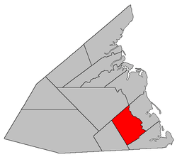 Location within Kent County, New Brunswick. | |
| Coordinates: 46°23′24″N 64°52′21″W / 46.39°N 64.8725°W | |
| Country |
|
| Province |
|
| County | Kent |
| Established | 1867 |
| Area[1] | |
| • Land | 238.21 km2 (91.97 sq mi) |
| Population (2011)[1] | |
| • Total | 2,008 |
| • Density | 8.4/km2 (22/sq mi) |
| • Pop 2006-2011 |
|
| • Dwellings | 1,046 |
| Time zone | UTC-4 (AST) |
| • Summer (DST) | UTC-3 (ADT) |
Saint-Marie, often called by its older English form, Saint Mary,[lower-alpha 1] is a Canadian parish in Kent County, New Brunswick.[3]
Its population in the 2011 Census was 2,008.
Delineation
Sainte-Marie Parish is defined in the Territorial Division Act[2] as being bounded:
- South by Dundas Parish; east by Wellington Parish; north by the western prolongation of the northern boundary of Wellington Parish; and west by the McLaughlin Road.[lower-alpha 2]
Communities
Parish population total does not include incorporated municipalities (in bold):
|
|
Demographics
See also
Footnotes
References
- 1 2 2011 Statistics Canada Census Profile: Saint Mary Parish, New Brunswick
- 1 2 "Territorial Division Act (R.S.N.B. 1973, c. T-3)". Government of New Brunswick website. Retrieved 25 August 2016.
- ↑ New Brunswick Provincial Archives - Saint Mary Parish
- ↑ Statistics Canada: 1996, 2001, 2006 census
- ↑ Statistics Canada Population and dwelling counts, for Canada and census subdivisions (municipalities), 2006 and 2001 censuses - 100% data
Places adjacent to Sainte-Marie Parish, New Brunswick | ||||||||||
|---|---|---|---|---|---|---|---|---|---|---|
| ||||||||||
| Subdivisions | |
|---|---|
| Cities | |
| Counties | |
| |
Coordinates: 46°23′24″N 64°52′21″W / 46.39000°N 64.87250°W
This article is issued from
Wikipedia.
The text is licensed under Creative Commons - Attribution - Sharealike.
Additional terms may apply for the media files.