Richibucto Parish, New Brunswick
| Richibucto | |
|---|---|
| Parish | |
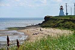 Cap-Lumière | |
 Location within Kent County, New Brunswick | |
| Coordinates: 46°37′03″N 64°47′24″W / 46.6175°N 64.79°W | |
| Country |
|
| Province |
|
| County | Kent County |
| Established | 1826 |
| Area[1] | |
| • Land | 249.45 km2 (96.31 sq mi) |
| Population (2011)[1] | |
| • Total | 1,986 |
| • Density | 8.0/km2 (21/sq mi) |
| • Pop 2006-2011 |
|
| • Dwellings | 1,115 |
| Time zone | UTC-4 (AST) |
| • Summer (DST) | UTC-3 (ADT) |
Richibucto is a Canadian parish in Kent County, New Brunswick.[2]
Its population in the 2011 Census was 1,986.
Delineation
Richibucto Parish is defined in the Territorial Division Act[3] as being bounded:
- South by Wellington Parish and Weldford Parish, west by Weldford Parish and a line running true south from the forks of the Saint-Charles River to the northern line of Weldford Parish; north by the centre of the Saint-Charles River and of the Northwest Branch and Richibucto [Harbour], and east by the Gulf of Saint Lawrence, including all the islands in front; except that portion thereof formerly in said Parish of Richibucto, now included in the Parish of Saint-Charles as described below.
Communities
Parish population total does not include incorporated municipalities (in bold):
- Bedec
- Bells Mills
- Cap-de-Richiboucto
- Cap-Lumière
- Côte-Sainte-Anne
- East Galloway
- Galloway
- Jardineville
- Peters Mills
- Petit-Chockpish
- Pirogue
- Rexton
- Richibucto
- Richibucto Village Cape
- Richibucto-Village
- Saint-Charles Station
- Sainte-Anne-de-Kent
- Village-La-Prairie
- West Galloway
Demographics
See also
References
- 1 2 2011 Statistics Canada Census Profile: Richibucto Parish, New Brunswick
- ↑ New Brunswick Provincial Archives - Richibucto Parish
- ↑ "Territorial Division Act (R.S.N.B. 1973, c. T-3)". Government of New Brunswick website. Retrieved 24 August 2016.
- ↑ Statistics Canada: 1996, 2001, 2006 census
- ↑ 2006 Statistics Canada Community Profile: Richibucto Parish, New Brunswick
External links
Places adjacent to Richibucto Parish, New Brunswick | ||||||||||
|---|---|---|---|---|---|---|---|---|---|---|
| ||||||||||
| Subdivisions | |
|---|---|
| Cities | |
| Counties | |
| |
Coordinates: 46°37′03″N 64°47′24″W / 46.61750°N 64.79000°W
This article is issued from
Wikipedia.
The text is licensed under Creative Commons - Attribution - Sharealike.
Additional terms may apply for the media files.