Saint-Paul Parish, New Brunswick
| Saint-Paul St. Paul | |
|---|---|
| Parish | |
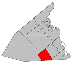 Location within Kent County, New Brunswick. | |
| Coordinates: 46°19′39″N 65°01′03″W / 46.3275°N 65.0175°W | |
| Country |
|
| Province |
|
| County | Kent County |
| Established | 1883 |
| Area[1] | |
| • Land | 228.80 km2 (88.34 sq mi) |
| Population (2011)[1] | |
| • Total | 866 |
| • Density | 3.8/km2 (10/sq mi) |
| • Pop 2006-2011 |
|
| • Dwellings | 357 |
| Time zone | UTC-4 (AST) |
| • Summer (DST) | UTC-3 (ADT) |
Saint-Paul is a Canadian parish in Kent County, New Brunswick.[2]
Its population in the 2011 Census was 866.
Delineation
Saint-Paul Parish is defined in the Territorial Division Act[3] as being bounded:
- North by the western prolongation of the northern line of Wellington Parish; east by the McLaughlin Road;[lower-alpha 1] west by the Canadian National Railways Line, and southwest by the County line.
Governance
The entire parish forms the local service district of the parish of Saint-Paul,[lower-alpha 2] established in 1966 to assess for fire protection. Community services were added in 1987, recreational and sports facilities in 2008, and non-fire related rescue in 2015. First aid and ambulance services (1982–2008) were formerly included.
Communities
|
|
Demographics
PopulationPopulation trend[4]
|
LanguageMother tongue language (2006)[5]
|
See also
Footnotes
Footnotes
References
- 1 2 2011 Statistics Canada Census Profile: Saint-Paul Parish, New Brunswick
- ↑ New Brunswick Provincial Archives - Saint-Paul Parish
- ↑ "Territorial Division Act (R.S.N.B. 1973, c. T-3)". Government of New Brunswick website. Retrieved 25 August 2016.
- ↑ Statistics Canada: 1996, 2001, 2006 census
- ↑ 2006 Statistics Canada Community Profile: Saint-Paul Parish, New Brunswick
External links
Places adjacent to Saint-Paul Parish, New Brunswick | ||||||||||
|---|---|---|---|---|---|---|---|---|---|---|
| ||||||||||
| Subdivisions | |
|---|---|
| Cities | |
| Counties | |
| |
Coordinates: 46°19′39″N 65°01′03″W / 46.32750°N 65.01750°W
This article is issued from
Wikipedia.
The text is licensed under Creative Commons - Attribution - Sharealike.
Additional terms may apply for the media files.