Saint-Nérée-de-Bellechasse, Quebec
| Saint-Nérée-de-Bellechasse | |
|---|---|
| Municipality | |
 | |
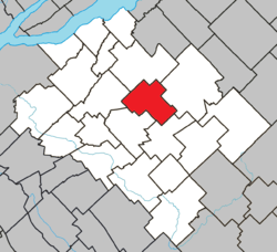 Location within Bellechasse RCM. | |
 Saint-Nérée-de-Bellechasse Location in province of Quebec. | |
| Coordinates: 46°44′N 70°43′W / 46.733°N 70.717°WCoordinates: 46°44′N 70°43′W / 46.733°N 70.717°W[1] | |
| Country |
|
| Province |
|
| Region | Chaudière-Appalaches |
| RCM | Bellechasse |
| Constituted | March 29, 1887 |
| Government[2] | |
| • Mayor | Pascal Fournier |
| • Federal riding | Lévis—Bellechasse |
| • Prov. riding | Bellechasse |
| Area[2][3] | |
| • Total | 76.30 km2 (29.46 sq mi) |
| • Land | 75.23 km2 (29.05 sq mi) |
| Population (2011)[3] | |
| • Total | 743 |
| • Density | 9.9/km2 (26/sq mi) |
| • Pop 2006-2011 |
|
| • Dwellings | 468 |
| Time zone | UTC−5 (EST) |
| • Summer (DST) | UTC−4 (EDT) |
| Postal code(s) | G0R 3V0 |
| Area code(s) | 418 and 581 |
| Highways | No major routes |
| Website |
www |
Saint-Nérée-de-Bellechasse is a municipality of 739 people in the Bellechasse Regional County Municipality, part of the Chaudière-Appalaches administrative region.
Prior to February 18, 2012, it was known simply as Saint-Nérée.[4]
References
- ↑ Reference number 414514 of the Commission de toponymie du Québec (in French)
- 1 2 Geographic code 19045 in the official Répertoire des municipalités (in French)
- 1 2 "(Code 2419045) Census Profile". 2011 census. Statistics Canada. 2012.
- ↑ http://www.stat.gouv.qc.ca/publications/referenc/pdf2012/modif_fev12.pdf%5Bpermanent+dead+link%5D
Places adjacent to Saint-Nérée-de-Bellechasse, Quebec | ||||||||||
|---|---|---|---|---|---|---|---|---|---|---|
| ||||||||||
| Municipalities | |
|---|---|
| Parishes | |
| |
This article is issued from
Wikipedia.
The text is licensed under Creative Commons - Attribution - Sharealike.
Additional terms may apply for the media files.