SEPTA Routes 101 and 102
| Routes 101 and 102 Media–Sharon Hill Line | |
|---|---|
 | |
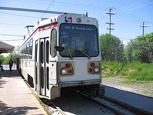 Route 102 at Sharon Hill station | |
| Overview | |
| Type | Light rail |
| Locale | Delaware County, Pennsylvania |
| Termini |
Media-Orange Street (Route 101) Sharon Hill (Route 102) 69th Street Transportation Center |
| Stations | 52 |
| Services |
2
|
| Daily ridership |
Route 101: 4,400 Route 102: 3,576 (average weekday, FY 2014)[1] |
| Operation | |
| Opened | 1906 |
| Operator(s) | SEPTA |
| Character | Surface (at-grade) |
| Technical | |
| Line length | 11.9 mi (19.2 km)[2] |
| Track gauge | PA gauge 5 ft 2 1⁄4 in (1,581 mm)[3][4] |
| Electrification | Overhead lines |
SEPTA Routes 101 and 102[5], also known as the Media–Sharon Hill Line[6], are light rail lines operated by the Suburban Transit Division of the Southeastern Pennsylvania Transportation Authority. The routes' eastern terminus is 69th Street Transportation Center in Upper Darby, Pennsylvania; Route 101 to Media, Route 102 to Sharon Hill. Altogether, the two lines operate on approximately 11.9 miles (19.2 km) of route.[2] The lines were formerly interurbans.
Along with the Norristown High Speed Line, formerly the Philadelphia and Western Railroad, the routes are the remaining lines of the Red Arrow Trolley System once operated by the Philadelphia Suburban Transportation Company (successor to the Philadelphia and West Chester Traction Company); some local residents still call them "Red Arrow".
This route uses 29 Kawasaki Heavy Industries Rolling Stock Company K cars, similar to those used on the SEPTA Subway–Surface Trolley Lines, but unlike them, the K cars on routes 101 and 102 are double-ended and use pantograph collection instead of trolley poles.
Current system
| Route | Length[7] | South terminal | North terminal |
|---|---|---|---|
| 101 | 8.6 miles (13.8 km) | Media Orange Street at State Street |
Upper Darby 69th Street Transportation Center |
| 102 | 5.3 miles (8.5 km) | Sharon Hill Sharon Hill | |
The 101 and 102 run together on their exclusive right-of-way from Upper Darby to Drexel Hill Junction for approximately 2 miles (3.2 km), at which point they diverge.
Route 101 continues on its own right-of-way traveling west and southwest through Drexel Hill and Springfield with an important stop at the Springfield Mall before entering the street in Media. The 101 has double tracks to Woodland Avenue, then a single track to just before Pine Ridge, then enters the street at Providence Road in Media and runs on a single track the rest of the way. Cars in the street must yield to the trolley. The line terminates in the middle of the street just west of the Delaware County Courthouse.
Route 102 runs southeast from Drexel Hill Junction through Drexel Hill and Clifton Heights and then goes into the street in Aldan. After Aldan, it returns to its own right-of-way, then passes through Collingdale before terminating at Chester Pike in Sharon Hill. The 102 has double tracks until up to North Street in Collingdale, where the 102 returns to its own right-of-way, and after North Street, there is a single track until the end of the line.
Springfield Road contains two stops along both lines. Route 101 stops at Springfield Road in Springfield. Route 102 stops at Springfield Road in Clifton Heights, then joins this street until it moves onto Woodlawn Avenue through Aldan.
History
The Sharon Hill Line (Route 102) was originally built by the Philadelphia and West Chester Traction Company on March 15, 1906, and the Media Line (Route 101) was originally built by the same company on April 1, 1913.[8] The lines were later bought by the Philadelphia Suburban Transit Company in 1954.
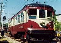
Besides Routes 101 and 102, there were also two other, now defunct, Red Arrow trolley lines. The direct ancestor of the SEPTA Route 104 bus line went to West Chester, splitting off from the rest of the system right after 69th Street Transportation Center onto West Chester Pike. The tracks continued all the way up West Chester Pike. West Chester trolleys were replaced by buses in 1954 due to widening of West Chester Pike; rush-hour trips to Westgate Hills lasted until 1958. Tracks remained in use for access to the Red Arrow's carbarn in Llanerch until SEPTA closed the barn in 1971; all tracks were soon removed except for a portion near 69th Street that SEPTA occasionally uses to store out-of service trolleys. The other now-defunct Red Arrow trolley line went to Ardmore until December 1966. It split from the West Chester line at Llanerch and continued on its own exclusive right-of-way. Much of the right-of-way still remains between Schauffele Plaza in Ardmore (the former terminus of the line) and Eagle Road in Havertown, although the tracks were removed and the right-of-way paved for dedicated use by the replacement bus line, now SEPTA Route 103. The 103 still uses this private right-of-way, although much of its other street routing has changed. Until the 1970s, Routes 101 and 102 were interurbans.
Stations
.jpg)
.jpg)
.jpg)
| Location | Station | Transfers | Notes | |
|---|---|---|---|---|
| Stations served by Route 101 (Media) only | ||||
| Media | Orange Street – State Street | Route 101 western terminus. | ||
| Veterans Square – State Street | ||||
| Olive Street – State Street | ||||
| Jackson Street – State Street | ||||
| Monroe Street – State Street | ||||
| Edgemont Street – State Street | ||||
| Manchester Avenue – State Street | ||||
| Begin right-of-way and two-track operation. Formerly known as Bowling Green. | ||||
| Beatty Road | ||||
| Springfield | Tracks converge east of this station. | |||
| Paper Mill Road | Serves Smedley Park | |||
| Formerly known as Sproul Road. | ||||
| Thomson Avenue | ||||
| Woodland Avenue | Resume two-track operation east of this station. | |||
| Leamy Avenue | ||||
| Saxer Avenue | ||||
| Drexel Hill | ||||
| Drexelbrook | ||||
| Anderson Avenue | ||||
| Aronimink | ||||
| School Lane | ||||
| Huey Avenue | ||||
| Stations served by Route 102 (Sharon Hill) only | ||||
| Sharon Hill | Sharon Hill – Chester Pike | Route 102 western terminus. | ||
| Collingdale | MacDade Boulevard – Woodlawn Avenue | Formerly known as Collingdale. | ||
| Andrews Avenue – Woodlawn Avenue | ||||
| Bartram Avenue – Woodlawn Avenue | ||||
| North Street – Woodlawn Avenue | Tracks leave right-of-way and merge with Woodlawn Avenue north of this station. | |||
| Aldan | Magnolia Avenue – Woodlawn Avenue | |||
| Providence Road – Woodlawn Avenue | ||||
| Shisler Avenue – Woodlawn Avenue | Station closed on March 15, 2010. | |||
| Clifton Heights | Clifton-Aldan – Woodlawn Avenue
' |
SEPTA Media/Elwyn Line | Tracks transition onto Springfield Road. | |
| Springfield Road | Tracks leave Springfield Road for right-of-way south of this station. | |||
| Penn Street | ||||
| Baltimore Pike | ||||
| Drexel Hill | Creek Road | Located in Indian Rock Park. Formerly known as Oakdale. | ||
| Marshall Road | ||||
| Drexel Manor | ||||
| Garrettford | ||||
| Stations shared by both routes | ||||
| Drexel Hill | Drexel Hill Junction | Also known as Shadeland Avenue. Routes 101 and 102 diverge west of this station. | ||
| Irvington Road | Bypassed by select Route 101 rush hour express service. | |||
| Drexel Park | Bypassed by select Route 101 rush hour express service. Also called Fairfax Road. | |||
| Upper Darby | Lansdowne Avenue – Garrett Road | |||
| Congress Avenue – Garrett Road | Bypassed by select Route 101 rush hour express service. | |||
| Beverly Boulevard – Garrett Road & Bywood Avenue | Bypassed by select Route 101 rush hour express service. Formerly known as Beverly Hills. | |||
| Hilltop Road – Garrett Road & Bywood Avenue | Bypassed by select Route 101 rush hour express service. | |||
| Avon Road – Garrett Road & Bywood Avenue | Bypassed by select Route 101 rush hour express service. Formerly known as Bywood. | |||
| Walnut Street – Garrett Road & Bywood Avenue | Bypassed by select Route 101 rush hour express service. | |||
| Fairfield Avenue – Bywood Avenue | Bypassed by select Route 101 rush hour express service. Tracks merge with street east of this station. | |||
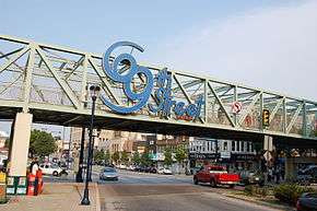
| 69th Street Transportation Center – Market Street | 116, 120, 123, 126 Market–Frankford Line Norristown High Speed Line |
|||
References
- ↑ "Fiscal Year 2014 Annual Service Plan" (PDF). SEPTA. May 2013. p. 42. Archived from the original (pdf) on 2013-09-22. Retrieved 2014-06-19.
- 1 2 Demery, Jr., Leroy W. (November 2011). "U.S. Urban Rail Transit Lines Opened From 1980" (PDF). publictransit.us. pp. 37–40. Archived from the original (pdf) on 2013-11-04. Retrieved 2013-11-02.
- ↑ "The history of trolley cars and routes in Philadelphia". SEPTA. June 1, 1974. p. 2. Retrieved 2014-06-11.
An early city ordinance prescribed that all tracks were to have a gauge of 5' 2 1⁄4.
- ↑ Hilton, George W.; Due, John Fitzgerald (January 1, 2000). The Electric Interurban Railways in America. Stanford University Press. Retrieved 2014-06-10.
- ↑ 101 and 102 Official map. Accessed July 22, 2018.
- ↑ "SEPTA Capital Improvements in Delaware County" (PDF). SEPTA. December 2007. p. 4. Retrieved 2008-01-04.
- ↑ "SEPTA - Spring 2012 Route Statistics" (PDF). Southeastern Pennsylvania Transportation Authority. 2012. Retrieved 2013-06-28.
- ↑ Philadelphia Suburban Transit Routes (ChicagoRailFan.net)
External links
Route map:
| Wikimedia Commons has media related to SEPTA Routes 101 and 102. |
- U.S. Urban Rail Transit Lines Opened From 1980 (PDF)
- Rt. 101/102 – Media/Sharon Hill; Images, guide, and slight history at World-NYC Subway.org
Founded 1736 | ||
| Communities |
|   |
| Education | ||
| Historic Sites | ||
| Infrastructure | ||
| Regional Rail Stations | ||
| Trolley/Subway Station |
| |