Rwekunye–Apac–Aduku–Lira–Kitgum–Musingo Road
| Rwekunye–Apac–Aduku–Lira–Kitgum–Musingo Road | |
|---|---|
| Route information | |
| Length | 217.5 mi (350.0 km) |
| History |
Designation in 2015 Expected completion TBD |
| Major junctions | |
| South end | Rwekunye |
|
Apac Lira Acholibur Kitgum | |
| North end | Musingo |
Rwekunye–Apac–Aduku–Lira–Kitgum–Musingo Road is a road in the Northern Region of Uganda, connecting the towns of Masindi Port in Kiryandongo District to Apac in Apac District, Lira in Lira District, Acholibur in Pader District, Kitgum in Kitgum District, and Musingo in Lamwo District at the international border with South Sudan.
Location
The road starts at Rwekunye, a suburb of the town of Masindi Port, on the Kampala-Gulu highway, about 5 kilometres (3 mi) west of the Victoria Nile.[1] The road continues through five northern Ugandan districts to end at Musingo, a total distance of about 350 kilometres (217 mi).[2] The coordinates of the road near Lira are 2°22'27.0"N, 32°56'04.0"E (Latitude:2.374167; Longitude:32.934444).[3]
Upgrading to bitumen
In 2009, the Ugandan government commissioned a feasibility study and a detailed engineering design for this road and for the 167 kilometres (104 mi) Acholibur–Gulu–Olwiyo Road, both in northern Uganda. The reports became available in 2013.[2]
In February 2015, the upgrade from unsealed gravel surface to class II bitumen surface began. President Yoweri Museveni commissioned the start of the project on 21 February 2015. The work on the 86 kilometres (53 mi) from Acholibur to Musingo is assigned to Chongqing International Construction Corporation. Work is expected to last three years.[4] The road project is fully funded by the Ugandan government.[5] The work on the Rwekunye to Acholibur section of the road will be commissioned at a later date.[4]
See also
References
- ↑ GFC (16 July 2015). "Road Distance Between Rwekunye And Masindi Port With Map". Globefeed.com (GFC). Retrieved 16 July 2015.
- 1 2 AICPI (April 2013). "RWENKUNYE-APAC-LIRA-KITGUM-MUSINGO, OLWIYO-GULU-KITGUM ROADS". Aicprogetti.it (AICPI). Retrieved 16 July 2015.
- ↑ Google (16 July 2015). "Location of Rwekunye–Apac–Aduku–Lira–Kitgum–Musingo Road At Google Maps" (Map). Google Maps. Google. Retrieved 16 July 2015.
- 1 2 Komakech, Dan Michael (23 February 2015). "Museveni launches road works". Daily Monitor. Kampala. Retrieved 15 July 2015.
- ↑ Rwothungeyo, Billy (August 2014). "Solicitor General clears contracts for 450km of roads". New Vision Mobile. Kampala. Archived from the original on 16 July 2015. Retrieved 15 July 2015.
External links
Capital: Lamwo | ||
| Towns and villages |
| 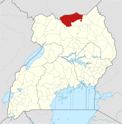 |
| Transport | ||
| Notable people | ||
Capital: Kitgum | ||
| Counties and sub-counties | Chwa County | 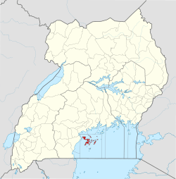 |
| Towns and villages |
| |
| Economy | ||
| Health | ||
| Transport | ||
| Education |
| |
| Notable people | ||
Capital: Pader | ||
| Towns and villages | 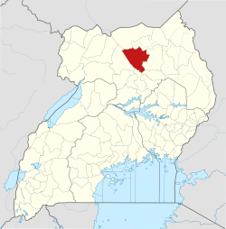 | |
| Economy | ||
| Energy | ||
| Education |
| |
| Transport | ||
| Notable people |
| |
Capital: Lira | ||
| Counties and sub-counties | Otuke County | 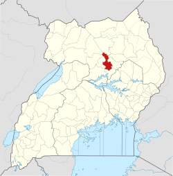 |
| Towns and villages | ||
| Economy | ||
| Industry | ||
| Transport | ||
| Energy | ||
| Notable landmarks | ||
| Health |
| |
| Education | ||
| Notable people | ||
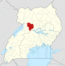
Capital: Apac | ||
| Towns and villages | 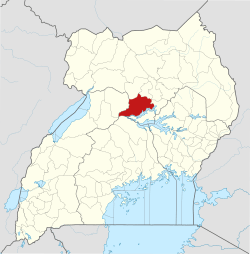 | |
| Geography | ||
| Transport | ||
| Economy | ||
| Notable landmarks |
| |
| Education |
| |
| Health | ||
| Notable people | ||
Capital: Kiryandongo | ||
| Towns and villages |
|  |
| Geography | ||
| Economy | ||
| Energy | ||
| Notable landmarks | ||
| Transport | ||
| Education | ||
| Health | ||
| Notable people | ||