Musingo
| Musingo | |
|---|---|
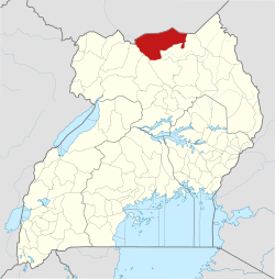
 Musingo Map of Uganda showing the location of Musingo | |
| Coordinates: 03°46′17″N 33°11′59″E / 3.77139°N 33.19972°E | |
| Country |
|
| Region | Northern Region of Uganda |
| Sub-region | Acholi sub-region |
| District | Lamwo District |
| Elevation | 1,100 m (3,600 ft) |
| Time zone | UTC+3 (EAT) |
Musingo is a settlement in the Northern Region of Uganda at the international border with South Sudan.
Location
The settlement is located approximately 67 kilometres (42 mi) northeast of Kitgum, the nearest large urban centre. This is about 86 kilometres (53 mi) northeast of Acholibur on the Rwekunye–Apac–Aduku–Lira–Kitgum–Musingo Road.[1] The coordinates of Musingo are 3°46'17.0"N, 33°11'59.0"E (Latitude:3.771389; Longitude:33.199722).[2]
Points of interest
The following points of interest lie within the settlement or near its edges:
- offices of Musingo Town Council
- Musingo central market
- northern terminus of the 350 kilometres (217 mi) Rwekunye–Apac–Aduku–Lira–Kitgum–Musingo Road
See also
References
- ↑ Komakech, Dan Michael (23 February 2015). "Museveni launches road works". Daily Monitor. Kampala. Retrieved 16 July 2015.
- ↑ Google (16 July 2015). "Location of Musingo At Google Maps" (Map). Google Maps. Google. Retrieved 16 July 2015.
Coordinates: 03°46′17″N 33°11′59″E / 3.77139°N 33.19972°E
Capital: Lamwo | ||
| Towns and villages |
|  |
| Transport | ||
| Notable people | ||
This article is issued from
Wikipedia.
The text is licensed under Creative Commons - Attribution - Sharealike.
Additional terms may apply for the media files.