Masindi Port
| Masindi Port | |
|---|---|
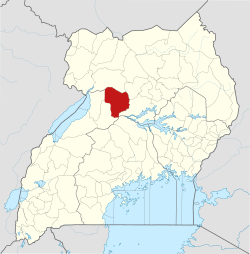
 Masindi Port Map of Uganda showing the location of Masindi Port. | |
| Coordinates: 01°41′54″N 32°04′40″E / 1.69833°N 32.07778°E | |
| Country |
|
| District | Masindi District |
| Elevation | 1,040 m (3,410 ft) |
| Population (2009 Estimate) | |
| • Total | 10,400 |
| Time zone | UTC+3 (EAT) |
Masindi Port is a town in Uganda.
Location
Masindi Port is in Kiryandongo District in western Uganda on the western banks of the Victoria Nile, approximately 197 kilometres (122 mi), by road, northwest of Kampala, Uganda's capital and largest city.[1] This is approximately 39 kilometres (24 mi), by road, south of Kiryandongo, the district capital.[2] The coordinates of the town are 1°41'54.0"N, 32°04'40.0"E (Latitude:1.6983;, 32.0778).[3]
Overview
Masindi Port was a busy river boat docking station during the late 19th and early 20th centuries. Steamboats were a major mode of transport on the Nile River. Because of the Karuma Falls and the Murchison Falls on the Victoria Nile between Lake Kyoga and Lake Albert, steamboats could not navigate that part of the Nile. Passengers would travel by boat from Lake Victoria, down the Victoria Nile into Lake Kyoga. They would then disembark at Masindi Port and travel by land to Butiaba, a port on Lake Albert, where they would resume their water journey downstream the Nile. With the decline of this mode of river transportation, Masindi Port and Butiaba have been reduced to mainly market towns.[4]
Population
In 2009, the Uganda Bureau of Statistics estimated the population of Masindi Port at about 10,400.[5]
See also
References
- ↑ GFC (16 July 2015). "Road Distance Between Kampala And Masindi Port". Globefeed.com (GFC). Retrieved 16 July 2015.
- ↑ GFC (16 July 2015). "Road Distance Between Kiryandongo (Bweyale) And Masindi Port With Map". Globefeed.com (GFC). Retrieved 16 July 2015.
- ↑ Google (16 July 2015). "Location of Masindi Port At Google Maps" (Map). Google Maps. Google. Retrieved 16 July 2015.
- ↑ Michael Hodd, and Angela Roche (2002). Uganda Handbook. Footprint Handbooks. ISBN 9781903471340. Retrieved 16 July 2015.
- ↑ UBOS (2009). "Kiryandongo District Community Information System: Chapter Two - Socio-Demographic Characteristics" (PDF). Kampala: Uganda Bureau of Statistics (UBOS). Retrieved 16 July 2015.
External links
- [ ]
Capital: Kiryandongo | ||
| Towns and villages |
|  |
| Geography | ||
| Economy | ||
| Energy | ||
| Notable landmarks | ||
| Transport | ||
| Education | ||
| Health | ||
| Notable people | ||