Aduku
| Aduku | |
|---|---|
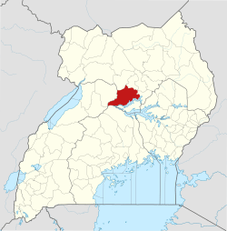
 Aduku Map of Uganda showing the location of Aduku | |
| Coordinates: 02°01′10″N 32°43′12″E / 2.01944°N 32.72000°ECoordinates: 02°01′10″N 32°43′12″E / 2.01944°N 32.72000°E | |
| Country | Uganda |
| District | Apac District |
| Population (2009 Estimate) | |
| • Total | 10,700 |
| Time zone | UTC+3 (EAT) |
Aduku is a town in, Apac District in northern Uganda. It is one of the municipalities within Apac District.[1]
Location
Aduku is located approximately 36 kilometres (22 mi), by road, southwest of Lira, the largest city in the sub-region.[2] Aduku is located about 24 kilometres (15 mi), by road, east of Apac, the district headquarters.[3] The coordinates of the town are:2°01'10.0"N, 32°43'12.0"E (Latitude:2.0194; Longitude:32.7200).[4]
Points of interest
The following points of interest lie within the town limits or near its boundaries:
- Aduku Central Market
- Aduku Senior Secondary School - A public, mixed high school
- Aduku UCC (Uganda College of Commerce) - A public institution
- Ikwera Girls Secondary School - A public all-girls high school
- West Lango Anglican Diocese
- A branch of Stanbic Bank
- Rwekunye–Apac–Aduku–Lira–Kitgum–Musingo Road passes through the middle of town.
See also
References
- ↑ Cyprian Musoke, and Joyce Namutebi (1 September 2009). "MPS Warn On New Town Councils". New Vision. Kampala. Archived from the original on 26 February 2015. Retrieved 18 July 2015.
- ↑ GFC, . (18 July 2015). "Road Distance Between Lira And Aduku With Map". Globefeed.com (GFC). Retrieved 18 July 2015.
- ↑ GFC, . (18 July 2015). "Map Showing Apac And Aduku With Route Marker". Globefeed.com (GFC). Retrieved 18 July 2015.
- ↑ Google. "Location of Aduku At Google Maps" (Map). Google Maps. Google.
External links
This article is issued from
Wikipedia.
The text is licensed under Creative Commons - Attribution - Sharealike.
Additional terms may apply for the media files.
