Roseller Lim, Zamboanga Sibugay
| Roseller Lim | |
|---|---|
| Municipality | |
| Municipality of Roseller Lim | |
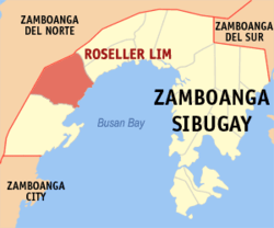 Map of Zamboanga Sibugay with Roseller Lim highlighted | |
.svg.png) Roseller Lim Location within the Philippines | |
| Coordinates: 7°42′N 122°28′E / 7.7°N 122.47°ECoordinates: 7°42′N 122°28′E / 7.7°N 122.47°E | |
| Country |
|
| Region | Zamboanga Peninsula (Region IX) |
| Province | Zamboanga Sibugay |
| District | 2nd District |
| Barangays | 26 (see Barangays) |
| Government [1] | |
| • Type | Sangguniang Bayan |
| • Mayor | Michael Piodena |
| • Electorate | 23,859 voters (2016) |
| Area [2] | |
| • Total | 300 km2 (100 sq mi) |
| Population (2015 census)[3] | |
| • Total | 43,646 |
| • Density | 150/km2 (380/sq mi) |
| Time zone | UTC+8 (PST) |
| ZIP code | 7002 |
| PSGC | 098312000 |
| IDD : area code | +63 (0)62 |
| Climate type | Tropical climate |
| Income class | 3rd municipal income class |
| Revenue (₱) | 120,709,571.77 (2016) |
| Native languages |
Subanon language Cebuano Chavacano Tagalog |
| Website |
www |
Roseller Lim, officially the Municipality of Roseller Lim, is a 3rd class municipality in the province of Zamboanga Sibugay, Philippines. According to the 2015 census, it has a population of 43,646 people.[3]
The town is named in honor of the first Senator from Zamboanga, Senator Roseller T. Lim.
Barangays
Roseller Lim is politically subdivided into 26 barangays.
- Ali Alsree
- Balansag
- Calula
- Casacon
- Don Perfecto
- Gango
- Katipunan
- Kulambugan
- Mabini
- Magsaysay
- Malubal
- New Antique
- New Sagay
- Palmera
- Pres. Roxas
- Remedios
- San Antonio
- San Fernandino
- San Jose
- Santo Rosario
- Siawang
- Silingan
- Surabay
- Taruc
- Tilasan
- Tupilac
Attractions
- Arka sa RTLim
Demographics
| Population census of Roseller Lim | ||
|---|---|---|
| Year | Pop. | ±% p.a. |
| 1990 | 29,325 | — |
| 1995 | 31,291 | +1.22% |
| 2000 | 34,152 | +1.89% |
| 2007 | 34,952 | +0.32% |
| 2010 | 37,216 | +2.31% |
| 2015 | 43,646 | +3.08% |
| Source: Philippine Statistics Authority[3][4][5][6] | ||
List of former mayors
- Romeo Billote
- Camilo Bicoy
- Danilo "Dan" Piodena
- Michael "Papong" Piodena - present
Education
Roseller Lim has many elementary and high schools, as well as colleges.
Elementary
- Surabay Central Elementary School
- Surabay SPED
- Magsaysay Elementary School
- Kulambugan Elementary School
- Katipunan Elementary School
- Silingan Elementary School
- Tupilac Elementary School
- Malubal Elementary School
- San Jose Primary School
- Siawang Elementary School
- Taruc Elementary School
- Butalian Elementary School
- Guinabucan Elementary School
Secondary
- Surabay National High School (SNHS)
- Malubal High school (MHS)
- Sto. Rosario National High school (SrNHS)
- San Fernandino National High School (SFNHS)
- Guinabucan National High School (GNHS)
Tertiary
- Western Sibugay College (WESCO)
- Western Mindanao Cooperative College-Annex (WMCC)
Churches
- Catholic
- Baptist
- Islam
- Iglesia Ni Cristo
- Alliance Church
- Grace Gospel Church of Christ
- New Hope
- The Bishop of the Dumaguete City Christian Fellowship Churches of the Philippines
- Members Church of God International (Ang Dating Daan)
References
- ↑ "Municipality". Quezon City, Philippines: Department of the Interior and Local Government. Retrieved 31 May 2013.
- ↑ "Province: Zamboanga Sibugay". PSGC Interactive. Quezon City, Philippines: Philippine Statistics Authority. Retrieved 12 November 2016.
- 1 2 3 Census of Population (2015). "Region IX (Zamboanga Peninsula)". Total Population by Province, City, Municipality and Barangay. PSA. Retrieved 20 June 2016.
- ↑ Census of Population and Housing (2010). "Region IX (Zamboanga Peninsula)". Total Population by Province, City, Municipality and Barangay. NSO. Retrieved 29 June 2016.
- ↑ Censuses of Population (1903–2007). "Region IX (Zamboanga Peninsula)". Table 1. Population Enumerated in Various Censuses by Province/Highly Urbanized City: 1903 to 2007. NSO.
- ↑ "Province of Zamboanga Sibugay". Municipality Population Data. Local Water Utilities Administration Research Division. Retrieved 17 December 2016.
External links
Places adjacent to Roseller Lim, Zamboanga Sibugay | |
|---|---|
Ipil (capital) | |
| Municipalities | |
This article is issued from
Wikipedia.
The text is licensed under Creative Commons - Attribution - Sharealike.
Additional terms may apply for the media files.