Kabasalan, Zamboanga Sibugay
| Kabasalan | |
|---|---|
| Municipality | |
| Municipality of Kabasalan | |
| Motto(s): Agri-Aqua Basin of Zambaoanga Sibugay | |
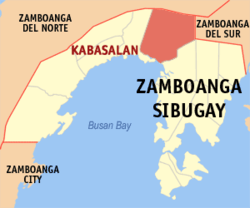 Map of Zamboanga Sibugay with Kabasalan highlighted | |
.svg.png) Kabasalan Location within the Philippines | |
| Coordinates: 7°49′N 122°49′E / 7.82°N 122.82°ECoordinates: 7°49′N 122°49′E / 7.82°N 122.82°E | |
| Country |
|
| Region | Zamboanga Peninsula (Region IX) |
| Province | Zamboanga Sibugay |
| District | 2nd District |
| Founded | 1917 |
| Barangays | 29 (see Barangays) |
| Government [1] | |
| • Type | Sangguniang Bayan |
| • Mayor | Isgani Balladares |
| • Electorate | 29,324 voters (2016) |
| Area [2] | |
| • Total | 289.2 km2 (111.7 sq mi) |
| Population (2015 census)[3] | |
| • Total | 44,336 |
| • Density | 150/km2 (400/sq mi) |
| Time zone | UTC+8 (PST) |
| ZIP code | 7005 |
| PSGC | 098306000 |
| IDD : area code | +63 (0)62 |
| Climate type | Tropical climate |
| Income class | 2nd municipal income class |
| Revenue (₱) | 142,016,889.09 (2016) |
| Native languages |
Subanon language Cebuano Chavacano Tagalog |
| Website |
www |
Kabasalan, officially the Municipality of Kabasalan, is a 2nd class municipality in the province of Zamboanga Sibugay, Philippines. According to the 2015 census, it has a population of 44,336 people.[3]
Barangays
Kabasalan is politically subdivided into 29 barangays.
- Banker
- Bolo Battalion
- Buayan
- Cainglet
- Calapan
- Calubihan (F.L.Pena)
- Concepcion (Balungis)
- Diampak
- Dipala
- Gacbusan
- Goodyear
- Lacnapan
- Little Baguio
- Lumbayao
- Nazareth
- Palinta
- Peñaranda
- Poblacion
- Riverside (Salipyasin)
- Sanghanan
- Santa Cruz
- Sayao
- Shiolan
- Simbol
- Sininan
- Tamin
- Tampilisan
- Tigbangagan
- Timuay Danda (Mangahas)
History
The first inhabitants of the place are of Subanen origin. Kabasalan comes from the word basal, meaning to play the agung, a musical instrument which is a favorite pastime of the Subanon. It was during the old times that the whole peninsula was resonating with the sound of that instrument. Every Subanen family owns a set of the instrument.
Kabasalan was greatly affected by Typhoon Tembin (2017) which most of the municipality where flooded.
School were destroyed due to strong winds
Demographics
| Population census of Kabasalan | ||
|---|---|---|
| Year | Pop. | ±% p.a. |
| 1918 | 9,843 | — |
| 1939 | 15,882 | +2.30% |
| 1948 | 19,037 | +2.03% |
| 1960 | 19,920 | +0.38% |
| 1970 | 15,304 | −2.60% |
| 1975 | 19,175 | +4.63% |
| 1980 | 24,658 | +5.16% |
| 1990 | 32,323 | +2.74% |
| 1995 | 34,483 | +1.22% |
| 2000 | 37,619 | +1.88% |
| 2007 | 40,169 | +0.91% |
| 2010 | 41,421 | +1.12% |
| 2015 | 44,336 | +1.30% |
| Source: Philippine Statistics Authority[3][4][5][6] | ||
Media
Kabasalan and its neighboring towns is being served by Flash-FM 91.3 MHz and Countryside Cable Television, Inc.
References
- ↑ "Municipality". Quezon City, Philippines: Department of the Interior and Local Government. Retrieved 31 May 2013.
- ↑ "Province: Zamboanga Sibugay". PSGC Interactive. Quezon City, Philippines: Philippine Statistics Authority. Retrieved 12 November 2016.
- 1 2 3 Census of Population (2015). "Region IX (Zamboanga Peninsula)". Total Population by Province, City, Municipality and Barangay. PSA. Retrieved 20 June 2016.
- ↑ Census of Population and Housing (2010). "Region IX (Zamboanga Peninsula)". Total Population by Province, City, Municipality and Barangay. NSO. Retrieved 29 June 2016.
- ↑ Censuses of Population (1903–2007). "Region IX (Zamboanga Peninsula)". Table 1. Population Enumerated in Various Censuses by Province/Highly Urbanized City: 1903 to 2007. NSO.
- ↑ "Province of Zamboanga Sibugay". Municipality Population Data. Local Water Utilities Administration Research Division. Retrieved 17 December 2016.
External links
Places adjacent to Kabasalan, Zamboanga Sibugay | |
|---|---|