Naga, Zamboanga Sibugay
| Naga | ||
|---|---|---|
| Municipality | ||
| Municipality of Naga | ||
| ||
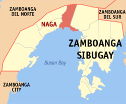 Map of Zamboanga Sibugay with Naga highlighted | ||
.svg.png) Naga Location within the Philippines | ||
| Coordinates: 7°50′N 122°42′E / 7.83°N 122.7°ECoordinates: 7°50′N 122°42′E / 7.83°N 122.7°E | ||
| Country |
| |
| Region | Zamboanga Peninsula (Region IX) | |
| Province | Zamboanga Sibugay | |
| District | 2nd District | |
| Barangays | 23 (see Barangays) | |
| Government [1] | ||
| • Type | Sangguniang Bayan | |
| • Mayor | Gemma F. Adana | |
| • Electorate | 25,275 voters (2016) | |
| Area [2] | ||
| • Total | 246.30 km2 (95.10 sq mi) | |
| Population (2015 census)[3] | ||
| • Total | 38,547 | |
| • Density | 160/km2 (410/sq mi) | |
| Time zone | UTC+8 (PST) | |
| ZIP code | 7004 | |
| PSGC | 098309000 | |
| IDD : area code | +63 (0)62 | |
| Climate type | Tropical climate | |
| Income class | 3rd municipal income class | |
| Revenue (₱) | 109,949,519.87 (2016) | |
| Native languages |
Subanon language Cebuano Chavacano Tagalog | |
| Website |
www | |

Naga, officially the Municipality of Naga, is a 3rd class municipality in the province of Zamboanga Sibugay, Philippines. According to the 2015 census, it has a population of 38,547 people.[3]
Barangays
Naga is politically subdivided into 23 barangays.
- Aguinaldo
- Baga
- Baluno
- Bangkaw-bangkaw
- Cabong
- Crossing Sta. Clara
- Gubawang
- Guintoloan
- Kaliantana
- La Paz
- Lower Sulitan
- Mamagon
- Marsolo
- Poblacion
- San Isidro
- Sandayong
- Santa Clara
- Sulo
- Tambanan
- Taytay Manubo
- Tilubog
- Tipan
- Upper Sulitan
Demographics
| Population census of Naga | ||
|---|---|---|
| Year | Pop. | ±% p.a. |
| 1970 | 20,591 | — |
| 1975 | 24,162 | +3.26% |
| 1980 | 24,209 | +0.04% |
| 1990 | 31,582 | +2.69% |
| 1995 | 31,421 | −0.10% |
| 2000 | 35,176 | +2.45% |
| 2007 | 37,349 | +0.83% |
| 2010 | 37,814 | +0.45% |
| 2015 | 38,547 | +0.37% |
| Source: Philippine Statistics Authority[3][4][5][6] | ||
References
- ↑ "Municipality". Quezon City, Philippines: Department of the Interior and Local Government. Retrieved 31 May 2013.
- ↑ "Province: Zamboanga Sibugay". PSGC Interactive. Quezon City, Philippines: Philippine Statistics Authority. Retrieved 12 November 2016.
- 1 2 3 Census of Population (2015). "Region IX (Zamboanga Peninsula)". Total Population by Province, City, Municipality and Barangay. PSA. Retrieved 20 June 2016.
- ↑ Census of Population and Housing (2010). "Region IX (Zamboanga Peninsula)". Total Population by Province, City, Municipality and Barangay. NSO. Retrieved 29 June 2016.
- ↑ Censuses of Population (1903–2007). "Region IX (Zamboanga Peninsula)". Table 1. Population Enumerated in Various Censuses by Province/Highly Urbanized City: 1903 to 2007. NSO.
- ↑ "Province of Zamboanga Sibugay". Municipality Population Data. Local Water Utilities Administration Research Division. Retrieved 17 December 2016.
External links
Places adjacent to Naga, Zamboanga Sibugay | |
|---|---|
Ipil (capital) | |
| Municipalities | |
This article is issued from
Wikipedia.
The text is licensed under Creative Commons - Attribution - Sharealike.
Additional terms may apply for the media files.