Mabuhay, Zamboanga Sibugay
| Mabuhay | |
|---|---|
| Municipality | |
| Municipality of Mabuhay | |
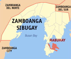 Map of Zamboanga Sibugay with Mabuhay highlighted | |
.svg.png) Mabuhay Location within the Philippines | |
| Coordinates: 7°25′N 122°54′E / 7.42°N 122.9°ECoordinates: 7°25′N 122°54′E / 7.42°N 122.9°E | |
| Country |
|
| Region | Zamboanga Peninsula (Region IX) |
| Province | Zamboanga Sibugay |
| District | 1st District |
| Barangays | 18 (see Barangays) |
| Government [1] | |
| • Type | Sangguniang Bayan |
| • Mayor | Restituto O. Calo |
| • Electorate | 12,109 voters (2016) |
| Area [2] | |
| • Total | 82.85 km2 (31.99 sq mi) |
| Population (2015 census)[3] | |
| • Total | 36,870 |
| • Density | 450/km2 (1,200/sq mi) |
| Time zone | UTC+8 (PST) |
| ZIP code | 7010 |
| PSGC | 098307000 |
| IDD : area code | +63 (0)62 |
| Climate type | Tropical climate |
| Income class | 4th municipal income class |
| Revenue (₱) | 87,476,693.90 (2016) |
| Native languages |
Subanon language Cebuano Chavacano Tagalog |
| Website |
www |
Mabuhay, officially the Municipality of Mabuhay, is a 4th class municipality in the province of Zamboanga Sibugay, Philippines. According to the 2015 census, it has a population of 36,870 people.[3]
The municipality is located in the northeastern part of Olutanga Island.
Barangays
Mabuhay is politically subdivided into 18 barangays.
- Abunda
- Bagong Silang (Tumalog)
- Bangkaw-bangkaw
- Caliran (Turko)
- Catipan
- Kauswagan
- Ligaya
- Looc-Barlac
- Malinao (Sagasa)
- Pamansaan
- Pinalim (San Roque)
- Poblacion (Mabuhay)
- Punawan
- Santo Niño (Tobi-an)
- Sawa
- Sioton
- Taguisian
- Tandu-Comot (Katipunan)
Demographics
| Population census of Mabuhay | ||
|---|---|---|
| Year | Pop. | ±% p.a. |
| 1970 | 13,349 | — |
| 1975 | 21,562 | +10.09% |
| 1980 | 9,141 | −15.77% |
| 1990 | 13,292 | +3.82% |
| 1995 | 19,512 | +7.46% |
| 2000 | 25,199 | +5.64% |
| 2007 | 30,589 | +2.71% |
| 2010 | 33,093 | +2.90% |
| 2015 | 36,870 | +2.08% |
| Source: Philippine Statistics Authority[3][4][5][6] | ||
References
- ↑ "Municipality". Quezon City, Philippines: Department of the Interior and Local Government. Retrieved 31 May 2013.
- ↑ "Province: Zamboanga Sibugay". PSGC Interactive. Quezon City, Philippines: Philippine Statistics Authority. Retrieved 12 November 2016.
- 1 2 3 Census of Population (2015). "Region IX (Zamboanga Peninsula)". Total Population by Province, City, Municipality and Barangay. PSA. Retrieved 20 June 2016.
- ↑ Census of Population and Housing (2010). "Region IX (Zamboanga Peninsula)". Total Population by Province, City, Municipality and Barangay. NSO. Retrieved 29 June 2016.
- ↑ Censuses of Population (1903–2007). "Region IX (Zamboanga Peninsula)". Table 1. Population Enumerated in Various Censuses by Province/Highly Urbanized City: 1903 to 2007. NSO.
- ↑ "Province of Zamboanga Sibugay". Municipality Population Data. Local Water Utilities Administration Research Division. Retrieved 17 December 2016.
External links
- Philippine Standard Geographic Code
- Philippine Census Information
- https://web.archive.org/web/20080508205738/http://digitalmabuhay.com/
Places adjacent to Mabuhay, Zamboanga Sibugay | |
|---|---|
Ipil (capital) | |
| Municipalities | |
This article is issued from
Wikipedia.
The text is licensed under Creative Commons - Attribution - Sharealike.
Additional terms may apply for the media files.