Rebrikhinsky District
| Rebrikhinsky District Ребрихинский район (Russian) | |
|---|---|
.svg.png) Location of Rebrikhinsky District in Altai Krai | |
| Coordinates: 53°05′N 82°20′E / 53.083°N 82.333°ECoordinates: 53°05′N 82°20′E / 53.083°N 82.333°E | |
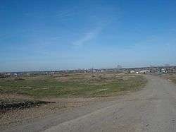 Entrance to the selo of Ust-Mosikha in Rebrikhinsky District | |
| Location | |
| Country | Russia |
| Federal subject | Altai Krai[1] |
| Administrative structure (as of September 2015) | |
| Administrative center | selo of Rebrikha[1] |
| Administrative divisions:[1] | |
| Selsoviets | 14 |
| Inhabited localities:[1] | |
| Rural localities | 28 |
| Municipal structure (as of September 2015) | |
| Municipally incorporated as | Rebrikhinsky Municipal District[2] |
| Municipal divisions:[2] | |
| Urban settlements | 0 |
| Rural settlements | 14 |
| Statistics | |
| Area | 2,686 km2 (1,037 sq mi)[3] |
| Population (2010 Census) | 24,559 inhabitants[4] |
| • Urban | 0% |
| • Rural | 100% |
| Density | 9.14/km2 (23.7/sq mi)[5] |
| Time zone | KRAT (UTC+07:00)[6] |
| Official website | |
| Rebrikhinsky District on WikiCommons | |
| 2010 Census | 24,559[4] |
|---|---|
| 2002 Census | 28,238[7] |
| 1989 Census | 30,488[8] |
| 1979 Census | 33,140[9] |
Rebrikhinsky District (Russian: Ребри́хинский райо́н) is an administrative[1] and municipal[2] district (raion), one of the fifty-nine in Altai Krai, Russia. It is located in the north of the krai. The area of the district is 2,686 square kilometers (1,037 sq mi).[3] Its administrative center is the rural locality (a selo) of Rebrikha.[1] As of the 2010 Census, the total population of the district was 24,559, with the population of Rebrikha accounting for 34.5% of that number.[4]
Geography
Rebrikhinsky District is located in the north-central region of Altai Krail. The terrain is relatively flat forest-steppe, with some ravines, on the Ob Plateau. The soils are a variety of medium-humus chernozems, sandy areas in the ravines, and salt marshes. The main river through the district is the Kasmala River, which flows from southwest to northeast through the district, ultimately joining the Ob River about 50 km to the northeast. The Kalunda River runs parallel to the Kasmala, and forms the northern border of the district, while a third river, the Barnaulka River runs along the southern border.
Rebrikhinsky District is 75 km west of the regional city of Barnaul, and 2,800 km southeast of Moscow. The area measures 65 km (north-south), and 55 km (west-east); total area is 2,686 km2 (about 1.6% of Altai Krai). The administrative center is the town of Rebrikha.[3]
The district is bordered on the north by Shelabolikhinsky District, on the east by Pavlovsky District, on the south by Aleysky District, and on the west by Mamontovsky District.
References
Notes
- 1 2 3 4 5 6 Law #28-ZS
- 1 2 3 Law #48-ZS
- 1 2 3 "General Information" (in Russian). Rebrikhinsky District. Retrieved January 4, 2017.
- 1 2 3 Russian Federal State Statistics Service (2011). "Всероссийская перепись населения 2010 года. Том 1" [2010 All-Russian Population Census, vol. 1]. Всероссийская перепись населения 2010 года (2010 All-Russia Population Census) (in Russian). Federal State Statistics Service. Retrieved June 29, 2012.
- ↑ The value of density was calculated automatically by dividing the 2010 Census population by the area specified in the infobox. Please note that this value is only approximate as the area specified in the infobox does not necessarily correspond to the area of the entity proper or is reported for the same year as the population.
- ↑ Правительство Российской Федерации. Федеральный закон №107-ФЗ от 3 июня 2011 г. «Об исчислении времени», в ред. Федерального закона №271-ФЗ от 03 июля 2016 г. «О внесении изменений в Федеральный закон "Об исчислении времени"». Вступил в силу по истечении шестидесяти дней после дня официального опубликования (6 августа 2011 г.). Опубликован: "Российская газета", №120, 6 июня 2011 г. (Government of the Russian Federation. Federal Law #107-FZ of June 31, 2011 On Calculating Time, as amended by the Federal Law #271-FZ of July 03, 2016 On Amending Federal Law "On Calculating Time". Effective as of after sixty days following the day of the official publication.).
- ↑ Russian Federal State Statistics Service (May 21, 2004). "Численность населения России, субъектов Российской Федерации в составе федеральных округов, районов, городских поселений, сельских населённых пунктов – районных центров и сельских населённых пунктов с населением 3 тысячи и более человек" [Population of Russia, Its Federal Districts, Federal Subjects, Districts, Urban Localities, Rural Localities—Administrative Centers, and Rural Localities with Population of Over 3,000] (XLS). Всероссийская перепись населения 2002 года [All-Russia Population Census of 2002] (in Russian). Retrieved August 9, 2014.
- ↑ Demoscope Weekly (1989). "Всесоюзная перепись населения 1989 г. Численность наличного населения союзных и автономных республик, автономных областей и округов, краёв, областей, районов, городских поселений и сёл-райцентров" [All Union Population Census of 1989: Present Population of Union and Autonomous Republics, Autonomous Oblasts and Okrugs, Krais, Oblasts, Districts, Urban Settlements, and Villages Serving as District Administrative Centers]. Всесоюзная перепись населения 1989 года [All-Union Population Census of 1989] (in Russian). Институт демографии Национального исследовательского университета: Высшая школа экономики [Institute of Demography at the National Research University: Higher School of Economics]. Retrieved August 9, 2014.
- ↑ "Всесоюзная перепись населения 1979 г. Национальный состав населения по регионам России. (All Union Population Census of 1979. Ethnic composition of the population by regions of Russia.)". Всесоюзная перепись населения 1979 года (All-Union Population Census of 1979) (in Russian). Demoscope Weekly (website of the Institute of Demographics of the State University—Higher School of Economics. 1979. Retrieved 2008-11-25.
Sources
- Алтайский краевой Совет народных депутатов. Закон №28-ЗС от 1 марта 2008 г. «Об административно-территориальном устройстве Алтайского края», в ред. Закона №16-ЗС от 4 апреля 2017 г. «О присоединении станции Железнодорожная Казарма 572 км к посёлку Октябрьскому Октябрьского сельсовета Кулундинского района Алтайского края и внесении изменений в отдельные законы Алтайского края». Вступил в силу 8 марта 2008 г. Опубликован: "Алтайская правда", №67, 8 марта 2008 г. (Altai Krai Council of People's Deputies. Law #28-ZS of March 1, 2008 On the Administrative-Territorial Structure of Altai Krai, as amended by the Law #16-ZS of April 4, 2017 On Merging the Station of Zheleznodorozhnaya Kazarma 572 km into the Settlement of Oktyabrsky in Oktyabrsky Selsoviet of Kulundinsky District of Altai Krai and on Amending Various Laws of Altai Krai. Effective as of March 8, 2008.).
- Алтайский краевой Совет народных депутатов. Закон №48-ЗС от 2 июня 2008 г. «О статусе и границах муниципальных и административно-территориальных образований Ребрихинского района Алтайского края», в ред. Закона №62-ЗС от 30 июня 2015 г. «О внесении изменений в Закон Алтайского края "О статусе и границах муниципальных и административно-территориальных образований Ребрихинского района Алтайского края"». Вступил в силу через 10 дней после дня официального опубликования. Опубликован: "Алтайская правда", №170–171 (без приложений), 18 июня 2008 г. (Altai Krai Council of People's Deputies. Law #48-ZS of June 2, 2008 On the Status and the Borders of the Municipal and the Administrative-Territorial Formations of Rebrikhinsky District of Altai Krai, as amended by the Law #62-ZS of June 30, 2015 On Amending the Law of Altai Krai "On the Status and the Borders of the Municipal and the Administrative-Territorial Formations of Rebrikhinsky District of Altai Krai". Effective as of after 10 days after the day of the official publication.).