Bystroistoksky District
| Bystroistoksky District Быстроистокский район (Russian) | |
|---|---|
.svg.png) Location of Bystroistoksky District in Altai Krai | |
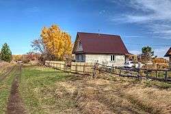 Autumn in Bystroistoksky District | |
| Location | |
| Country | Russia |
| Federal subject | Altai Krai[1] |
| Administrative structure (as of October 2012) | |
| Administrative center | selo of Bystry Istok[1] |
| Administrative divisions:[1] | |
| selsoviet | 8 |
| Inhabited localities:[1] | |
| Rural localities | 12 |
| Municipal structure (as of October 2011) | |
| Municipally incorporated as | Bystroistoksky Municipal District[2] |
| Municipal divisions:[2] | |
| Urban settlements | 0 |
| Rural settlements | 8 |
| Statistics | |
| Area | 1,924 km2 (743 sq mi)[3] |
| Population (2010 Census) | 10,150 inhabitants[4] |
| • Urban | 0% |
| • Rural | 100% |
| Density | 5.28/km2 (13.7/sq mi)[5] |
| Time zone | KRAT (UTC+07:00)[6] |
| Official website | |
| Bystroistoksky District on WikiCommons | |
Bystroistoksky District (Russian: Быстроисто́кский райо́н) is an administrative[1] and municipal[2] district (raion), one of the fifty-nine in Altai Krai, Russia. It is located in the eastern central part of the krai. The area of the district is 1,924 square kilometers (743 sq mi).[3] Its administrative center is the rural locality (a selo) of Bystry Istok.[1] Population: 10,150 (2010 Census);[4] 12,484 (2002 Census);[7] 13,618 (1989 Census).[8] The population of Bystry Istok accounts for 38.0% of the district's total population.[4]
Geography
Bystroistoksky District is located in the southeast of Altai Krai, on rolling plain leading into foothills of the Altai Mountains to the east. The Ob River flows from east to west across the northern part of the district. The area north of the Ob is forested, while south of the river is steppe terrain and agricultural fields. Bystroistoksky District is 25 km west of the city of Biysk, and 3,000 km east of Moscow. The area measures 55 km (north-south), and 45 km (west-east); total area is 1,804 km2 (about 2% of Altai Krai). The administrative center is the town of Bystry Istok, on the banks of the Ob.[3]
The soils are chernozem (black), and the forests mostly conifer and mixed forest. About one-third of the district is forested.
The district is bordered on the north by Zonalny District, on the east by Smolensky District, on the south by Petropavlovsky District, and on the west by Troitsky District.
History
The first small settlement of European Russians occurred in 1749 with the founding of the village of Bystry Istok, on the high left bank of the Ob River. A census in the early 1800s showed 38 households in the village.[3] A few villages developed around a peasant agricultural economy, with many of the settlers being retired soldiers who received land allotments. A glassworks was founded in the village of Akutiha in 1911, and virgin agricultural land was open in the 1950s.
References
Notes
- 1 2 3 4 5 6 Law #28-ZS
- 1 2 3 Law #92-ZS
- 1 2 3 4 "General Information" (in Russian). Bystroistoksky District. Retrieved April 23, 2017.
- 1 2 3 Russian Federal State Statistics Service (2011). "Всероссийская перепись населения 2010 года. Том 1" [2010 All-Russian Population Census, vol. 1]. Всероссийская перепись населения 2010 года (2010 All-Russia Population Census) (in Russian). Federal State Statistics Service. Retrieved June 29, 2012.
- ↑ The value of density was calculated automatically by dividing the 2010 Census population by the area specified in the infobox. Please note that this value is only approximate as the area specified in the infobox does not necessarily correspond to the area of the entity proper or is reported for the same year as the population.
- ↑ Правительство Российской Федерации. Федеральный закон №107-ФЗ от 3 июня 2011 г. «Об исчислении времени», в ред. Федерального закона №271-ФЗ от 03 июля 2016 г. «О внесении изменений в Федеральный закон "Об исчислении времени"». Вступил в силу по истечении шестидесяти дней после дня официального опубликования (6 августа 2011 г.). Опубликован: "Российская газета", №120, 6 июня 2011 г. (Government of the Russian Federation. Federal Law #107-FZ of June 31, 2011 On Calculating Time, as amended by the Federal Law #271-FZ of July 03, 2016 On Amending Federal Law "On Calculating Time". Effective as of after sixty days following the day of the official publication.).
- ↑ Russian Federal State Statistics Service (May 21, 2004). "Численность населения России, субъектов Российской Федерации в составе федеральных округов, районов, городских поселений, сельских населённых пунктов – районных центров и сельских населённых пунктов с населением 3 тысячи и более человек" [Population of Russia, Its Federal Districts, Federal Subjects, Districts, Urban Localities, Rural Localities—Administrative Centers, and Rural Localities with Population of Over 3,000] (XLS). Всероссийская перепись населения 2002 года [All-Russia Population Census of 2002] (in Russian). Retrieved August 9, 2014.
- ↑ Demoscope Weekly (1989). "Всесоюзная перепись населения 1989 г. Численность наличного населения союзных и автономных республик, автономных областей и округов, краёв, областей, районов, городских поселений и сёл-райцентров" [All Union Population Census of 1989: Present Population of Union and Autonomous Republics, Autonomous Oblasts and Okrugs, Krais, Oblasts, Districts, Urban Settlements, and Villages Serving as District Administrative Centers]. Всесоюзная перепись населения 1989 года [All-Union Population Census of 1989] (in Russian). Институт демографии Национального исследовательского университета: Высшая школа экономики [Institute of Demography at the National Research University: Higher School of Economics]. Retrieved August 9, 2014.
Sources
- Алтайский краевой Совет народных депутатов. Закон №28-ЗС от 1 марта 2008 г. «Об административно-территориальном устройстве Алтайского края», в ред. Закона №16-ЗС от 4 апреля 2017 г. «О присоединении станции Железнодорожная Казарма 572 км к посёлку Октябрьскому Октябрьского сельсовета Кулундинского района Алтайского края и внесении изменений в отдельные законы Алтайского края». Вступил в силу 8 марта 2008 г. Опубликован: "Алтайская правда", №67, 8 марта 2008 г. (Altai Krai Council of People's Deputies. Law #28-ZS of March 1, 2008 On the Administrative-Territorial Structure of Altai Krai, as amended by the Law #16-ZS of April 4, 2017 On Merging the Station of Zheleznodorozhnaya Kazarma 572 km into the Settlement of Oktyabrsky in Oktyabrsky Selsoviet of Kulundinsky District of Altai Krai and on Amending Various Laws of Altai Krai. Effective as of March 8, 2008.).
- Алтайский краевой Совет народных депутатов. Закон №92-ЗС от 5 октября 2007 г. «О статусе и границах муниципальных и административно-территориальных образований Быстроистокского района Алтайского края», в ред. Закона №55-ЗС от 5 июля 2012 г. «О внесении изменений в отдельные Законы Алтайского края в связи с преобразованием муниципальных и административно-территориальных образований». Вступил в силу через 10 дней со дня официального опубликования. Опубликован: "Алтайская правда", №306 (без приложений), 13 октября 2007 г. (Altai Krai Council of People's Deputies. Law #92-ZS of October 5, 2007 On the Status and the Borders of the Municipal and the Administrative-Territorial Formations of Bystroistoksky District of Altai Krai, as amended by the Law #55-ZS of July 5, 2012 On Amending Various Laws of Altai Krai Due to the Transformation of the Municipal and Administrative-Territorial Formations. Effective as of after 10 days from the day of the official publication.).