Ranked list of Hungarian counties
The following article is a ranked list of Hungarian counties.
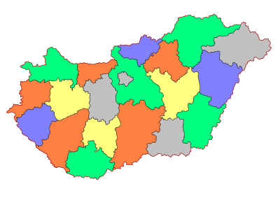
By area
The following table presents a listing of Hungarian 19 counties ranked in order of their surface area.
| Rank | County | Area (km2) | % of total |
|---|---|---|---|
| 1 | Bács-Kiskun | 8,444.90 | 9.08 |
| 2 | Borsod-Abaúj-Zemplén | 7,247.21 | 7.79 |
| 3 | Pest | 6,391.13 | 6.87 |
| 4 | Hajdú-Bihar | 6,210.45 | 6.68 |
| 5 | Somogy | 6,065.49 | 6.52 |
| 6 | Szabolcs-Szatmár-Bereg | 5,936.15 | 6.38 |
| 7 | Békés | 5,629.71 | 6.05 |
| 8 | Jász-Nagykun-Szolnok | 5,581.63 | 6.00 |
| 9 | Veszprém | 4,463.64 | 4.80 |
| 10 | Baranya | 4,429.60 | 4.76 |
| 11 | Fejér | 4,358.48 | 4.69 |
| 12 | Csongrád | 4,262.80 | 4.58 |
| 13 | Győr-Moson-Sopron | 4,207.86 | 4.52 |
| 14 | Zala | 3,783.84 | 4.07 |
| 15 | Tolna | 3,703.23 | 3.98 |
| 16 | Heves | 3,637.17 | 3.91 |
| 17 | Vas | 3,336.11 | 3.59 |
| 18 | Nógrád | 2,544.48 | 2.74 |
| 19 | Komárom-Esztergom | 2,264.36 | 2.43 |
| [note 1] | Budapest | 525.14 | 0.56 |
| 93,023.38 | 100.00 | ||
Population
By population
The following table presents a listing of Hungarian 19 counties ranked in order of their total population (based on 2011 census).[1] The data is taken from the Hungarian Central Statistical Office (KSH) censuses results,[2] as well as from the Gazetteer of Hungary.
| Rank in 2011 |
County | Population | |||||
|---|---|---|---|---|---|---|---|
| 1949 | 1960 | 1980 | 1990 | 2001 | 2011 | ||
| [note 1] | Budapest | 1,590,316 | 1,804,606 | 2,059,347 | 2,016,774 | 1,777,921 | 1,729,040 |
| 1 | Pest | 686,953 | 781,501 | 973,830 | 949,842 | 1,083,877 | 1,217,476 |
| 2 | Borsod-Abaúj-Zemplén | 630,621 | 725,303 | 809,468 | 761,963 | 744,404 | 686,266 |
| 3 | Szabolcs-Szatmár-Bereg | 558,098 | 586,451 | 593,829 | 572,301 | 582,256 | 559,272 |
| 4 | Hajdú-Bihar | 498,271 | 522,787 | 551,448 | 548,728 | 552,998 | 546,721 |
| 5 | Bács-Kiskun | 591,482 | 589,744 | 571,448 | 546,898 | 546,517 | 520,331 |
| 6 | Győr-Moson-Sopron | 374,987 | 401,861 | 437,857 | 432,126 | 438,773 | 447,985 |
| 7 | Fejér | 295,750 | 357,897 | 420,317 | 418,852 | 434,317 | 425,847 |
| 8 | Csongrád | 429,083 | 434,046 | 456,300 | 438,842 | 433,344 | 417,456 |
| 9 | Jász-Nagykun-Szolnok | 449,551 | 461,307 | 445,624 | 425,583 | 415,917 | 386,594 |
| 10 | Baranya | 356,533 | 395,342 | 432,617 | 417,400 | 407,448 | 386,441 |
| 11 | Békés | 471,561 | 467,861 | 436,910 | 411,887 | 397,791 | 359,948 |
| 12 | Veszprém | 294,289 | 337,836 | 377,746 | 374,466 | 369,727 | 353,068 |
| 13 | Somogy | 361,213 | 368,183 | 360,270 | 344,708 | 335,237 | 316,137 |
| 14 | Heves | 316,273 | 347,856 | 350,360 | 334,408 | 325,727 | 308,882 |
| 15 | Komárom-Esztergom | 220,914 | 270,810 | 322,893 | 316,984 | 316,590 | 304,568 |
| 16 | Zala | 305,433 | 317,145 | 317,298 | 306,398 | 297,404 | 282,179 |
| 17 | Vas | 283,070 | 282,728 | 285,498 | 275,944 | 268,123 | 256,629 |
| 18 | Tolna | 275,644 | 272,101 | 266,273 | 253,675 | 249,683 | 230,361 |
| 19 | Nógrád | 214,757 | 235,675 | 240,251 | 227,137 | 220,261 | 202,427 |
| 9,204,799 | 9,961,044 | 10,709,463 | 10,374,823 | 10,200,298 | 9,937,628 | ||
Bold: record number of the population
By density
The following table presents a listing of Hungarian 19 counties ranked in order of their population density (based on 2011 census).
| Rank | County | Population | Area (km2) |
Density (pop./km2) |
|---|---|---|---|---|
| [note 1] | Budapest | 1,729,040 | 525.14 | 3293 |
| 1 | Pest | 1,217,476 | 6,391.13 | 190 |
| 2 | Komárom-Esztergom | 304,568 | 2,264.36 | 135 |
| 3 | Győr-Moson-Sopron | 447,985 | 4,207.86 | 106 |
| 4 | Fejér | 425,847 | 4,358.48 | 98 |
| Csongrád | 417,456 | 4,262.80 | 98 | |
| 6 | Borsod-Abaúj-Zemplén | 686,266 | 7,247.21 | 95 |
| 7 | Szabolcs-Szatmár-Bereg | 559,272 | 5,936.15 | 94 |
| 8 | Hajdú-Bihar | 546,721 | 6,210.45 | 88 |
| 9 | Baranya | 386,441 | 4,429.60 | 87 |
| 10 | Heves | 308,882 | 3,637.17 | 85 |
| 11 | Nógrád | 202,427 | 2,544.48 | 80 |
| 12 | Veszprém | 353,068 | 4,463.64 | 79 |
| 13 | Vas | 256,629 | 3,336.11 | 77 |
| 14 | Zala | 282,179 | 3,783.84 | 75 |
| 15 | Jász-Nagykun-Szolnok | 386,594 | 5,581.63 | 69 |
| 16 | Békés | 359,948 | 5,629.71 | 64 |
| 17 | Bács-Kiskun | 520,331 | 8,444.90 | 62 |
| Tolna | 230,361 | 3,703.23 | 62 | |
| 19 | Somogy | 316,137 | 6,065.49 | 52 |
| 9,937,628 | 93,023.38 | 107 | ||
By urban and rural population
Hungarian counties by their urban and rural population as of 2015.[3]
| County | Urban | Rural | % Urban | % Rural |
|---|---|---|---|---|
| Baranya | 243,528 | 130,456 | 65.1 | 34.9 |
| Bács-Kiskun | 351,187 | 165,705 | 67.9 | 32.1 |
| Békés | 272,184 | 83,015 | 76.6 | 23.4 |
| Borsod-Abaúj-Zemplén | 396,686 | 278,313 | 58.8 | 41.2 |
| Budapest [note 1] | 1,744,665 | – | 100.0 | 0.0 |
| Csongrád | 305,622 | 101,767 | 75.0 | 25.0 |
| Fejér | 254,922 | 164,584 | 60.8 | 39.2 |
| Győr-Moson-Sopron | 270,429 | 179,889 | 60.1 | 39.9 |
| Hajdú-Bihar | 430,963 | 108,544 | 79.9 | 20.1 |
| Heves | 144,373 | 159,130 | 47.6 | 52.4 |
| Jász-Nagykun-Szolnok | 281,089 | 102,400 | 73.3 | 26.7 |
| Komárom-Esztergom | 201,802 | 98,875 | 67.1 | 32.9 |
| Nógrád | 83,124 | 115,268 | 41.9 | 58.1 |
| Pest | 846,329 | 374,419 | 69.3 | 30.7 |
| Somogy | 163,995 | 151,517 | 52.0 | 48.0 |
| Szabolcs-Szatmár-Bereg | 305,397 | 255,982 | 54.4 | 45.6 |
| Tolna | 128,036 | 99,924 | 56.2 | 43.8 |
| Vas | 156,316 | 98,264 | 61.4 | 38.6 |
| Veszprém | 215,374 | 133,633 | 61.7 | 38.3 |
| Zala | 158,094 | 121,529 | 56.5 | 43.5 |
| 6,954,115 | 2,923,250 | 70.4 | 29.6 |
Economy
Source: Knoema
| Name | GDP, million of EUR (2012) |
GDP, per capita EUR (2012) |
GDP per cap., % of EU average |
Unemployment rate (age 15 or over), %[4] |
|---|---|---|---|---|
| Baranya | 2,477 | 6,500 | 25 | 8,3 |
| Bács-Kiskun | 3,621 | 7,000 | 26 | 7,4 |
| Békés | 2,039 | 5,600 | 21 | 7,5 |
| Borsod-Abaúj-Zemplén | 4,215 | 6,100 | 23 | 7,2 |
| Budapest | 37,633 | 21,700 | 82 | 4,9 |
| Csongrád | 3,059 | 7,400 | 28 | 6,4 |
| Fejér | 3,931 | 9,300 | 35 | 3,4 |
| Győr-Moson-Sopron | 5,141 | 11,500 | 44 | 3,3 |
| Hajdú-Bihar | 3,979 | 7,300 | 28 | 9,3 |
| Heves | 2,010 | 6,500 | 25 | 6,0 |
| Jász-Nagykun-Szolnok | 2,489 | 6,400 | 24 | 8,0 |
| Komárom-Esztergom | 3,059 | 10,100 | 38 | 4,9 |
| Nógrád | 880 | 4,400 | 16 | 8,9 |
| Pest | 10,062 | 8,300 | 31 | 4,4 |
| Somogy | 2,002 | 6,300 | 24 | 8,4 |
| Szabolcs-Szatmár-Bereg | 3,050 | 5,400 | 20 | 12,6 |
| Tolna | 1,777 | 7,700 | 29 | 7,3 |
| Vas | 2,399 | 9,400 | 35 | 3,7 |
| Veszprém | 2,484 | 7,000 | 27 | 3,7 |
| Zala | 2,393 | 8,500 | 32 | 3,6 |
By number and type of municipalities
Hungarian counties by their population living in urban counties (megyei jogú városok), towns (városok), large villages (nagyközségek) and villages (falvak), according to the 2017 Gazetteer of Hungary.
| County | Number of | ||||
|---|---|---|---|---|---|
| Urban county | Town | Large village | Village | Municipalities | |
| Baranya | 1 | 13 | 3 | 284 | 301 |
| Bács-Kiskun | 1 | 21 | 9 | 88 | 119 |
| Békés | 1 | 21 | 8 | 45 | 75 |
| Borsod-Abaúj-Zemplén | 1 | 28 | 9 | 320 | 358 |
| Csongrád | 2 | 8 | 8 | 42 | 60 |
| Fejér | 2 | 15 | 12 | 79 | 108 |
| Győr-Moson-Sopron | 2 | 10 | 4 | 167 | 183 |
| Hajdú-Bihar | 1 | 20 | 10 | 51 | 82 |
| Heves | 1 | 10 | 5 | 105 | 121 |
| Jász-Nagykun-Szolnok | 1 | 21 | 4 | 52 | 78 |
| Komárom-Esztergom | 1 | 11 | 2 | 62 | 76 |
| Nógrád | 1 | 5 | 0 | 125 | 131 |
| Pest | 1 + 1 | 53 | 24 | 109 | 187 |
| Somogy | 1 | 15 | 2 | 228 | 246 |
| Szabolcs-Szatmár-Bereg | 1 | 27 | 16 | 185 | 229 |
| Tolna | 1 | 10 | 5 | 93 | 109 |
| Vas | 1 | 12 | 0 | 203 | 216 |
| Veszprém | 1 | 14 | 3 | 199 | 217 |
| Zala | 2 | 8 | 3 | 245 | 258 |
By largest cities
Largest cities within a county, according to the 2017 Gazetteer of Hungary (according to the number of inhabitants). In all counties, the largest city is also the county seat.
See also
Notes and references
- Notes
- References
External links
| Wikimedia Commons has media related to Counties of Hungary. |