Ralleigh Airstrip
| Ralleigh Airstrip Raleighvallen Airstrip | |||||||||||
|---|---|---|---|---|---|---|---|---|---|---|---|
| Summary | |||||||||||
| Airport type | Public | ||||||||||
| Operator | Luchtvaartdienst Suriname | ||||||||||
| Serves | Central Suriname Nature Reserve | ||||||||||
| Elevation AMSL | 109 ft / 33 m | ||||||||||
| Coordinates | 4°43′22″N 56°12′30″W / 4.72278°N 56.20833°WCoordinates: 4°43′22″N 56°12′30″W / 4.72278°N 56.20833°W | ||||||||||
| Map | |||||||||||
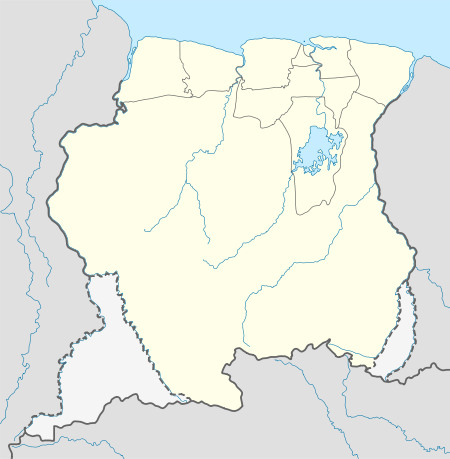 SMRA Location in Suriname | |||||||||||
| Runways | |||||||||||
| |||||||||||
Raleigh Vallen Airstrip (IATA: SMRA) is an airstrip serving the Central Suriname Nature Reserve, Suriname. The runway is on Fungu Tabiki,[3] an island in the Coppename River.
The airstrip is an entry and/or exit point for many nature hiking tours[4][5][6] to the cascading Raleigh Falls and to Voltzberg, one of several black granite monoliths in the Central Suriname Nature Reserve.
Charters and destinations
Charter Airlines serving this airport are:
| Airlines | Destinations |
|---|---|
| Blue Wing Airlines | Paramaribo, Zorg en Hoop Airport[7] |
| Caricom Airways | Paramaribo, Zorg en Hoop Airport |
| Gum Air | Paramaribo, Zorg en Hoop Airport[8] |
| Hi-Jet Helicopter Services | Paramaribo, Zorg en Hoop Airport |
| Suriname Air Force / Surinaamse Luchtmacht | Paramaribo, Zorg en Hoop Airport |
See also

- List of airports in Suriname
- Transport in Suriname
References
External links
This article is issued from
Wikipedia.
The text is licensed under Creative Commons - Attribution - Sharealike.
Additional terms may apply for the media files.