Queens Chapel
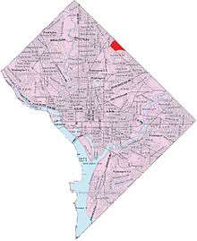
Queens Chapel is a mostly residential neighborhood with commercial elements located in Ward 5 of Northeast Washington, D.C. in the Upper Northeast area element[1]. Queens Chapel is contained between Galloway Street NE to the south, Riggs Rd to South Dakota Avenue to Kennedy St NE to the North, Eastern Avenue to the East, and the WMATA/CSX Railroad Tracks to the West. The Queens Chapel neighborhood is often confused with the Queens Chapel Neighborhood Association which is located in the Michigan Park neighborhood. It was named for early landowner Richard Queen[2][3]
Queens Chapel is home to the Bertie Backus Community College (formerly Bertie Backus Middle School, which closed and was demolished in 2008), the Lamond-Riggs Library, Food & Friends, and the Art Place at Fort Totten development.
References
Places adjacent to Queens Chapel | |
|---|---|
Coordinates: 38°57′17″N 76°59′51″W / 38.9546°N 76.9974°W