Lincoln Heights, Washington, D.C.

Map of Washington, D.C., with Lincoln Heights highlighted in red
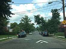
Lincoln Heights neighborhood at the intersection of Ames St and 53rd St NE looking East, August 2018
Lincoln Heights is a residential neighborhood in Northeast Washington, D.C. It is bounded by Nannie Helen Burroughs Avenue to the north, Blaine Street to the south, Division Avenue to the east, and 49th Street NE to the west.
Places adjacent to Lincoln Heights, Washington, D.C. | ||||||||||
|---|---|---|---|---|---|---|---|---|---|---|
| ||||||||||
Coordinates: 38°53′39″N 76°55′44″W / 38.8941°N 76.9288°W
This article is issued from
Wikipedia.
The text is licensed under Creative Commons - Attribution - Sharealike.
Additional terms may apply for the media files.