President Manuel A. Roxas, Zamboanga del Norte
| President Manuel A. Roxas | |
|---|---|
| Municipality | |
| Municipality of President Manuel A. Roxas | |
| Nickname(s): Industrial Capital of Zamboanga del Norte | |
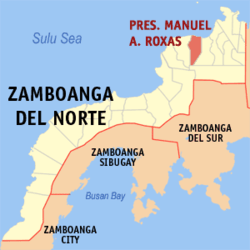 Map of Zamboanga del Norte with President Manuel A. Roxas highlighted | |
.svg.png) President Manuel A. Roxas Location within the Philippines | |
| Coordinates: 8°29′N 123°13′E / 8.48°N 123.22°ECoordinates: 8°29′N 123°13′E / 8.48°N 123.22°E | |
| Country |
|
| Region | Zamboanga Peninsula (Region IX) |
| Province | Zamboanga del Norte |
| District | 2nd District |
| Founded | June 17, 1967 |
| Barangays | 31 (see Barangays) |
| Government [1] | |
| • Type | Sangguniang Bayan |
| • Mayor | Jan Hendrik Vallecer |
| • Electorate | 21,929 voters (2016) |
| Area [2] | |
| • Total | 206.25 km2 (79.63 sq mi) |
| Population (2015 census)[3] | |
| • Total | 39,323 |
| • Density | 190/km2 (490/sq mi) |
| Time zone | UTC+8 (PST) |
| ZIP code | 7104 |
| PSGC | 097211000 |
| IDD : area code | +63 (0)65 |
| Climate type | Tropical climate |
| Income class | 5th municipal income class |
| Revenue (₱) | 129,675,697.39 (2016) |
| Native languages |
Subanon language Cebuano Chavacano Tagalog |
| Website |
roxas |
President Manuel A. Roxas, officially the Municipality of President Manuel A. Roxas, is a 5th class municipality in the province of Zamboanga del Norte, Philippines. According to the 2015 census, it has a population of 39,323 people.[3]
Barangays
Pres. Manuel A. Roxas is politically subdivided into 31 barangays.
- Balubo
- Banbanan
- Canibongan
- Capase
- Cape
- Denoman
- Dohinob
- Galokso
- Gubat
- Lower Irasan
- Labakid
- Langatian
- Lipakan
- Marupay
- Moliton
- Nabilid
- Panampalay
- Pangologon
- Piao
- Piñalan
- Piñamar
- Pongolan
- Salisig
- Sebod
- Sibatog
- Situbo
- Tanayan
- Tantingon
- Upper Irasan
- Upper Minang
- Villahermoso
Demographics
| Population census of President Manuel A. Roxas | ||
|---|---|---|
| Year | Pop. | ±% p.a. |
| 1970 | 18,851 | — |
| 1975 | 21,514 | +2.69% |
| 1980 | 24,222 | +2.40% |
| 1990 | 27,154 | +1.15% |
| 1995 | 31,662 | +2.92% |
| 2000 | 33,659 | +1.32% |
| 2007 | 35,939 | +0.91% |
| 2010 | 37,611 | +1.67% |
| 2015 | 39,323 | +0.85% |
| Source: Philippine Statistics Authority[3][4][5][6] | ||
References
- ↑ "Municipality". Quezon City, Philippines: Department of the Interior and Local Government. Retrieved 31 May 2013.
- ↑ "Province: Zamboanga del Norte". PSGC Interactive. Quezon City, Philippines: Philippine Statistics Authority. Retrieved 12 November 2016.
- 1 2 3 Census of Population (2015). "Region IX (Zamboanga Peninsula)". Total Population by Province, City, Municipality and Barangay. PSA. Retrieved 20 June 2016.
- ↑ Census of Population and Housing (2010). "Region IX (Zamboanga Peninsula)". Total Population by Province, City, Municipality and Barangay. NSO. Retrieved 29 June 2016.
- ↑ Censuses of Population (1903–2007). "Region IX (Zamboanga Peninsula)". Table 1. Population Enumerated in Various Censuses by Province/Highly Urbanized City: 1903 to 2007. NSO.
- ↑ "Province of Zamboanga del Norte". Municipality Population Data. Local Water Utilities Administration Research Division. Retrieved 17 December 2016.
External links
Places adjacent to President Manuel A. Roxas, Zamboanga del Norte | ||||||||||
|---|---|---|---|---|---|---|---|---|---|---|
| ||||||||||
Dipolog (capital) | |
| Municipalities | |
| Component cities | |
This article is issued from
Wikipedia.
The text is licensed under Creative Commons - Attribution - Sharealike.
Additional terms may apply for the media files.