Manukan, Zamboanga del Norte
| Manukan | |
|---|---|
| Municipality | |
| Municipality of Manukan | |
| Etymology: Manukan lit. Poultry | |
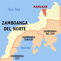 Map of Zamboanga del Norte with Manukan highlighted | |
.svg.png) Manukan Location within the Philippines | |
| Coordinates: 8°32′N 123°06′E / 8.53°N 123.1°ECoordinates: 8°32′N 123°06′E / 8.53°N 123.1°E | |
| Country |
|
| Region | Zamboanga Peninsula (Region IX) |
| Province | Zamboanga del Norte |
| District | 2nd district of Zamboanga del Norte |
| Founded | June 16, 1951 |
| Barangays | 22 (see Barangays) |
| Government [1] | |
| • Type | Sangguniang Bayan |
| • Mayor | Eugene Caballero |
| • Vice Mayor | Enriquita U. Winters |
| • Electorate | 22,067 voters (2016) |
| Area [2] | |
| • Total | 246.35 km2 (95.12 sq mi) |
| Population (2015 census)[3] | |
| • Total | 36,526 |
| • Density | 150/km2 (380/sq mi) |
| Time zone | UTC+8 (PST) |
| ZIP code | 7110 |
| PSGC | 097207000 |
| IDD : area code | +63 (0)65 |
| Climate type | Tropical climate |
| Income class | 3rd municipal income class |
| Revenue (₱) | 113,146,130.59 (2016) |
| Native languages |
Subanon language Cebuano Chavacano Tagalog |
| Website |
manukan |
Manukan, officially the Municipality of Manukan, (Cebuano: Lungsod sa Manukan Subanon: Benwa Banukan), is a 3rd class municipality in the province of Zamboanga del Norte, Philippines. According to the 2015 census, it has a population of 36,526 people.[3]
It is located 38 kilometres (24 mi) west of Dipolog City, the provincial capital, and 282 kilometres (175 mi) north-east of Zamboanga City, the regional capital.
History
During the Pre-Spanish era this town was inhabited by the Subanons. During the Spanish colonization, Manukan was a barrio, part of Dapitan (now City of Dapitan). In the creation of the municipality of Katipunan, this barrio became a barangay Banukan. Chickens were plenty and breeds that supply the northern part of Mindanao come from this town. "Manukan" word means poultry farm. The birth of the Municipality of Manukan was inaugurated on June 16, 1951 by virtue of Republic Act 655, duly signed by President Elpidio Quirino. In 1952, the barrios of Manukan, Lipras, Dipane, Linay, Mate, Sirongan, Libuton, Disakan, Siparok, Ponot, and Manawan of Katipunan were formed into the town of Manukan.[4]
Sitio Libuton became a barangay in 1954.[5]
Lipras was renamed San Antonio in 1957.[6]
Barangays
Manukan is politically subdivided into 22 barangays. The central Poblacion is where the municipal seat is located. Nine of the barangays are along the national highway and the rest are mountain barangays, being three or more kilometers away from the national highway that runs mostly along the coast of the municipality.
- Dipane
- Disakan
- Don Jose Aguirre
- East Poblacion
- Gupot
- Libuton
- Linay
- Lingatongan
- Lupasang
- Mate
- Meses
- Palaranan
- Pangandao
- Patagan
- Poblacion
- Punta Blanca
- Saluyong
- San Antonio
- Serongan
- Suisayan
- Upper Disakan
- Villaramos
Demographics
| Population census of Manukan | ||
|---|---|---|
| Year | Pop. | ±% p.a. |
| 1960 | 19,886 | — |
| 1970 | 27,286 | +3.21% |
| 1975 | 33,444 | +4.17% |
| 1980 | 23,112 | −7.12% |
| 1990 | 28,554 | +2.14% |
| 1995 | 29,681 | +0.73% |
| 2000 | 31,855 | +1.53% |
| 2007 | 33,129 | +0.54% |
| 2010 | 35,589 | +2.64% |
| 2015 | 36,526 | +0.50% |
| Source: Philippine Statistics Authority[3][7][8][9] | ||
Education
|
Manukan I District
|
Manukan II District
|
References
- ↑ "Municipality". Quezon City, Philippines: Department of the Interior and Local Government. Retrieved 31 May 2013.
- ↑ "Province: Zamboanga del Norte". PSGC Interactive. Quezon City, Philippines: Philippine Statistics Authority. Retrieved 12 November 2016.
- 1 2 3 Census of Population (2015). "Region IX (Zamboanga Peninsula)". Total Population by Province, City, Municipality and Barangay. PSA. Retrieved 20 June 2016.
- ↑ "An Act Creating the Municipality of Manukan in the Province of Zamboanga". LawPH.com. Retrieved 2011-04-09.
- ↑ "An Act to Create the Barrio of Libuton in the Municipality of Manucan, Province of Zamboanga Del Norte". LawPH.com. Retrieved 2011-04-11.
- ↑ "An Act Changing the Name of Barrio Lipras, Municipality of Manukan, Province of Zamboanga Del Norte, to Villa Ramos". LawPH.com. Retrieved 2011-04-12.
- ↑ Census of Population and Housing (2010). "Region IX (Zamboanga Peninsula)". Total Population by Province, City, Municipality and Barangay. NSO. Retrieved 29 June 2016.
- ↑ Censuses of Population (1903–2007). "Region IX (Zamboanga Peninsula)". Table 1. Population Enumerated in Various Censuses by Province/Highly Urbanized City: 1903 to 2007. NSO.
- ↑ "Province of Zamboanga del Norte". Municipality Population Data. Local Water Utilities Administration Research Division. Retrieved 17 December 2016.
External links
Places adjacent to Manukan, Zamboanga del Norte | |
|---|---|
Dipolog (capital) | |
| Municipalities | |
| Component cities | |