Leon B. Postigo, Zamboanga del Norte
| Leon B. Postigo | |
|---|---|
| Municipality | |
| Municipality of Leon B. Postigo | |
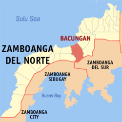 Map of Zamboanga del Norte with Leon B. Postigo highlighted | |
.svg.png) Leon B. Postigo Location within the Philippines | |
| Coordinates: 8°05′N 122°56′E / 8.08°N 122.93°ECoordinates: 8°05′N 122°56′E / 8.08°N 122.93°E | |
| Country |
|
| Region | Zamboanga Peninsula (Region IX) |
| Province | Zamboanga del Norte |
| District | 3rd District |
| Founded | March 25, 1982 |
| Renamed | December 30, 1989 |
| Barangays | 18 (see Barangays) |
| Government [1] | |
| • Type | Sangguniang Bayan |
| • Mayor | Hermogenes Cordova |
| • Electorate | 15,456 voters (2016) |
| Area [2] | |
| • Total | 255.50 km2 (98.65 sq mi) |
| Population (2015 census)[3] | |
| • Total | 26,221 |
| • Density | 100/km2 (270/sq mi) |
| Time zone | UTC+8 (PST) |
| ZIP code | 7112 |
| PSGC | 097226000 |
| IDD : area code | +63 (0)65 |
| Climate type | Tropical climate |
| Income class | 4th municipal income class |
| Revenue (₱) | 110,060,684.25 (2016) |
| Native languages |
Subanon language Cebuano Chavacano Tagalog |
| Website |
leonpostigo |
Leon B. Postigo, officially the Municipality of Leon B. Postigo, is a 4th class municipality in the province of Zamboanga del Norte, Philippines. According to the 2015 census, it has a population of 26,221 people.[3]
The municipality, originally named Bacungan, was formed by virtue of Batas Pambansa No. 204 on March 25, 1982.[4] It was renamed to its current name by virtue of Republic Act No. 6830 on December 30, 1989,[5] in honor of Leon Bayot Postigo, a Philippine Constabulary corporal whose 10-hectare lot in the town was donated by his heirs to the local government.[6]
Barangays
Leon B. Postigo is politically subdivided into 18 barangays.
- Bacungan (Poblacion)
- Bogabongan
- Delusom
- Mangop
- Manil
- Mawal
- Midatag
- Morob
- Nasibac
- Palandok (Rizon)
- Santa Maria
- Sipacong
- Talinga
- Tinaplan
- Tiniguiban
- Tinuyop
- Tiogan
- Titik
Demographics
| Population census of Leon B. Postigo | ||
|---|---|---|
| Year | Pop. | ±% p.a. |
| 1990 | 14,618 | — |
| 1995 | 20,728 | +6.76% |
| 2000 | 19,550 | −1.25% |
| 2007 | 21,195 | +1.12% |
| 2010 | 24,643 | +5.64% |
| 2015 | 26,221 | +1.19% |
| Source: Philippine Statistics Authority[3][7][8][9] | ||
See also
References
- ↑ "Municipality". Quezon City, Philippines: Department of the Interior and Local Government. Retrieved 31 May 2013.
- ↑ "Province: Zamboanga del Norte". PSGC Interactive. Quezon City, Philippines: Philippine Statistics Authority. Retrieved 12 November 2016.
- 1 2 3 Census of Population (2015). "Region IX (Zamboanga Peninsula)". Total Population by Province, City, Municipality and Barangay. PSA. Retrieved 20 June 2016.
- ↑ http://www.chanrobles.com/bataspambansa/bataspambansablg204.html
- ↑ http://www.chanrobles.com/republicacts/republicactno6830.html
- ↑ "Archived copy". Archived from the original on 2013-07-26. Retrieved 2012-04-15.
- ↑ Census of Population and Housing (2010). "Region IX (Zamboanga Peninsula)". Total Population by Province, City, Municipality and Barangay. NSO. Retrieved 29 June 2016.
- ↑ Censuses of Population (1903–2007). "Region IX (Zamboanga Peninsula)". Table 1. Population Enumerated in Various Censuses by Province/Highly Urbanized City: 1903 to 2007. NSO.
- ↑ "Province of Zamboanga del Norte". Municipality Population Data. Local Water Utilities Administration Research Division. Retrieved 17 December 2016.
External links
Places adjacent to Leon B. Postigo, Zamboanga del Norte | ||||||||||
|---|---|---|---|---|---|---|---|---|---|---|
| ||||||||||
Dipolog (capital) | |
| Municipalities | |
| Component cities | |
This article is issued from
Wikipedia.
The text is licensed under Creative Commons - Attribution - Sharealike.
Additional terms may apply for the media files.