Labason, Zamboanga del Norte
| Labason | |
|---|---|
| Municipality | |
| Municipality of Labason | |
| Motto(s): Abante Labason | |
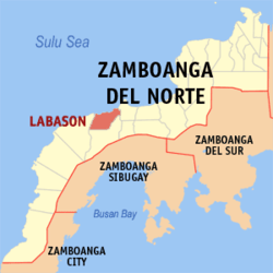 Map of Zamboanga del Norte with Labason highlighted | |
.svg.png) Labason Location within the Philippines | |
| Coordinates: 8°04′N 122°31′E / 8.07°N 122.52°ECoordinates: 8°04′N 122°31′E / 8.07°N 122.52°E | |
| Country |
|
| Region | Zamboanga Peninsula (Region IX) |
| Province | Zamboanga del Norte |
| District | 3rd District |
| Founded | August 12, 1947 |
| Barangays | 20 (see Barangays) |
| Government [1] | |
| • Type | Sangguniang Bayan |
| • Mayor | Eddie Quimbo |
| • Vice Mayor | Virgilio Go |
| • Electorate | 24,067 voters (2016) |
| Area [2] | |
| • Total | 169.58 km2 (65.48 sq mi) |
| Population (2015 census)[3] | |
| • Total | 41,357 |
| • Density | 240/km2 (630/sq mi) |
| Time zone | UTC+8 (PST) |
| ZIP code | 7119 |
| PSGC | 097205000 |
| IDD : area code | +63 (0)65 |
| Climate type | Tropical climate |
| Income class | 3rd municipal income class |
| Revenue (₱) | 45,348,267.53 (2016) |
| Native languages |
Subanon language Cebuano Chavacano Tagalog |
| Website |
www |
Labason, officially the Municipality of Labason, is a 3rd class municipality in the province of Zamboanga del Norte, Philippines. According to the 2015 census, it has a population of 41,357 people.[3]
Labason's commercial buildings have improved over the past years.
Murcielagos Island is within the municipal jurisdiction of Labason.
History
In 1959, the sitios of Bacong, Gabong, Pitawe and Banga-an were constituted into the barrio of Pitawe.[4]
Barangays
Labason is politically subdivided into 20 barangays.
Demographics
| Population census of Labason | ||
|---|---|---|
| Year | Pop. | ±% p.a. |
| 1939 | 5,745 | — |
| 1948 | 8,633 | +4.63% |
| 1960 | 14,204 | +4.24% |
| 1970 | 23,999 | +5.38% |
| 1975 | 32,879 | +6.52% |
| 1980 | 36,047 | +1.86% |
| 1990 | 24,994 | −3.60% |
| 1995 | 28,515 | +2.50% |
| 2000 | 33,528 | +3.53% |
| 2007 | 40,420 | +2.61% |
| 2010 | 40,375 | −0.04% |
| 2015 | 41,357 | +0.46% |
| Source: Philippine Statistics Authority[3][5][6][7] | ||
References
- ↑ "Municipality". Quezon City, Philippines: Department of the Interior and Local Government. Retrieved 31 May 2013.
- ↑ "Province: Zamboanga del Norte". PSGC Interactive. Quezon City, Philippines: Philippine Statistics Authority. Retrieved 12 November 2016.
- 1 2 3 Census of Population (2015). "Region IX (Zamboanga Peninsula)". Total Population by Province, City, Municipality and Barangay. PSA. Retrieved 20 June 2016.
- ↑ "R.A. No. 2104, An Act Creating the Barrio of Pitawe in the Municipality of Labason, Province of Zamboanga Del Norte". LawPH.com. Retrieved 2011-04-13.
- ↑ Census of Population and Housing (2010). "Region IX (Zamboanga Peninsula)". Total Population by Province, City, Municipality and Barangay. NSO. Retrieved 29 June 2016.
- ↑ Censuses of Population (1903–2007). "Region IX (Zamboanga Peninsula)". Table 1. Population Enumerated in Various Censuses by Province/Highly Urbanized City: 1903 to 2007. NSO.
- ↑ "Province of Zamboanga del Norte". Municipality Population Data. Local Water Utilities Administration Research Division. Retrieved 17 December 2016.
External links
Dipolog (capital) | |
| Municipalities | |
| Component cities | |
This article is issued from
Wikipedia.
The text is licensed under Creative Commons - Attribution - Sharealike.
Additional terms may apply for the media files.