Port Carbon, Pennsylvania
| Port Carbon, Pennsylvania | |
|---|---|
| Borough | |
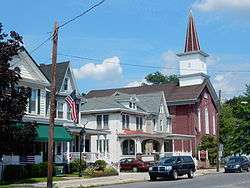 Pike Street in Port Carbon | |
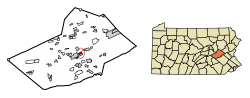 Location of Port Carbon in Schuylkill County, Pennsylvania. | |
 Port Carbon Location in Pennsylvania  Port Carbon Port Carbon (the US) | |
| Coordinates: 40°41′50″N 76°10′00″W / 40.69722°N 76.16667°WCoordinates: 40°41′50″N 76°10′00″W / 40.69722°N 76.16667°W | |
| Country | United States |
| State | Pennsylvania |
| County | Schuylkill |
| Settled | 1826 |
| Incorporated | 1852 |
| Government | |
| • Type | Borough Council |
| • Mayor | Harold Herndon (R) |
| Area[1] | |
| • Total | 0.75 sq mi (1.95 km2) |
| • Land | 0.75 sq mi (1.95 km2) |
| • Water | 0.00 sq mi (0.00 km2) |
| Population (2010) | |
| • Total | 1,889 |
| • Estimate (2016)[2] | 1,807 |
| • Density | 2,396.55/sq mi (925.11/km2) |
| Time zone | UTC-5 (Eastern (EST)) |
| • Summer (DST) | UTC-4 (EDT) |
| Zip code | 17965 |
| Area code(s) | 570 |
| FIPS code | 42-62128 |
Port Carbon is a borough of Schuylkill County, Pennsylvania, two miles (3 km) northeast of Pottsville. It is in a coal-mining area; in the past, ironworks had been a feature of the borough. In 1900, 2,168 people lived here; in 1910, 2,678 people were inhabitants of Port Carbon. The population was 2,019 at the 2000 census.
Geography
Port Carbon is located at 40°41′50″N 76°10′0″W / 40.69722°N 76.16667°W (40.697210, -76.166734).[3]
According to the United States Census Bureau, the borough has a total area of 0.8 square miles (2.1 km2), all of it land.
Demographics
| Historical population | |||
|---|---|---|---|
| Census | Pop. | %± | |
| 1830 | 900 | — | |
| 1840 | 912 | 1.3% | |
| 1850 | 2,142 | 134.9% | |
| 1860 | 1,904 | −11.1% | |
| 1870 | 2,251 | 18.2% | |
| 1880 | 2,346 | 4.2% | |
| 1890 | 1,976 | −15.8% | |
| 1900 | 2,168 | 9.7% | |
| 1910 | 2,678 | 23.5% | |
| 1920 | 2,882 | 7.6% | |
| 1930 | 3,225 | 11.9% | |
| 1940 | 3,279 | 1.7% | |
| 1950 | 3,024 | −7.8% | |
| 1960 | 2,775 | −8.2% | |
| 1970 | 2,717 | −2.1% | |
| 1980 | 2,576 | −5.2% | |
| 1990 | 2,134 | −17.2% | |
| 2000 | 2,019 | −5.4% | |
| 2010 | 1,889 | −6.4% | |
| Est. 2016 | 1,807 | [2] | −4.3% |
| Sources:[4][5][6] | |||
As of the census[5] of 2000, there were 2,019 people, 846 households, and 577 families residing in the borough. The population density was 2,638.6 people per square mile (1,012.4/km²). There were 927 housing units at an average density of 1,211.5 per square mile (464.8/km²). The racial makeup of the borough was 99.11% White, 0.54% African American, 0.05% Native American, 0.05% Asian, 0.05% Pacific Islander, 0.05% from other races, and 0.15% from two or more races. Hispanic or Latino of any race were 0.54% of the population.
There were 846 households out of which 25.9% had children under the age of 18 living with them, 48.9% were married couples living together, 13.2% had a female householder with no husband present, and 31.7% were non-families. 28.8% of all households were made up of individuals and 17.3% had someone living alone who was 65 years of age or older. The average household size was 2.38 and the average family size was 2.91.
In the borough the population was spread out with 20.5% under the age of 18, 7.8% from 18 to 24, 26.7% from 25 to 44, 24.3% from 45 to 64, and 20.7% who were 65 years of age or older. The median age was 42 years. For every 100 females, there were 89.4 males. For every 100 females age 18 and over, there were 85.5 males.
The median income for a household in the borough was $30,875, and the median income for a family was $37,939. Males had a median income of $30,165 versus $20,872 for females. The per capita income for the borough was $16,496. About 5.2% of families and 7.2% of the population were below the poverty line, including 8.4% of those under age 18 and 7.6% of those age 65 or over.
History
Port Carbon was founded by Abraham Pott, son of John Pott who founded Pottsville in 1806.
Port Carbon was the site of the first lock on the Schuylkill Canal, on its route for transport of coal (mined in the region) to Philadelphia. Robert Allison a local industrialist, purchased the first commercially manufactured automobile, a Winton.
Gallery
 Port Carbon Borough Hall.
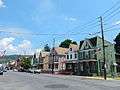 Pike Street.
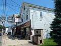 Public Library.
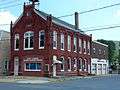 Port Carbon Senior Citizens Center.
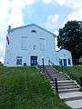
 St. Stephen's Catholic Church.
References
- ↑ "2016 U.S. Gazetteer Files". United States Census Bureau. Retrieved Aug 14, 2017.
- 1 2 "Population and Housing Unit Estimates". Retrieved June 9, 2017.
- ↑ "US Gazetteer files: 2010, 2000, and 1990". United States Census Bureau. 2011-02-12. Retrieved 2011-04-23.
- ↑ "Census of Population and Housing". U.S. Census Bureau. Retrieved 11 December 2013.
- 1 2 "American FactFinder". United States Census Bureau. Retrieved 2008-01-31.
- ↑ "Incorporated Places and Minor Civil Divisions Datasets: Subcounty Resident Population Estimates: April 1, 2010 to July 1, 2012". Population Estimates. U.S. Census Bureau. Archived from the original on 17 June 2013. Retrieved 11 December 2013.
| Wikimedia Commons has media related to Port Carbon, Pennsylvania. |