Pinili
| Pinili | ||
|---|---|---|
| Municipality | ||
| Municipality of Pinili | ||
| ||
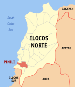 Map of Ilocos Norte with Pinili highlighted | ||
.svg.png) Pinili Location within the Philippines | ||
| Coordinates: 17°57′14″N 120°31′37″E / 17.954°N 120.527°ECoordinates: 17°57′14″N 120°31′37″E / 17.954°N 120.527°E | ||
| Country |
| |
| Region | Ilocos Region (Region I) | |
| Province | Ilocos Norte | |
| District | 2nd District | |
| Barangays | 25 (see Barangays) | |
| Government [1] | ||
| • Type | Sangguniang Bayan | |
| • Mayor | Samuel S. Pagdilao, Sr. | |
| • Electorate | 10,887 voters (2016) | |
| Area [2] | ||
| • Total | 89.48 km2 (34.55 sq mi) | |
| Population (2015 census)[3] | ||
| • Total | 17,300 | |
| • Density | 190/km2 (500/sq mi) | |
| Time zone | UTC+8 (PST) | |
| ZIP code | 2905 | |
| PSGC | 012819000 | |
| IDD : area code | +63 (0)77 | |
| Climate type | Tropical monsoon climate | |
| Income class | 3rd municipal income class | |
| Revenue (₱) | 198,779,516.94 (2016) | |
| Native languages |
Ilocano Tagalog | |
| Website |
www | |

Pinili, officially the Municipality of Pinili, is a 3rd class municipality in the province of Ilocos Norte, Philippines. According to the 2015 census, it has a population of 17,300 people.[3]
The place is called Pinili because Gregorio Aglipay, founder of the Philippine Independent Church, chose (pinili in Tagalog) to hide in this mountainous municipality. Aglipay has a statue in honor of him, having a bible and a revolver in his hands.
Barangays
Demographics
| Population census of Pinili | ||
|---|---|---|
| Year | Pop. | ±% p.a. |
| 1939 | 7,890 | — |
| 1948 | 8,318 | +0.59% |
| 1960 | 10,472 | +1.94% |
| 1970 | 12,211 | +1.55% |
| 1975 | 12,741 | +0.86% |
| 1980 | 13,521 | +1.20% |
| 1990 | 14,950 | +1.01% |
| 1995 | 14,817 | −0.17% |
| 2000 | 15,903 | +1.53% |
| 2007 | 16,185 | +0.24% |
| 2010 | 16,732 | +1.22% |
| 2015 | 17,300 | +0.64% |
| Source: Philippine Statistics Authority[3][4][5][6] | ||
In the 2015 census, the population of Pinili was 17,300 people,[3] with a density of 190 inhabitants per square kilometre or 490 inhabitants per square mile.
References
- ↑ "Municipality". Quezon City, Philippines: Department of the Interior and Local Government. Retrieved 31 May 2013.
- 1 2 "Province: Ilocos Norte". PSGC Interactive. Quezon City, Philippines: Philippine Statistics Authority. Retrieved 12 November 2016.
- 1 2 3 4 Census of Population (2015). "Region I (Ilocos Region)". Total Population by Province, City, Municipality and Barangay. PSA. Retrieved 20 June 2016.
- ↑ Census of Population and Housing (2010). "Region I (Ilocos Region)". Total Population by Province, City, Municipality and Barangay. NSO. Retrieved 29 June 2016.
- ↑ Censuses of Population (1903–2007). "Region I (Ilocos Region)". Table 1. Population Enumerated in Various Censuses by Province/Highly Urbanized City: 1903 to 2007. NSO.
- ↑ "Province of Ilocos Norte". Municipality Population Data. Local Water Utilities Administration Research Division. Retrieved 17 December 2016.
External links
- Pasyalan Ilocos Norte
- Philippine Standard Geographic Code
- Philippine Census Information
- Local Governance Performance Management System
Places adjacent to Pinili | ||||||||||
|---|---|---|---|---|---|---|---|---|---|---|
| ||||||||||
Laoag (capital) | |
| Municipalities | |
| Component cities | |
| Barangays | |
This article is issued from
Wikipedia.
The text is licensed under Creative Commons - Attribution - Sharealike.
Additional terms may apply for the media files.