Dumalneg
| Dumalneg | ||
|---|---|---|
| Municipality | ||
| Municipality of Dumalneg | ||
| ||
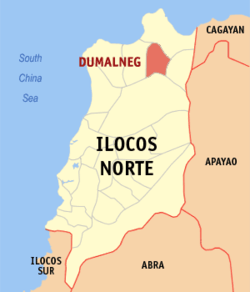 Map of Ilocos Norte with Dumalneg highlighted | ||
.svg.png) Dumalneg Location within the Philippines | ||
| Coordinates: 18°30′N 120°49′E / 18.5°N 120.82°ECoordinates: 18°30′N 120°49′E / 18.5°N 120.82°E | ||
| Country |
| |
| Region | Ilocos Region (Region I) | |
| Province | Ilocos Norte | |
| District | 1st District | |
| Barangays | 4 (see Barangays) | |
| Government [1] | ||
| • Type | Sangguniang Bayan | |
| • Mayor | Lairvee Garvida Espiritu | |
| • Electorate | 1,807 voters (2016) | |
| Area [2] | ||
| • Total | 88.48 km2 (34.16 sq mi) | |
| Population (2015 census)[3] | ||
| • Total | 2,947 | |
| • Density | 33/km2 (86/sq mi) | |
| Time zone | UTC+8 (PST) | |
| ZIP code | 2921 | |
| PSGC | 012810000 | |
| IDD : area code | +63 (0)77 | |
| Climate type | Tropical monsoon climate | |
| Income class | 5th municipal income class | |
| Revenue (₱) | 52,211,277.15 (2016) | |
| Native languages |
Ilocano Tagalog | |
| Website |
www | |
Dumalneg, officially the Municipality of Dumalneg, is a 5th class municipality in the province of Ilocos Norte, Philippines. According to the 2015 census, it has a population of 2,947 people.[3]
Until 2013 when the writ of execution was issued, Dumalneg was composed of only a single barangay of the same name. On August 10, 2012, the Supreme Court ruled in favor of Dumalneg in its territorial dispute with neighboring Bangui over the jurisdiction of Barangay San Isidro.[4]
Geography
Dumalneg is border by Pagudpud in the north; Adams in the east; Vintar in the south and Bangui in the west. It has a land area of 88.48 km2 and it is a land-locked municipality. Nearly all parts of Dumalneg are mountainous. Only the starting of Dumalneg is well inhabited.
Barangays
Dumalneg is politically divided in 4 barangays:
- Cabaritan (Dumalneg)
- Kalaw (Dumalneg)
- Quibel (Dumalneg)
- San Isidro
The former Barangay Dumalneg was split into Barangay Cabaritan, Barangay Kalaw, and Barangay Quibel in pursuant to Republic Act No. 10955, which was ratified through a plebiscite conducted by the COMELEC on March 24, 2018.
Demographics
| Population census of Dumalneg | ||
|---|---|---|
| Year | Pop. | ±% p.a. |
| 1939 | 322 | — |
| 1948 | 454 | +3.89% |
| 1960 | 554 | +1.67% |
| 1970 | 435 | −2.39% |
| 1975 | 570 | +5.57% |
| 1980 | 602 | +1.10% |
| 1990 | 828 | +3.24% |
| 1995 | 1,109 | +5.63% |
| 2000 | 1,486 | +6.47% |
| 2007 | 1,716 | +2.00% |
| 2010 | 1,814 | +2.04% |
| 2015 | 2,947 | +9.68% |
| Source: Philippine Statistics Authority[3] [5] [6] | ||
In the 2015 census, the population of Dumalneg was 2,947 people,[3] with a density of 33 inhabitants per square kilometre or 85 inhabitants per square mile.
Dumalneg's population is predominantly made up of Ilocano and Apayao people.[7]
Transportation
There are few jeepneys that are going to Dumalneg. Tricycles are the main transportation to the town. Dumalneg is a landlocked town, and the only way to get there is via the Dumalneg Road, starting on the highway in Brgy. Lanao, Bangui, to the Town's Proper.
Local government
As of the term 2013-2016, this are the elected officials of Dumalneg:[8]
- Mayor: Lairvee G. Espiritu
- Vice Mayor: Francisco R. Espiritu
- Councilors:
- Dennis J. Garon
- Alejo M. Laguitan Jr.
- Danilo D. Agron
- Maylin P. Santos
- Pablo U. Balalio
- Sheryll L. Asipil
- Mavie Mae B. Cadiz
- Alexander R. Bunay
Government seal

Shield, derived from the provincial seal of Ilocos Norte
Red lettering, signifies the bravery of the legendary leader Apo Dumalneg and the Yapayaos
Background feathering, represents Mt. Quebrada, Mt Simmuda and the hills that surround Dumalneg
Orchids, symbolizes the municipal flower
Deers, represents wildlife that abounds in the municipality
Ribbon, depicts the peace-loving townspeople
Border of the Shield, represents rattan, the town’s forest product
Attractions
There are few attractions in Dumalneg. Mainly the Bolo River, locally known as "Ar-ar-o", the place where peoples of Bangui and Pagudpud also going in the said river. Also the view of the mountains of Vintar are considered also the town's attraction.
References
- ↑ "Municipality". Quezon City, Philippines: Department of the Interior and Local Government. Retrieved 31 May 2013.
- ↑ "Province: Ilocos Norte". PSGC Interactive. Quezon City, Philippines: Philippine Statistics Authority. Retrieved 12 November 2016.
- 1 2 3 4 Census of Population (2015). "Region I (Ilocos Region)". Total Population by Province, City, Municipality and Barangay. PSA. Retrieved 20 June 2016.
- ↑ "One Barangay Transferred to Another Municipality in the Second Quarter of 2011". National Statistical Coordination Board. Web. 19 Sep 2013.
- ↑ Census of Population and Housing (2010). "Region I (Ilocos Region)". Total Population by Province, City, Municipality and Barangay. NSO. Retrieved 29 June 2016.
- ↑ "Province of Ilocos Norte". Municipality Population Data. LWUA Research Division. Retrieved 3 October 2013.
- ↑ Wallace, Ben J. (2006). The changing village environment in Southeast Asia: applied anthropology and environmental reclamation in the northern Philippines. Psychology Press. p. 36. ISBN 978-0-415-36484-3.
- ↑ "Official City/Municipal 2013 Election Results". Intramuros, Manila, Philippines: Commission on Elections (COMELEC). 11 September 2013. Retrieved 3 October 2013.