Currimao
| Currimao | ||
|---|---|---|
| Municipality | ||
| Municipality of Currimao | ||
| ||
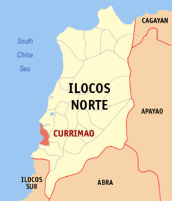 Map of Ilocos Norte with Currimao highlighted | ||
.svg.png) Currimao Location within the Philippines | ||
| Coordinates: 18°01′N 120°29′E / 18.02°N 120.48°ECoordinates: 18°01′N 120°29′E / 18.02°N 120.48°E | ||
| Country |
| |
| Region | Ilocos Region (Region I) | |
| Province | Ilocos Norte | |
| District | 2nd District | |
| Barangays | 23 (see Barangays) | |
| Government [1] | ||
| • Type | Sangguniang Bayan | |
| • Mayor | Rosario C. Go | |
| • Electorate | 8,308 voters (2016) | |
| Area [2] | ||
| • Total | 34.08 km2 (13.16 sq mi) | |
| Population (2015 census)[3] | ||
| • Total | 12,184 | |
| • Density | 360/km2 (930/sq mi) | |
| Time zone | UTC+8 (PST) | |
| ZIP code | 2903 | |
| PSGC | 012808000 | |
| IDD : area code | +63 (0)77 | |
| Climate type | Tropical monsoon climate | |
| Income class | 4th municipal income class | |
| Revenue (₱) | 83,006,081.22 (2016) | |
| Native languages |
Ilocano Tagalog | |
| Website |
www | |

Currimao, officially the Municipality of Currimao, is a 4th class municipality in the province of Ilocos Norte, Philippines. According to the 2015 census, it has a population of 12,184 people.[3]
It is surrounded by Pinili in the south, Batac in the east, South China Sea in the west, and Paoay in the north.
Barangays
Currimao is politically subdivided into 23 barangays. [2]
- Anggapang Norte
- Anggapang Sur
- Bimmanga
- Cabuusan
- Comcomloong
- Gaang
- Lang-ayan-Baramban
- Lioes
- Maglaoi Centro
- Maglaoi Norte
- Maglaoi Sur
- Paguludan-Salindeg
- Pangil
- Pias Norte
- Pias Sur
- Poblacion I
- Poblacion II
- Salugan
- San Simeon
- Santa Cruz
- Tapao-Tigue
- Torre
- Victoria
Demographics
| Population census of Currimao | ||
|---|---|---|
| Year | Pop. | ±% p.a. |
| 1939 | 4,494 | — |
| 1948 | 4,296 | −0.50% |
| 1960 | 5,435 | +1.98% |
| 1970 | 8,369 | +4.41% |
| 1975 | 10,018 | +3.67% |
| 1980 | 7,810 | −4.86% |
| 1990 | 9,467 | +1.94% |
| 1995 | 10,133 | +1.28% |
| 2000 | 10,615 | +1.00% |
| 2007 | 11,305 | +0.87% |
| 2010 | 11,970 | +2.10% |
| 2015 | 12,184 | +0.34% |
| Source: Philippine Statistics Authority[3] [4] [5] [6] | ||
In the 2015 census, the population of Currimao was 12,184 people,[3] with a density of 360 inhabitants per square kilometre or 930 inhabitants per square mile.
References
- ↑ "Municipality". Quezon City, Philippines: Department of the Interior and Local Government. Retrieved 31 May 2013.
- 1 2 "Province: Ilocos Norte". PSGC Interactive. Quezon City, Philippines: Philippine Statistics Authority. Retrieved 12 November 2016.
- 1 2 3 4 Census of Population (2015). "Region I (Ilocos Region)". Total Population by Province, City, Municipality and Barangay. PSA. Retrieved 20 June 2016.
- ↑ Census of Population and Housing (2010). "Region I (Ilocos Region)". Total Population by Province, City, Municipality and Barangay. NSO. Retrieved 29 June 2016.
- ↑ Censuses of Population (1903–2007). "Region I (Ilocos Region)". Table 1. Population Enumerated in Various Censuses by Province/Highly Urbanized City: 1903 to 2007. NSO.
- ↑ "Province of Ilocos Norte". Municipality Population Data. Local Water Utilities Administration Research Division. Retrieved 17 December 2016.
External links
- Pasyalan Ilocos Norte
- Philippine Standard Geographic Code
- Philippine Census Information
- Local Governance Performance Management System
Places adjacent to Currimao | ||||||||||
|---|---|---|---|---|---|---|---|---|---|---|
| ||||||||||
Laoag (capital) | |
| Municipalities | |
| Component cities | |
| Barangays | |
This article is issued from
Wikipedia.
The text is licensed under Creative Commons - Attribution - Sharealike.
Additional terms may apply for the media files.