Paquetville
| Paquetville | |
|---|---|
| Village | |
 Paquetville Location within New Brunswick. | |
| Coordinates: 47°40′08″N 65°05′57″W / 47.668889°N 65.099167°W | |
| Country |
|
| Province |
|
| County | Gloucester |
| Parish | Paquetville |
| Established | 1866 |
| Village Status | 1966 |
| Electoral Districts Federal |
Acadie—Bathurst |
| Provincial | Centre-Péninsule-Saint-Sauveur |
| Government[1] | |
| • Type | Village Council |
| • Mayor | André Gozzo |
| Area[2] | |
| • Land | 9.40 km2 (3.63 sq mi) |
| Population (2011)[2] | |
| • Total | 706 |
| • Density | 75.1/km2 (195/sq mi) |
| • Pop 2006-2011 |
|
| • Dwellings | 309 |
| Time zone | UTC-4 (AST) |
| • Summer (DST) | UTC-3 (ADT) |
| Postal code(s) | E8R |
| Area code(s) | 506 |
| Highways |
|
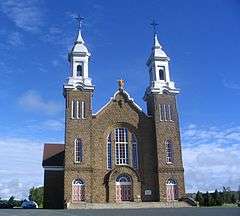
Paquetville church
| Wikimedia Commons has media related to Paquetville. |
Paquetville (2011 population: 706) is a Canadian village in Gloucester County, New Brunswick.[3] at the intersection of Route 340, Route 135 and Route 350. It is located on the Acadian Peninsula.
History
Paquetville was founded by Monseigneur Paquet in 1873, who brought several parishioners with him from Shippagan.
Demographics
Population
| Canada census – Paquetville community profile | |||
|---|---|---|---|
| 2011 | 2006 | ||
| Population: | 706 (+10.0% from 2006) | 642 (-3.7% from 2001) | |
| Land area: | 9.40 km2 (3.63 sq mi) | 9.40 km2 (3.63 sq mi) | |
| Population density: | 75.1/km2 (195/sq mi) | 68.3/km2 (177/sq mi) | |
| Median age: | 46.9 (M: 45.6, F: 48.3) | 44.3 (M: 43.4, F: 45.8) | |
| Total private dwellings: | 309 | 290 | |
| Median household income: | $52,040 | $34,040 | |
| References: 2011[2] 2006[4] earlier[5] | |||
| Historical Census Data - Les Cèdres, Quebec[6] | ||||||||||||||||||||||||||
|---|---|---|---|---|---|---|---|---|---|---|---|---|---|---|---|---|---|---|---|---|---|---|---|---|---|---|
|
|
| ||||||||||||||||||||||||
Language
| Canada Census Mother Tongue - Municipality, Quebec[6] | ||||||||||||||||||
|---|---|---|---|---|---|---|---|---|---|---|---|---|---|---|---|---|---|---|
| Census | Total | French |
English |
French & English |
Other | |||||||||||||
| Year | Responses | Count | Trend | Pop % | Count | Trend | Pop % | Count | Trend | Pop % | Count | Trend | Pop % | |||||
2011 |
680 |
650 | 95.59% | 15 | 2.21% | 10 | 1.47% | 5 | 0.73% | |||||||||
2006 |
600 |
575 | 95.83% | 10 | 1.67% | 15 | 2.50% | 0 | 0.00% | |||||||||
2001 |
655 |
645 | 98.47% | 10 | 1.53% | 0 | 0.00% | 0 | 0.00% | |||||||||
1996 |
665 |
645 | n/a | 96.99% | 20 | n/a | 3.01% | 0 | n/a | 0.00% | 0 | n/a | 0.00% | |||||
Notable people
The village is the home of Édith Butler, who sings the song Paquetville.
See also
References
- ↑ Government of New Brunswick website: Paquetville Archived 2011-06-11 at the Wayback Machine.
- 1 2 3 2011 Statistics Canada Census Profile: Paquetville, New Brunswick
- ↑ New Brunswick Provincial Archives - Paquetville
- ↑ "2006 Community Profiles". Canada 2006 Census. Statistics Canada. March 30, 2011. Retrieved 2014-04-06.
- ↑ "2001 Community Profiles". Canada 2001 Census. Statistics Canada. February 17, 2012.
- 1 2 Statistics Canada: 1996, 2001, 2006, 2011 census
Places adjacent to Paquetville | |
|---|---|
Coordinates: 47°40′08″N 65°05′57″W / 47.66889°N 65.09917°W
This article is issued from
Wikipedia.
The text is licensed under Creative Commons - Attribution - Sharealike.
Additional terms may apply for the media files.