Palau, Sardinia
| Palau Lu Palau (Gallurese) | ||
|---|---|---|
| Comune | ||
| Comune di Palau | ||
 | ||
| ||
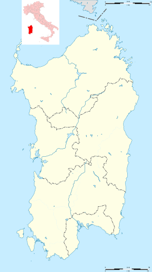 Palau Location of Palau in Sardinia | ||
| Coordinates: 41°11′N 9°23′E / 41.183°N 9.383°E | ||
| Country | Italy | |
| Region | Sardinia | |
| Province | Sassari (SS) | |
| Frazioni | Altura, Barrabisa, Capannaccia, Capo d'Orso, Costa Serena, L'Isuledda, Le Saline, Liscia Culumba, Petralana, Porto Pollo, Porto Rafael, Pulcheddu, Punta Sardegna | |
| Government | ||
| • Mayor | Francesco Pala | |
| Area | ||
| • Total | 44.4 km2 (17.1 sq mi) | |
| Elevation | 5 m (16 ft) | |
| Population (31 December 2013[1]) | ||
| • Total | 4,163 | |
| • Density | 94/km2 (240/sq mi) | |
| Demonym(s) | Palaesi | |
| Time zone | UTC+1 (CET) | |
| • Summer (DST) | UTC+2 (CEST) | |
| Postal code | 07020 | |
| Dialing code | 0789 | |
| Website | Official website | |
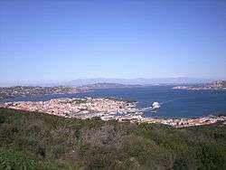
Palau (Gallurese: Lu Palau) is a comune (municipality) in the Province of Sassari in the Italian region Sardinia, about 220 kilometres (140 mi) north of Cagliari and about 30 kilometres (19 mi) northwest of Olbia. It was a frazione of the comune of Tempio Pausania until 1959.
It is located on Punta Sardegna, and was founded in 1875 by local shepherds.
The Capo D'Orso or "Cape of the Bear" formation is nearby, at the very northwest tip of Sardinia.[2] The unique formation is a result of honeycomb weathering, a form of salt weathering.
Gallery
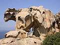 The Capo D'Orso formation.
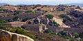 Monte Altura fortress, near Palau.
.jpg) A tourist's map of Palau.
A tourist's map of Palau.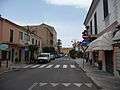 The streets of Palau.
References
External links
| Wikimedia Commons has media related to Palau (Italy). |

This article is issued from
Wikipedia.
The text is licensed under Creative Commons - Attribution - Sharealike.
Additional terms may apply for the media files.