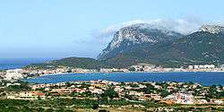
Golfo Aranci
| Golfo Aranci Figari | |
|---|---|
| Comune | |
| Comune di Golfo Aranci | |
 | |
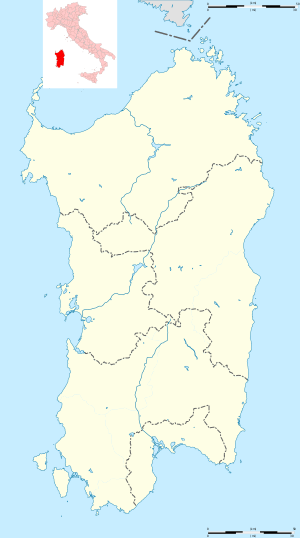 Golfo Aranci Location of Golfo Aranci in Sardinia | |
| Coordinates: 41°0′N 9°37′E / 41.000°N 9.617°E | |
| Country | Italy |
| Region | Sardinia |
| Province | Sassari (SS) |
| Frazioni | Bados, Marinella, Nodu Pianu, Rudalza |
| Government | |
| • Mayor | Giuseppe Fasolino |
| Area | |
| • Total | 37.43 km2 (14.45 sq mi) |
| Elevation | 19 m (62 ft) |
| Population (31 August 2017) | |
| • Total | 2,475 |
| • Density | 66/km2 (170/sq mi) |
| Demonym(s) | Golfarancini |
| Time zone | UTC+1 (CET) |
| • Summer (DST) | UTC+2 (CEST) |
| Postal code | 07020 |
| Dialing code | 0789 |
| Website | Official website |
Golfo Aranci (Gallurese: Figari, Sardinian: Figari) is a comune (municipality) in the Province of Sassari in the Italian region Sardinia, located about 200 kilometres (120 mi) north of Cagliari and about 13 kilometres (8 mi) northeast of Olbia.
History
The name of the comune derives from a wrong translation from the old Gallurese toponym of the Golfu di li Ranci ("Gulf of the Crabs").[1] Once known as Figari, the current town grew up in the mid-18th century as a fishing port. In the early 19th century a Royal Decree made it the main port for the arrivals from the mainland, contributing to its population growth.
References
External links
| Wikimedia Commons has media related to Golfo Aranci. |


This article is issued from
Wikipedia.
The text is licensed under Creative Commons - Attribution - Sharealike.
Additional terms may apply for the media files.