Oliver Municipal Airport
| Oliver Municipal Airport | |||||||||||
|---|---|---|---|---|---|---|---|---|---|---|---|
 | |||||||||||
| Summary | |||||||||||
| Airport type | Public | ||||||||||
| Owner/Operator | Town of Oliver | ||||||||||
| Location | Oliver, British Columbia | ||||||||||
| Time zone | PST (UTC−08:00) | ||||||||||
| • Summer (DST) | PDT (UTC−07:00) | ||||||||||
| Elevation AMSL | 1,015 ft / 309 m | ||||||||||
| Coordinates | 49°10′24″N 119°33′04″W / 49.17333°N 119.55111°WCoordinates: 49°10′24″N 119°33′04″W / 49.17333°N 119.55111°W | ||||||||||
| Website | www.oliver.ca/airport | ||||||||||
| Map | |||||||||||
 CAU3 Location in British Columbia  CAU3 CAU3 (Canada) | |||||||||||
| Runways | |||||||||||
| |||||||||||
|
Source: Canada Flight Supplement[1] | |||||||||||
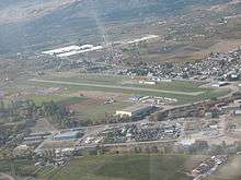
Oliver Municipal Airport (TC LID: CAU3) is a registered aerodrome located adjacent to Oliver, British Columbia, Canada. The airport has been considered for expansion.[2][3]
The aerodrome is the home of Okanagan-Kooteney Air Cadet Gliding Program, Atom Helicopters, Transwest Helicopters, Oliver Osoyoos Search and Rescue (OOSAR) and Oliver Fire Department (OFD).
See also
References
- ↑ Canada Flight Supplement. Effective 0901Z 19 July 2018 to 0901Z 13 September 2018.
- ↑ "Update: Future of underutilized South Okanagan airport discussed". Global News. October 21, 2011. Retrieved November 23, 2012.
- ↑ "Oliver Municipal Airport".
External links
| Wikimedia Commons has media related to Oliver Airport. |
| By name | |
|---|---|
| By location indicator | |
| By province/territory | |
| By area | |
| National Airports System | |
| Related | |
| |
This article is issued from
Wikipedia.
The text is licensed under Creative Commons - Attribution - Sharealike.
Additional terms may apply for the media files.