Newfoundland and Labrador Route 346
| ||||
|---|---|---|---|---|
 | ||||
| Route information | ||||
| Length | 13.5 km[1] (8.4 mi) | |||
| Major junctions | ||||
| From |
| |||
| To | Toogood Arm | |||
| Highway system | ||||
|
Highways in Newfoundland and Labrador
| ||||

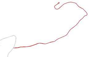
Route 346 in the province of Newfoundland and Labrador, Canada leads from Route 340 near Newville to Toogood Arm, the highway's terminus. The highway runs for approximately 14 kilometres and connects the communities of Cobb's Arm, Roger's Cove, Pike's Arm, Green Cove and Toogood Arm to Route 340.[1][2]
See also
References
- 1 2 Overview map of NL 346 (Map). Google Maps. Retrieved 2008-06-29.
- ↑ Map showing communities on NL 346 (Map). Wikimapia. Retrieved 2008-06-29.
This article is issued from
Wikipedia.
The text is licensed under Creative Commons - Attribution - Sharealike.
Additional terms may apply for the media files.