Baie Verte, Newfoundland and Labrador
| Baie Verte | ||
|---|---|---|
| Town | ||
| ||
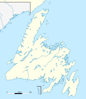 Baie Verte Location of Baie Verte in Newfoundland | ||
| Coordinates: 49°55′00″N 56°11′00″W / 49.91667°N 56.18333°W | ||
| Country |
| |
| Province |
| |
| Incorporated | 1968 | |
| Government | ||
| • Mayor | Brandon Philpott | |
| Population (2016) | ||
| • Total | 1,313 | |
| Time zone | UTC-3:30 (Newfoundland Time) | |
| • Summer (DST) | UTC-2:30 (Newfoundland Daylight) | |
| Area code(s) | 709 | |
Baie Verte (2016 Population 1,313) is a town located on the north coast of the island portion of the Canadian province of Newfoundland and Labrador on the Baie Verte Peninsula.
Geography
Baie Verte is one of 42 communities that make up the Emerald Zone which is located in the North Central portion of Newfoundland. Baie Verte dates to the late 19th century, but remained a small village until the discovery of asbestos and other ore bodies of copper, lead, zinc and gold in the mid-1950s when the town underwent major expansion. Bowering Brother's steamers called in the area in the 1950s to transport the ore found here. It became a town in 1968.
The major "Baie Verte fault line" starts here and runs from here to Long Island Sound by way of Vermont.[1]
History
The Baie Verte asbestos deposit was discovered in 1955, and Advocate Mines, a division of the giant Johns-Manville Company, began open-pit mining there in 1963. In the 1970s the town was gripped by a strike by asbestos miners over working conditions which lasted for 15 weeks.[2] The Advocate mine shut down in 1981.
The Point Rousse Project is located within the Baie Verte Mining District, on the Point Rousse/Ming’s Bight Peninsula. The Project covers three prospective gold trends: the Scrape Trend, the Goldenville Trend and the Deer Cove Trend. These trends have approximately 20 km of cumulative strike length and include three deposits (Pine Cove, Stog’er Tight and Argyle).
Anaconda Mining has been mining at the Pine Cove open pit mine in Baie Verte continuously since 2010, and has produced in excess of 118,028 ounces of gold.[3]
Notable people
- Brad Brown, National Hockey League player
See also
References
- ↑ The Chronicle, September 8, 2008, page 22, "Geologist give talk about Lowell's geologic history"
- ↑ http://www.heritage.nf.ca/society/baieverte.html
- ↑