New Zealand State Highway 38
| ||||
|---|---|---|---|---|
 | ||||
| Route information | ||||
| Maintained by NZ Transport Agency | ||||
| Length | 120.9 km (75.1 mi) | |||
| Major junctions | ||||
| Northwest end |
| |||
| Southeast end |
| |||
| Highway system | ||||
| ||||

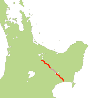
State Highway 38 (SH 38) is a road in the North Island of New Zealand that starts from SH 5 near Waiotapu, and ends at Wairoa, where it connects to SH 2. It is the shortest connection from the central North Island (Rotorua) to the East Coast (Gisborne), but it is not often used as such. Large parts of the road are narrow and winding, and about 74 kilometres (46 mi) is unsealed. Travel on this highway takes roughly four hours.[1]
Part of this unsealed section (between Te Whaiti and Aniwaniwa) is not designated a state highway and instead holds the names Ruatahuna Road and Waikaremoana Road. The administration of this middle section of highway is split between Whakatane District and Wairoa District Councils. NZTA still maintains control over the road and, in 2017, was working on a business case for tar sealing.[2]
Circa 1990, the length of SH 38 was 198 km from Wairoa to Waiotapu before the middle section designation was revoked. Due to its narrow and twisty nature, trucks are not permitted to tow heavy trailers on the unsealed section of the route.
Route
Starting at the intersection with SH 5, one drives through the Kaingaroa Forest and after 38 km the small town of Murupara is passed; at this point, the road temporarily loses its state highway status.[3] At km 44, at Te Whaiti, a road branches to Minginui, leading into Whirinaki Te Pua-a-Tāne Conservation Park. The highway travels south-east for a further 20 km past the settlement of Rautahuna, and passes entirely through forested mountains. The next 74 km are unsealed[4] and climb through Te Urewera, following small streams to reach the shores of Lake Waikaremoana. At km 134, at Aniwaniwa, is a visitor centre operated by the Department of Conservation where several different walks start, including a short stroll to the Aniwaniwa Falls. At the southern end of the lake, at Onepoto, is a motorcamp. Further south, along the Waikaretaheke River, the three power stations of the Waikaremoana Power Scheme[5] can be seen.
From Aniwaniwa the road regains its state highway status and enters the valley of the Waiau River, where the seal restarts. At km 185, at the village of Frasertown, where the Waiau River joins the Wairoa River, the Tiniroto Road branches off to Gisborne (another 97 km). At km 195, at Wairoa, the road finally terminates on SH 2 at the intersection of Mahia Avenue and Bridge Street.
See also
- List of New Zealand state highways
- List of roads and highways, for notable or famous roads worldwide
References
- ↑ State Highway 38 on Google Maps
- ↑ "Watch NZH Local Focus: Sealing the way to Waikaremoana". NZ Herald. 2017-03-31. ISSN 1170-0777. Retrieved 2017-10-17.
- ↑ "Revoking a Section of State Highway and Declaring a Section of State Highway-State Highway 25, Thames-Coromandel District". NZ Gazette. 6 September 2012. Retrieved 19 July 2016.
- ↑ "The section of the road between Murupara and Te Whaiti is sealed in 2000 / 2001 Transit Newsletter 19" (PDF) (Press release). Retrieved 19 July 2016.
- ↑ Waikaremoana Power Scheme of Genesis Energy
External links
| National | ||
|---|---|---|
| North Island |
| |
| South Island | ||
| Former state highways | ||
| Touring routes |
| |